Tag: wildfire

  • (OPINION) Canadian wildfire smoke is choking the U.S. It’s not really Canada’s fault.

    (OPINION) Canadian wildfire smoke is choking the U.S. It’s not really Canada’s fault.

    It’s back.

    Wildfire smoke in New Jersey. It’s grayed our sky, with hints of orange, too.

    In New Jersey, the smoke has been enough to reduce visibility. In fact, I (Joe Martucci) was driving back from the Ventnor Beach Concert at Ski Beach on Parkway North. Right as soon as you got into the Pinelands around exit 52, you noticed a layer of smoke along the tops of the trees. It looked like fog, but it was the Canadian wildfire smoke.
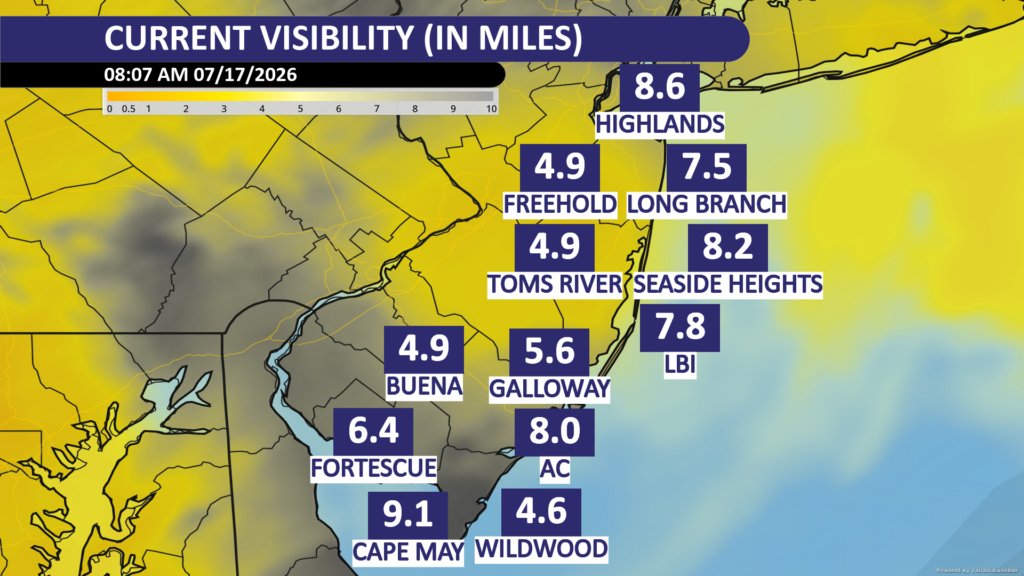
    Visibility at 8:07 a.m. on Friday, July 17. Without the wildfire smoke, the visibility would be 10 miles. However, visibility is cut in half in spots as a result.

    The culprit? Canada, and their wildfires.

    I wrote that as it if we should “Blame Canada!” like the South Park show did once. While no one has directly blamed Canada maliciously to me, social media shows a few examples of people doing so (example, example).

    The thing is… Canada can’t do much about it unless they spend much more money than they do now. Or, people move to where they haven’t moved before. Here’s why.

    Lightning causes the vast majority of wildfires in Canada

    As the climate warms, lightning has become more frequent. 93% of acres burned due to wildfires in Canada were caused from lightning, in 2023, according to research from the Northern Forestry Center.

    In the United States, that number falls to 60%.

    CountryLightning-causedHuman-caused
    CanadaAbout 83%About 17%
    United StatesAbout 60%About 40%

    You can’t arrest lightning. You can’t charge it with arson. Lightning has been around long before humans and will be long after humans, too.

    Canadian Wildfires Occur in Remote Regions

    About 50% of all acreage burned from Canadian wildfires come from Canadian Provinces and Territories with a population density at or less than 2.5 people per square kilometer. That’s 6.5 people per square mile.

    Northwest Territories – 21% of acres burned – 0.04 people per square kilmometer.

    Saskatchewan – 18% of acres burned – 2.0 people per square kilometer.

    Manitoba – 8% of acres burned – 2.5 people per square kilometer.

    Yukon Territory – 4.5% of acres burned – 0.1 people per square kilometer.

    Newfoundland and Labrador, as well as Nunavut also are very sparse, but contribute less than 1% to the total.

    Population density data comes from Canada’s 2021 Census.
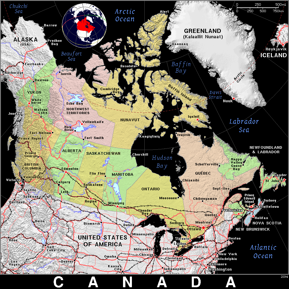
    A map of Canada, including major highways and railroads.

    When a wildfire occurs, there are few, if any, roads to drive to the fire. There also have to be firefighters stationed nearby, ready to go. These wildfires aren’t just occurring in remote areas 100 miles outside of a major city like Toronto. They’re happening 100 miles (and more) outside of towns like Yellowknife or Whitehorse, which have a few tens of thousands of people.

    Even if you had firefighters pre-stationed, they need food, they need water. Those towns do not have the resources on their own to supply them. The federal government needs to step in. Which, they do, but it’s still a logistical challenge.
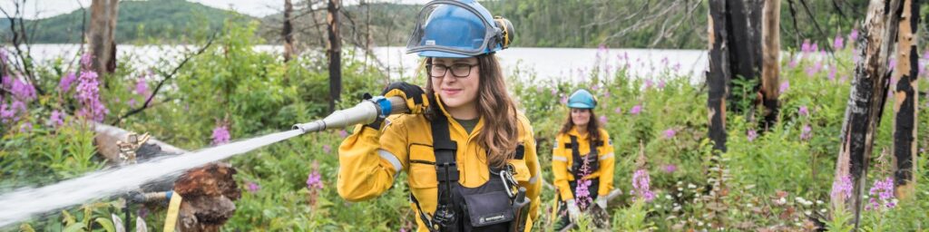
    Firefighters in the Canadian forest (via Parks Canada Agency)

    Why Can’t Canada Fight Fires By Air?

    They can and that does overcome the challenges poised by lack of roads. However, air is not as effective as ground.
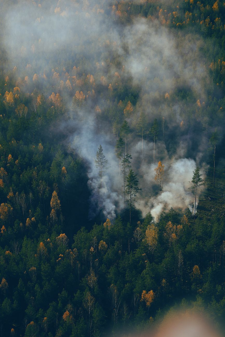
    smoking coming out of a forest
    Photo by POI on Pexels.com

    Canada cannot simply fight every remote wildfire from the air because aircraft alone rarely extinguish large, intense fires. Water and fire retardant drops mainly slow the flames, giving ground crews time to build firebreaks and secure the perimeter.

    In remote forests, there may be no roads, safe landing areas, nearby water sources or crews available to finish the job.

    Heavy smoke, strong winds, thunderstorms and nighttime conditions can also ground aircraft.

    With thousands of fires across an enormous landscape, Canada must prioritize communities, infrastructure and fires that can realistically be controlled.

    Plus, similar to the lack of roads, there are a lack of airports in those remote areas, too. Refueling must be closely coordinated.

    Canadian Wildfires are Generally Larger than America’s

    The vast boreal forests can start large fires at the tops of trees. On the ground, the deep layer of organic soil or peat can bring fire smoldering underground for a long period of time.

    The United States has that in parts, like Alaska, next to Canada. However, Western United States Wildfires often have steep terrain and complex winds. That brings faster moving fires that are aggressive locally. However, it’s the massive wildfires in Canada that bring the large smoke plumes, not the localized ones.

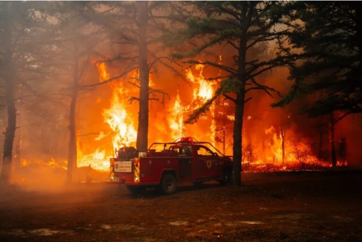
    Also, smoke spreads the further from the source you are. Take, for example, the Jones Road Fire in April 2026 in Ocean County, NJ
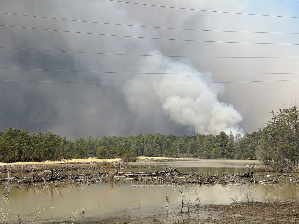
    The Jones Road Fire in April, 2025 in New Jersey (via Famartin on Wikipedia)

    Places like Long Branch and Cape May, which were east of the fire barely had smoke in the air. Meanwhile, they are both experiencing the smoky sky now with wildfires thousands of miles away.

    In Conclusion

    To be fair, wildfire smoke is hazardous to your health. Wildfire smoke contains PM2.5, tiny particles made of soot, ash, organic carbon and other burned material. These particles can travel deep into the lungs and enter the bloodstream. Smoke may also contain hazardous gases, including carbon monoxide, benzene, formaldehyde and acrolein, according the Environmental Protection Agency.
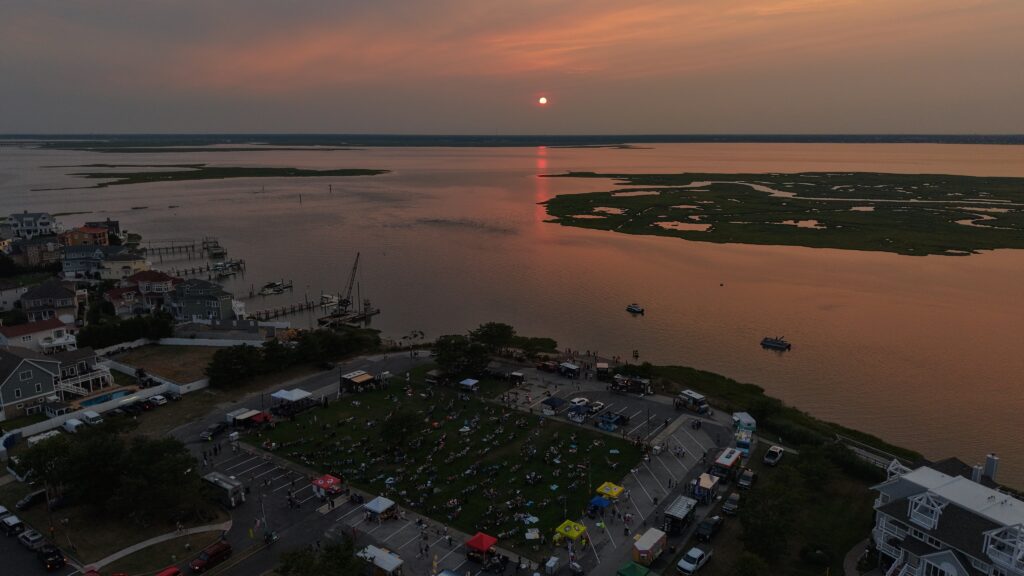
    A smoky sunset in Ventnor City, NJ on July 15, 2026

    At the same time, there’s not a whole lot Canada can realistically do to stop this. When fires erupt in the Pine Barrens of New Jersey, firefighters can get there in minutes. Planes can drop fire retardants with ease, refueling at nearby airports. Where the wildfires usually burn in Canada, those options just aren’t possible.

  • WILDFIRES a concern on otherwise beautiful NJ weather weekend

    WILDFIRES a concern on otherwise beautiful NJ weather weekend

    FRIDAY’S FORECAST | Yeah it’s gloomy this morning but I promise, the sun will come out! Once it comes out, it stays out this weekend. One concern? The possibility of wildfires. Like Smokey The Bear says, you can prevent wildfires.

    Our 24×7 Jersey Shore Weather Channel: https://www.youtube.com/watch?v=dcPpb_VycOM

    Jolt your brand with the Shore’s top weather media company. Advertise today! joe@cupajoe.live

  • Jones Road Fire shows how fragile NJ’s Pine Barrens are

    Jones Road Fire shows how fragile NJ’s Pine Barrens are

    The article initially appeared in Shore Local Magazine on May 1. Find it here.

    By Meteorologist Joe Martucci

    The Jones Road Fire, which was first spotted at 9:45 a.m. on April 22, was New Jersey’s largest wildfire in 18 years, swallowing up 23 square miles in Ocean County, or a little over 15,000 acres.

    While drought conditions have improved across the area, the fire is a stark reminder that we are in the midst of a wildfire season that has big potential to be severe, if we are not careful.

    Jones Road Wildfire update from 4/24, near the peak of the fire (New Jersey Forest Fire Service)

    The Pine Barrens is such a unique landscape that maybe we take it for granted. You learn about it in elementary school, and you might even be told about the Jersey Devil (whose home is in Galloway, according to legend).

    In Meteorology School at Rutgers University, you learn the sandy soil makes it cool off quickly at night. Its composition makes it perfect for growing cranberries and blueberries. The forest is so dense, that satellite imagery shows this as a noticeably darker area than the rest of the state.

    All that dense forest means one fire can spread quickly. Any forest that has dry ground with low humidity and a gusty wind can increase the size of the blaze. However, the New Jersey Pine Barrens, specifically, have a few factors that make this area uniquely prone to to fine.

    Pitch pine

    Pitch pine, which the region gets its Pine Barrens name from, is highly flammable. The needles and bark ignite easily.

    Quickly drying soil

    The sandy soil of the Pinelands, known as sugar soil to the locals, drains water quickly. Think of sand on the beach. You pour a bucket of water on it and a few minutes later, that wet spot pretty much dries out.

    The same is true in the Pinelands. The ground dries out faster than most forests. The old adage that it will rain overnight, and you’ll have wildfire by noon is based on this truth. This year’s drought only amplifies that.

    Topography and wind

    The Pine Barrens in New Jersey are flat, like a big, open field. The trees there aren’t very tall, and their tops (called the canopy) have lots of gaps. This makes fires spread really fast.

    Because the trees are shorter, wind from above can blow down to the ground where the fire is, without getting blocked like in other forests with taller trees.

    Forest next to people

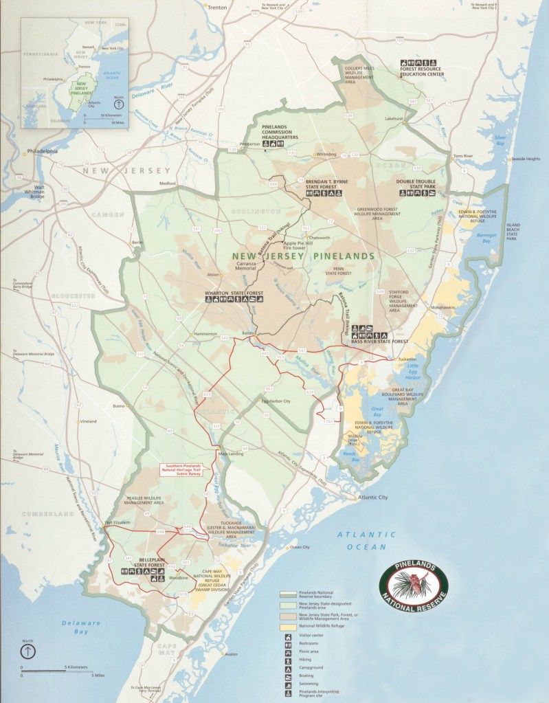
    Map of New Jersey, with the Pinelands National Reserve in the green outline. (State of New Jersey)

    The Garden State Parkway is like a big boundary line in New Jersey. It separates the wild, state-protected Pinelands Area to the west from towns and cities to the east.

    In Ocean County, starting at Toms River and going south, the west side of the Parkway is the Pinelands, while the east side has homes, stores, and businesses.

    The Jones Road Fire happened in Ocean County. In Atlantic County, the Parkway separates the Pinelands from developed areas until about Mays Landing. In Cape May County, the Pinelands National Reserve follows the Parkway from Marmora down to around Swainton and Goshen.

    You don’t have to go far from the Pinelands to find busy places! In Ocean County, right across the Parkway, there are huge neighborhoods with lots of houses. In Lacey Township and Ocean Township, where the Jones Road Fire burned, over 35,000 people live with homes, shops, and more, just a short distance from the forest.

    Plus, you have to consider the Garden State Parkway running through there. In 2018, 389 million toll transactions took place on the road, according to NJ.com. When the Parkway closes, it backs up traffic and slows the local economy.

    Last Tuesday, I had to go north, through the Jones Road Fire on the Parkway. I was diverted onto County Road 539 in Ocean County.

    Thankfully, the traffic was moving north. However, going south on that one lane it was bumper-to-bumper traffic for miles. It’s an issue which could happen in the South Jersey shore area, too.

    This drought plays a role

    As of April 25, 662 wildfires have occurred in New Jersey this year – 16,572 acres burned, the vast majority of that the Jones Road Fire.

    Last year through by April 25, about half as many wildfires occurred, burning just 315 acres.

    The difference is drought. When the Jones Road Fire began, that area was in a transitionary state between drought and no drought, known as abnormally dry conditions, according to the United States Drought Monitor.

    All of Atlantic and nearly all of Cape May counties were officially in drought. Plus, the New Jersey Department of Environmental Protection put forth a drought warning for the state in November.

    Drought means, among other things, the ground is dry, and the water table is lower. This only enhanced the spread of wildfire.

    There has been no wetter-than-average month in 2025. Statewide, it was the third driest January on record, according to the Office of the New Jersey State Climatologist (0.92 inch average).

    February was below average, too. March then bucked the trend, with nearly average precipitation. April should come in around the same (not known at the time of writing).

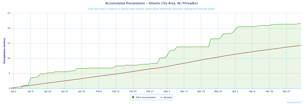
    Last year was nearly the opposite. It was the wettest start of the year, on record, through April 25, at Atlantic City International Airport, according to the National Oceanic and Atmospheric Administration. Located on the edge of the Pine Barrens, it’s a good indicator for the South Jersey Pinelands.

    Precipitation accumulated for Atlantic City International Airport in Egg Harbor Township from January 1 to April 25, 2024. Last year was the wettest start to the year, on record, up to April 25.

    In Hammonton, farther into the Pine Barrens, it was the sixth wettest. Records have been kept fairly regularly since 1893.

    As long as drought continues, and I believe it will in Atlantic and Cape May counties into the summer, the potential for another Jones Road Fire is higher than usual.

    You can prevent wildfires

    About 85% of wildfires in the United States are caused by humans, according to the United States Forest Service. Fire is a natural and needed part of our ecosystem. However, humans disrupt Mother Nature’s rhythm, which would typically happen from lightning strikes.

    No published research has been done in New Jersey, but in California, researchers found that human-sparked wildfires spread more than twice as fast as lightning-induced burns, according to the University of California-Irvine.

    What Smokey Bear first said in 1944 holds true in 2025, “Only you can prevent forest fires.”