Tag: sandy

  • NJ’s September nor’easter was bad, Sandy’s flood was much worse for most.

    NJ’s September nor’easter was bad, Sandy’s flood was much worse for most.

    The tidal flooding during the September nor’easter was bad. But Sandy was a whole different level for most of the Jersey Shore.

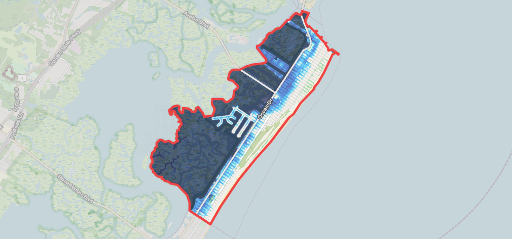
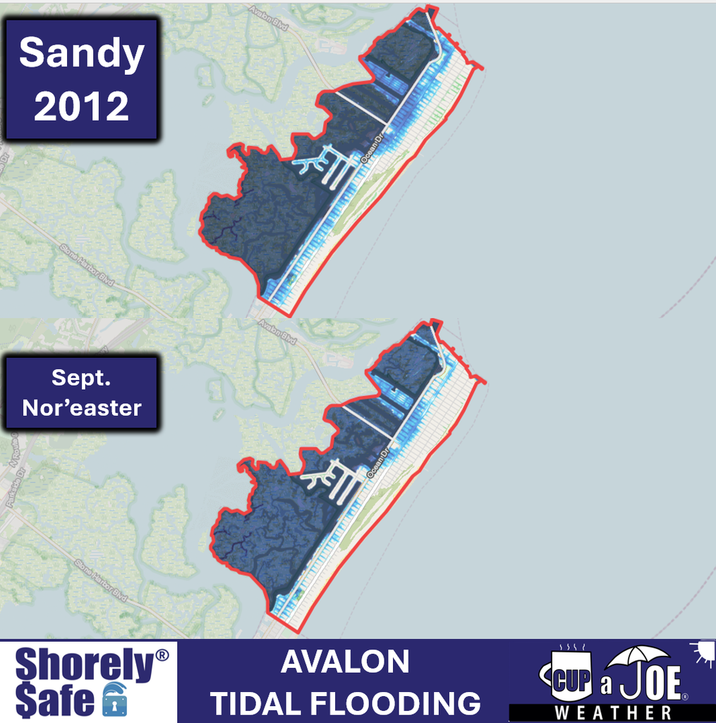
    This is what our ShorelySafe Floodmapper has for the peak of Sandy vs. September. These are 3 of our clients.

    Avalon (Cape May County)
    Highlands (Monmouth County)
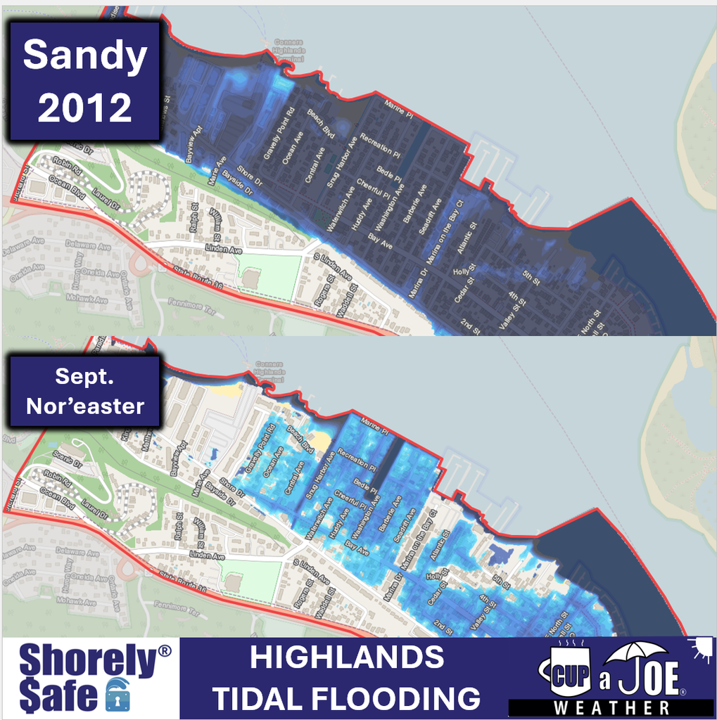
    Highlands (Monmouth) had the WORST flooding. It was feet higher than the nor’easter. That’s because water quickly filled the Raritan Bay and the strong east winds during high tide kept piling up the water. There was five feet of water on normally dry land in spots.

    Cape May
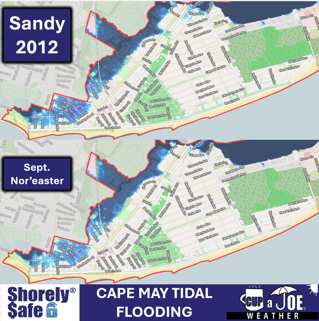
    Sandy was a little higher in Cape May. Keep in mind, winds were offshore during Sandy at high tide in Cape May because of where the storm made landfall.

  • NJ Halloween weekend forecast and 14 year Superstorm Sandy lookback

    NJ Halloween weekend forecast and 14 year Superstorm Sandy lookback

    THURSDAY’S FORECAST

    – 3 Sandy stats on her 14 year anniversary of hitting NJ.

    – Dry for a while.

    – Days of tidal flooding next week?

    ShorelySafe® helps organizations forecast tidal flooding 84 hours ahead, reduce flood risk and lower insurance costs with property-level flood intelligence.

    Request a meeting: www.shorelysafe.live

  • The 2 ways Superstorm Sandy and the 2026 Nor’easter are the same

    The 2 ways Superstorm Sandy and the 2026 Nor’easter are the same

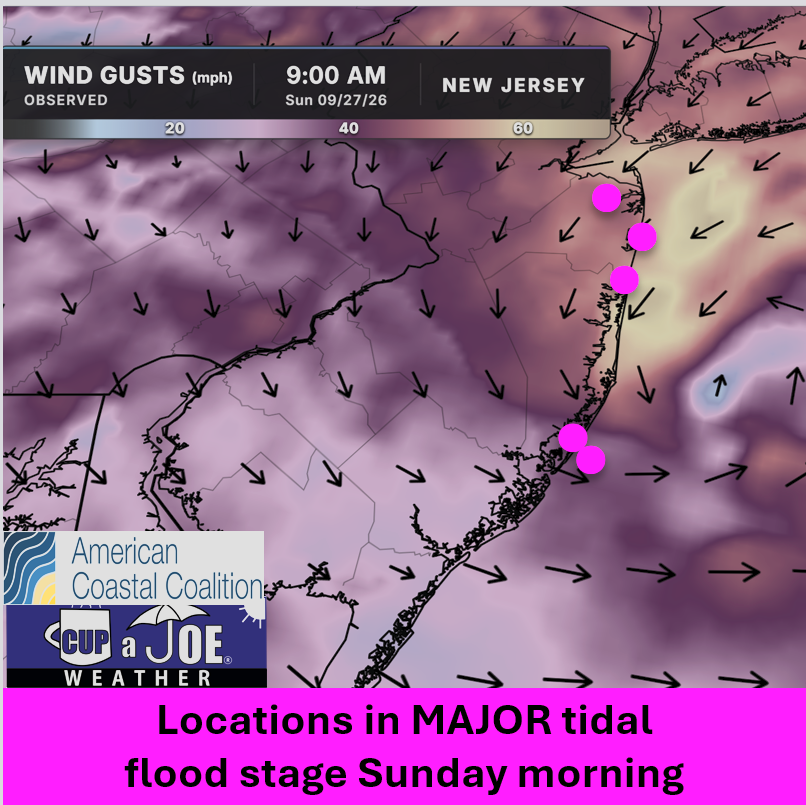
    1045AM SUNDAY FLOODING UPDATE | I’m getting reports of flooding nearly as bad as Saturday morning today. Major stage is gripping Keansburg, Sea Bright, Shark River Hills, etc.

    Why? The track of the storm and the direction of the wind.

    This is where we can bring Superstorm Sandy into play. Anywhere NORTH of where these make landfall had onshore winds, pushing the tide higher.

    Winds are from the northeast in Monmouth and Ocean Counties.

    South of there, they’re offshore winds. Cape May and Atlantic Counties are in moderate stage flooding.

    This is why miles matter in a storm track. Had this storm been 70 miles further south, all of the Jersey Shore would be in major flood stage.

    NJ beaches generate billions in revenue, supporting thousands of jobs and businesses. If they erode, our economy collapses. Federal beach funding was cut in 2025. Only the American Coastal Coalition fights 24/7 in DC to restore it. Protect your beach and business. Join today: americancoastalcoalition.org