
The tidal flooding during the September nor’easter was bad. But Sandy was a whole different level for most of the Jersey Shore.
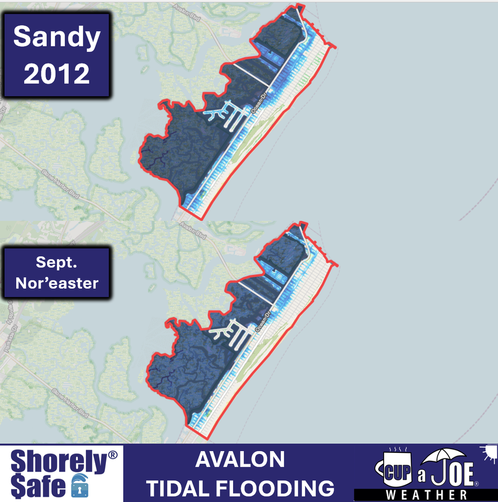
This is what our ShorelySafe Floodmapper has for the peak of Sandy vs. September. These are 3 of our clients.
Avalon (Cape May County)
Highlands (Monmouth County)
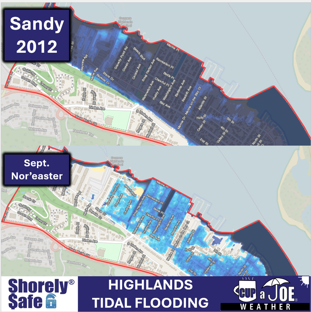
Highlands (Monmouth) had the WORST flooding. It was feet higher than the nor’easter. That’s because water quickly filled the Raritan Bay and the strong east winds during high tide kept piling up the water. There was five feet of water on normally dry land in spots.
Cape May
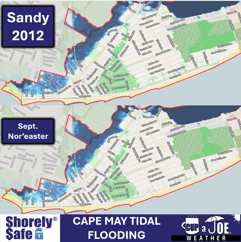
Sandy was a little higher in Cape May. Keep in mind, winds were offshore during Sandy at high tide in Cape May because of where the storm made landfall.


