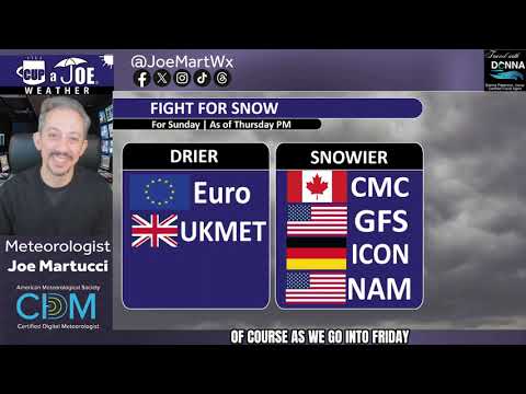
FRIDAY’S FORECAST: I’m not in love with it but my first call snow forecast for Sunday’s (1/18) system is here. It’s a matter of snow vs. no snow, not rain vs. snow. There’s also a little wintry weather on Saturday, too. Tune in for your (very cold) 7-day forecast!
THURSDAY PM UPDATE | The computer weather models are converging on a snowy solution for New Jersey on Sunday, 1/18. However, with a big, dry area of high pressure dominating the Northeast before, I just can’t fully buy it yet.
Embark on your next adventure with Travel with Donna, the shore’s premier full-service travel agency! This female-owned local gem is your ultimate travel guru. Reach out at Donna@TravelwithDonna.VIP or text 609-287-2870.
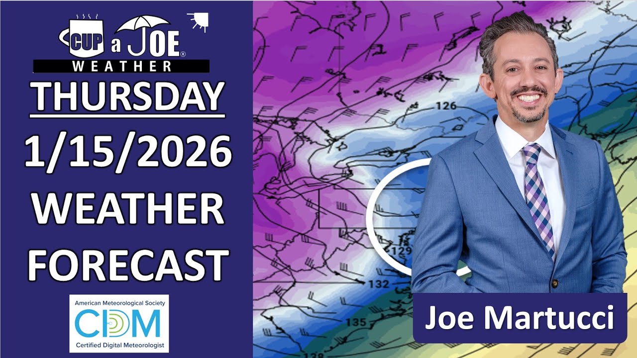
THURSDAY’S FORECAST: Today will shock you. It’s mild this morning but by sunset, wind chills will be in the 10s! Punches of polar air are set to rumble through NJ the next week. Sunday snow *may* come with that if a coastal storm takes a northerly track. Let’s talk!
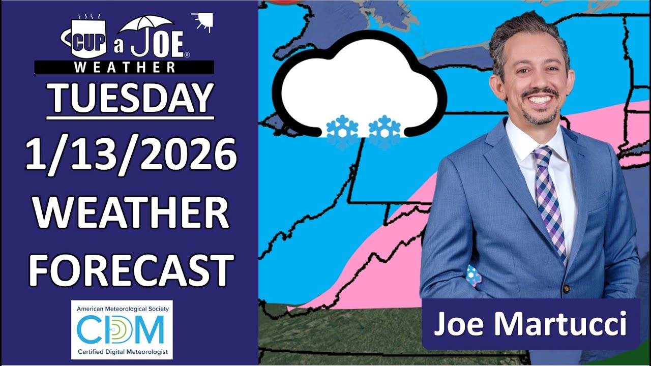
TUESDAY’S FORECAST: Like we talked about, a snowy nor’easter, even a rainstorm, was not coming to NJ for the end of the week. However, a little precipitation will fall Thursday. Let’s time it out and look toward a colder 7-day forecast ahead.
If your personal forecast feels uncertain this winter, support is available. See You Through It Counseling offers in-person and virtual therapy for children, adults, and couples. Invest in healing that lasts. Visit seeyouthroughitcounseling.com or call 856-335-1352.
Some weather models are giddy with snow next Friday (1/16). I’m not buying it. This January thaw and consistent neutral NAO pattern doesn’t scream snowmaggedon to me.
I’ll watch, though.If you want snow, MLK time looks better, since cold air will be pulled into our area after whatever happened Friday passes.
Details on a much needed rain for part of the Jersey Shore weekend
FRIDAY’S FORECAST: Enjoy the dry weather today. We got a soaker on the way for part of the weekend! It’s coming at a good time, too. Lower Cape is now in a “severe” drought and most of the Jersey Shore is on the brink of drought, too.
I can’t forecast the Jersey Shore weather 365 days out, but given a full year of a new president, and the recent election of a new governor, expect behind-the-scenes, policy-side changes when it comes to meteorology.
Overall, 2025 was a pretty quiet year for big weather and climate events at the Jersey Shore. We need to keep it that way. Here’s what to keep an eye out for in the year ahead.
How bad will the drought get?
It’s No. 1 on my list of top 10 weather events of 2025, and we’ll carry this over into our lookahead column for 2026.
The fifth wettest May on record going back to 1895, according to the New Jersey State Climatologist, pulled New Jersey out of the most significant drought since 1999-2002.
However, it was brief. Summer was dry and on Dec. 5, the New Jersey Department of Environmental Protection returned the state to Drought Warning status. That brought voluntary water conservation.
The United States Drought Monitor has the Lower Cape, the Delaware Bayshore and essentially the western half of the state in one of the four drought stages. A dry January may be good for your health, but it will hurt the heartbeat of New Jersey’s nature.
The Climate Prediction Center gives “equal chances” for either a wetter or drier rest of the winter. Hopefully, it will get wetter. If it doesn’t, expect an active forest fire season. Don’t be surprised if the state issues its first Drought Emergency, with mandatory water restrictions by the governor.
Will NJ REAL laws pass?
Speaking of governor, New Jersey will have a new one in 2026. Mikie Sherill takes the top spot in New Jersey government on Jan. 20. Also in January is the “anticipated adoption” of the Resilient Environments and Landscapes (REAL) rules to change environmental land use regulations by the New Jersey Department of Environmental Protection.
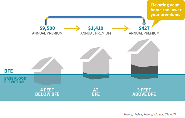
The NJ REAL rules will mandate a variety of changes. Most notably for the shore, however, would adjust the Base Flood Elevation (BFE) level upward. That’s the height floodwaters are expected to reach with a 1% chance in any given year. If you live in a flood zone with a federally backed mortgage, your lowest floor must be at or above the BFE.
BFE stands for Base Flood Elevation. In 2026, BFE could increase in New Jersey, raising the height homes with federally backed mortgages would have to be.
Right now, the state requires structures in flood zones to be one foot higher than BFE. The NJDEP first proposed this to go up to five feet above BFE, based on a 17% chance sea levels will rise that amount by 2100. However, after public feedback, it was revised to four feet.
The current DEP commissioner is Shawn LaTourette, who’s served since 2021. At the time of this writing (Jan. 8), Gov.-Elect Sherill had not announced whom the DEP commissioner will be.
If she keeps LaTourette, expect new homes at the Jersey Shore to go higher to protect against flooding. If a different commissioner comes in, you may see a quick change, or removal, of the NJ REAL rules.
NOAA helps keep people safe in the United States by providing daily weather forecasts, warnings of dangerous storms and information about long-term climate changes through its National Weather Service.
Since then, some jobs have come back. NOAA is hiring again. President Donald Trump and the Senate also tapped Dr. Neil Jacobs to be administrator. He held the “acting” role from 2019-2021.
One of the major changes in the new year is that the National Weather Service, which is under NOAA, can hire for positions directly. This allows our local office in Mount Holly, for example, to act quickly to fill vacancies.
Can AI weather models progress more?
Speaking of the United States Government, NOAA took a big leap forward at the end of 2025 with the announcement of three new artificial intelligence weather models.
The AI models are different. They take the current and recent state of the atmosphere, but they look for similar patterns in the weather that have happened before, with some physics. It then uses what happened in the past as a basis for what will happen in the future.
American, European and Google weather computer models have been better over their traditional physics-based counterparts. A downside has been the resolution of the forecast is lower than the physics-based models. If we can improve that in 2026, the old way of computer model forecasting will probably be out.
Changes at the National Hurricane Center
Each year, the NOAA’s National Hurricane Center, based in Miami, Fla., releases a list of updates and changes to the way they conduct business. Last year brought six changes. This always involves updating the size of the forecast track cone, which shows an area with a 66% chance of the storm’s eye to be in.
We’ve seen drastic improvements in the size of the forecast cone over time, allowing emergency managers, mayors, police, fire and meteorologists to tell you more accurately if you’ll be in harm’s way or not. Expect to see another slight improvement this year.
Easier to understand National Weather Service forecast discussions
The National Weather Service in Mount Holly, our local office, is hoping you will read more of their forecast reasonings this year.
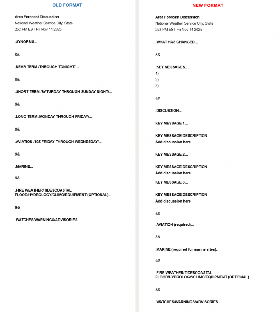
The “Area Forecast Discussion,” the NWS office’s way of explaining why the forecast will be the way they predict, switches from chronological order to severe impact order. If a nor’easter is hitting five days from now, that will be talked about first, not the forecast for tonight.
They will also include a “What Has Changed” section. This is an easier way to see their updates than before.
This change began on Jan. 6. So, you can see it now by going to www.weather.gov/phi and clicking on the “forecast discussion” link.
Soon, you’ll get a better-looking radar loop, which shows blue for snow, green for rain and is labeled with towns. You’ll also have more Jersey Shore local weather in the main player with automated, up-to-the-minute conditions. Plus, we’re looking to add webcams to the feed. So, if you have a webcam you’d like to share with us for the channel, reach out!
❓PRECIPITATION TYPES | From yucky sleet to beautiful snow, we get it all here in Jersey during the winter. One thing your generic weather app won’t tell you? What causes that to hit the ground anyway.
THURSDAY’S FORECAST: A much needed soaking rain will be on the way for the weekend. At least it’ll be a mild rain, high temperatures soaring 10-15F warmer than average. Enjoy the dry weather today!
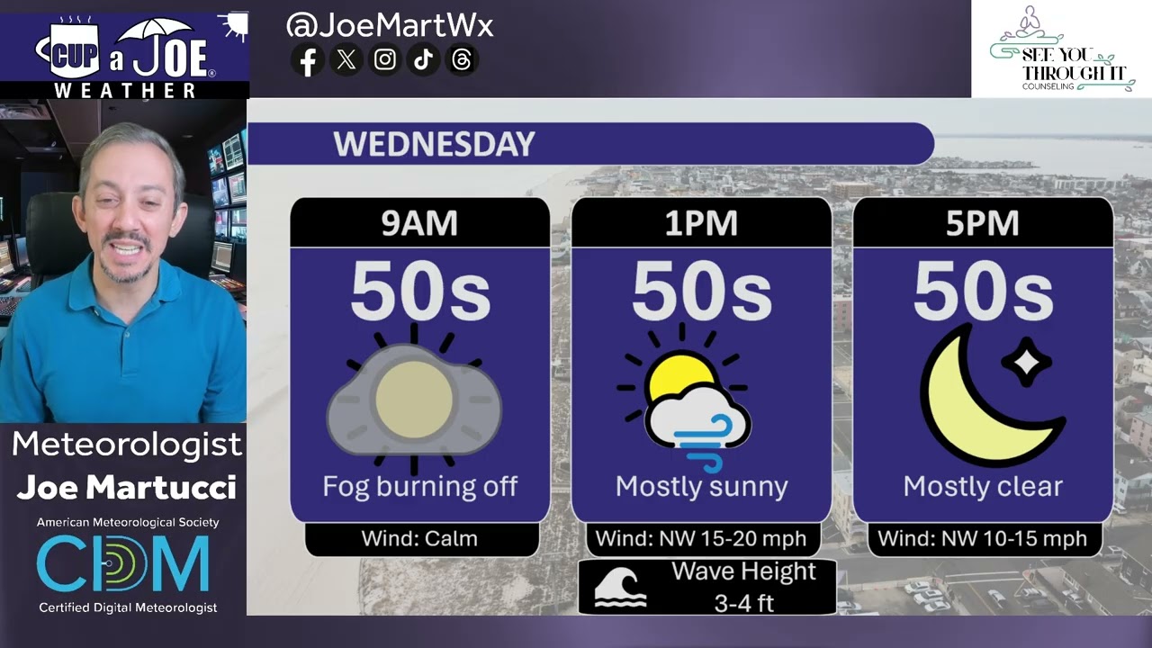
WEDNESDAY’S FORECAST: Up and down the Jersey Shore, the fog is thick in spots. I had a tough time seeing far walking this morning. By 10AM, it’ll be gone. Then, we’ll be in for lots of sunshine. January continues to thaw later this week, too!
If your personal forecast feels uncertain this winter, support is available. See You Through It Counseling offers in-person and virtual therapy for children, adults, and couples. Invest in healing that lasts. Visit seeyouthroughitcounseling.com or call 856-335-1352.