Category: Latest Weather News

  • ❄️NJ’s snowpack is once in a GENERATION. Here’s why.

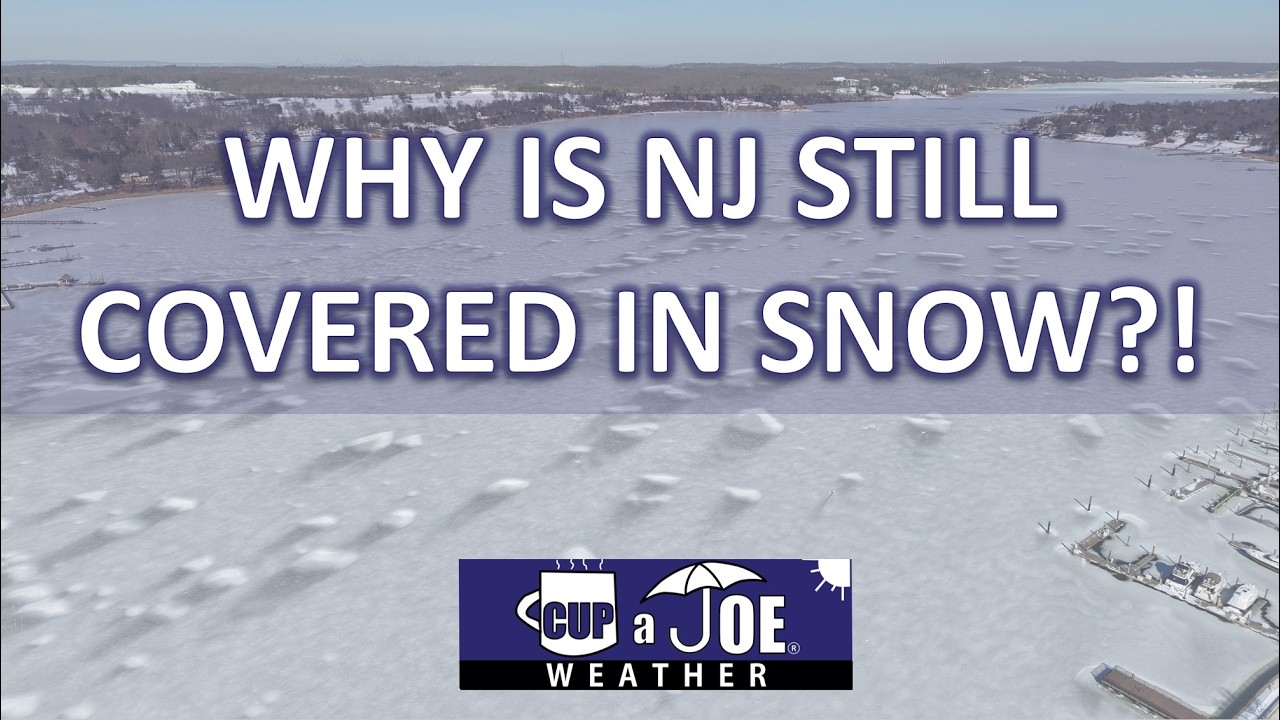
    ❄️NJ’s snowpack is once in a GENERATION. Here’s why.

    This snowpack on the ground is on a generational run. It’s not going away. Friday marks 20 straight days with snow and ice on the ground.

    At Atlantic City International Airport, that’s the 4th longest since records began in 1945. The last time it was longer than this was 24 days in 2010.

    Long Branch has had at least 6″ of snow cover for these 20 days. That’s the 5th longest streak since records began in 1907. You’d have to go back to 1961 to have this much snow on the ground
    for this long. Even at just 3 inches, it’s the longest streak since 1978.

    Quite literally, a generational run.

    So why is this snow so stubborn to melt? There are many weather reasons.

    Let’s start with the most obvious, the cold. That’s keep the ice in place.

    Since the winter storm on January 25th, anywhere from just 1-3 days has been in the 40s, according to NOAA. That’s it. Most days have been below freezing.

    In fact, Jan. 23 to Feb. 12 has been in the top 4 coldest on record at New Jersey’s major weather stations.

    At ACY Airport, the past 3 weeks have felt more like a typical stretch in Portland, Maine, according to the Southeast Regional Climate Center.

    Atlantic City has felt more like Milwaukee.

    Plus, the nights have been absolutely frigid for the most part.

    Going hand in hand with this is the sun. Sun helps melt the snow, but if it’s below freezing, it can only sublime the snow, going from a solid to a gas, like water vapor.

    That’s been happening, but at a slow process. Using Long Branch as the example, the depth of the snowpack went from 10″ on Jan. 26 to only 6″ on Feb. 13, just only 1 days in the 40s.

    Next, you’ve seen it all around you, this snowpack is more like an ice cube!

    Our winter storm on Jan. 25 was unique. Snow went to 1″-3″ of sleet. That makes the liquid density 2-3 more dense than a similarly deep snowpack comprised all of snow, the National Weather Service says.

    Then, freezing rain and rain only added more moisture. That deep freeze after that just locked all of that into place.

    The least obvious one is the dew point, or measure of moisture in the air.

    When dew points are above freezing, air temperatures are above freezing. So, that will melt the snow pack. However, it also has an even bigger role than that.

    Dew points above freezing causes water vapor to turn to liquid water on the snowpack. This change then releases heat, that melts the snow faster, even if the air isn’t super warm.

    And as you can probably tell by your chapstick usage, it’s been very dry.

    Since the Jan. 25 winter storm, no days has had a dew point above freezing at the Jersey Shore. Even when the air temperature is above freezing, that doesn’t do much to melt the snow.

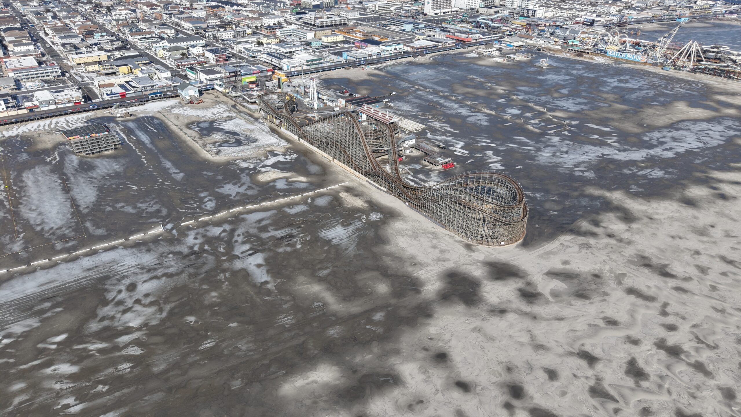
    The result? A Delaware Bay that’s nearly completely covered in ice, slush in the ocean water, ice skating on the Wildwood Beach and the return of the historic Van Nostrand Cup on the frozen Navesink River on Feb. 9.

    The Cup has only run five times since it began in 1891. The last time it happened on the river in Red Bank was 2003. The winner gets a Tiffany Silver Cup valued at $100,000.

    Just a fraction of the price for a generations worth of icy memories.

  • 👋Bye-bye to our frigid weather pattern! Rain on the way later this weekend

    👋Bye-bye to our frigid weather pattern! Rain on the way later this weekend

    FRIDAY’S FORECAST | After weeks of mostly frigid temperatures, biting wind and growing ice on the water, this weather pattern ends Friday. Temperatures rise into the 40s and 50s from here. Plus, we even have much needed rain, instead of snow, in the forecast.

    Our 24×7 Jersey Shore Weather Channel: https://www.youtube.com/watch?v=lGssDGu6xk0
    Jolt your brand, advertise here: joe@cupajoe.live

  • Drought’s getting worse in NJ, but this 1 thing will help us

    Drought’s getting worse in NJ, but this 1 thing will help us

    Drought got worse in NJ Thursday, according to the United States Drought Monitor. Now, over 75% of the Garden State is in drought. However, all of this snow and ice sitting out the ground will alleviate things, as long as it doesn’t all melt at once.

    Embark on your next adventure with Travel with Donna, the shore’s premier full-service travel agency! This female-owned local gem is your ultimate travel guru. Reach out at Donna@TravelwithDonna.VIP or text 609-287-2870.

  • Forget about Dry January is a DRY FEBRUARY. When will it rain/snow again?

    Forget about Dry January is a DRY FEBRUARY. When will it rain/snow again?

    THURSDAY’S FORECAST | Forget about Dry January, we’re living in Dry February across the Jersey Shore! We’ve seen near 0″ of precipitation this month. That’ll change late this weekend and if you’re a snow lover, there is a path toward the white stuff falling!

    Our 24×7 Jersey Shore Weather Channel: https://www.youtube.com/watch?v=lGssDGu6xk0

    Jolt your brand, advertise here: joe@cupajoe.live

  • 🌡️Wednesday’s our WARMEST in WEEKS for the Jersey Shore!

    🌡️Wednesday’s our WARMEST in WEEKS for the Jersey Shore!

    📹WEDNESDAY’S FORECAST | Break out the shorts, break out the flip flops, it’s our warmest day in weeks at the Jersey Shore!

    (OK, it’s not that warm but it’ll feel nice out).

    If your personal forecast feels uncertain this winter, support is available. See You Through It Counseling offers in-person and virtual therapy for children, adults, and couples. Invest in healing that lasts. Visit seeyouthroughitcounseling.com or call 856-335-1352.

  • THAWING OUT at the Jersey Shore, slowly

    THAWING OUT at the Jersey Shore, slowly

    TUESDAY’S FORECAST | Today will be just “regular cold”, not the bone-chilling, face-freezing air from the past 2 weeks. A warm front will then lift north Wednesday and you should see how warm it gets tomorrow! Then, a coastal storm is possible for the weekend.

    If your personal forecast feels uncertain this winter, support is available. See You Through It Counseling offers in-person and virtual therapy for children, adults, and couples. Invest in healing that lasts. Visit seeyouthroughitcounseling.com or call 856-335-1352.

  • Dangerous cold and wind for Super Bowl weekend

    Dangerous cold and wind for Super Bowl weekend

    The big weather story this weekend is not the coating of snow from last night, but the DANGEROUS cold and power outage threats. Here are the details for Super Bowl weekend!

    Follow my work: www.cupajoe.live
    Jolt your brand, advertise with me: joe@cupajoe.live
    Hire the drone and I: www.cupajoe.live/drone

  • Tremendous ice sits atop the Wildwood, NJ beach in 2026, but why?

    Tremendous ice sits atop the Wildwood, NJ beach in 2026, but why?

    The ice was so thick on the Wildwood beach, videos and photos of people ice skating on it went viral throughout New Jersey. I headed to the frozen sheet to explain the weather process behind the icy scene.

    Our 24×7 Jersey Shore Weather Channel: wild

    Jolt your brand, advertise here: joe@cupajoe.live

  • January 2026 Jersey Shore winter storm brought it all

    January 2026 Jersey Shore winter storm brought it all

    This article initially appeared in Shore Local magazine on Jan. 28

    The biggest New Jersey winter storm of the 2025-’26 season so far brought the roads, rails and skies to a halt on Sunday.

    An atmospheric river from the South Pacific collided with an Arctic air mass, creating near-perfect conditions for a significant winter storm on Jan. 25. However, this was not a pure snowstorm.

    A layer of above-freezing temperatures roughly 5,000 to 14,000 feet high eventually turned powdery snow into sloppy sleet late morning and early afternoon. This transition, though, came after several inches of snow was recorded around the area.

    Atlantic City International Airport recorded 6.2 inches of snow and sleet by the time the storm ended Sunday night, according to the National Oceanic and Atmospheric Administration (NOAA). Other totals in Cape May and Atlantic counties included:

    • Buena Vista – 6.7 inches
    • Hammonton – 6.3 inches
    • Ventnor – 6.0 inches
    • Ocean City – 6.0 inches
    • Woodbine – 6.0 inches
    • Cape May – 5.0 inches

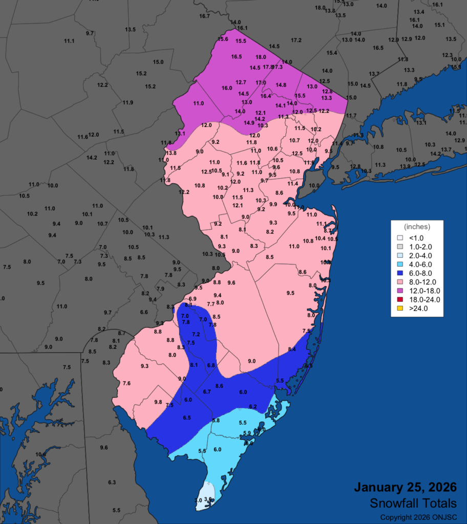
    Similar to the Dec. 14 storm, the northern half of the Jersey Shore cashed in on the snow and sleet. Point Pleasant reported 10.3 inches, Long Branch had 10.5 inches and Brick reported 10.9 inches.

    Snow and sleet totals for the Jan. 25, 2026 storm, via the Office of the New Jersey State Climatologist.

    The highest totals were in far northwest New Jersey. Not only was it all snow, but it was powdery snow. That was thanks to unusually cold temperatures during the snow. It was in the single digits with heavy snow. You just don’t see that often in New Jersey.

    Also unusual was the split in precipitation type across the state. The Jersey Shore warmed from the teens to the upper 20s by late Sunday morning. It was snowing. However, along the New Jersey Turnpike corridor in South Jersey, it was sleeting, despite temperatures in the mid-teens. It could have been much snowier, too.

    When you look at coastal storms you look at the track to give you an idea of who will receive snow, a mix or rain. Typically, when low pressure systems go over 40 degrees north latitude, 70 degrees west longitude, that brings all snow to the I-95 corridor, with mixing where we are, farther east. This low pressure system was farther west, though, roughly 74 degrees longitude at 40 degrees north latitude.

    Meteorologists call this the “benchmark.” However, the center of the storm was only about 50 miles east of Atlantic City at one point. Yet, we snowed and got sleet, with rain only falling in Cape May, Atlantic and Ocean counties. That was because of the brutally cold air mass we had Saturday. High pressure to the north was feeding in Arctic air. If the low pressure went over the typical benchmark, it would have been fair to say that 12 to 20 inches of snow and sleet would blanket the coastal counties, similar to the Blizzard of 2022.

    Snowfall was mostly in line with expectations and road conditions remained treacherous into Monday.

    Remember, generic weather apps are not human curated and can change on a dime, as it just spits out whatever blend of computer models they use.

    Meteorologist Jon Rocco created most of this report. You can follow him on Facebook or X.

  • A LOT of NJ weather to talk about on National Weatherpersons’ Day

    A LOT of NJ weather to talk about on National Weatherpersons’ Day

    THURSDAY’S FORECAST | Fitting for National Weatherpersons’ Day… a lot to talk about. Possible snow squall Friday evening, wind chills colder than last weekend and even lows below 0F. Let’s get into it!

    Our 24×7 Jersey Shore Weather Channel: https://www.youtube.com/watch?v=lGssDGu6xk0
    Jolt your brand, advertise here: joe@cupajoe.live