🌦️FRIDAY’S FORECAST | After a dry and warm day, a cold front brings showers tonight. More rain remains a threat for the end of the weekend.
🏈 Your Rutgers tailgate headquarters! Parking at Saint George Greek Orthodox Church Piscataway NJ is only 500 yards from SHI Stadium and features 500+ spots, clean restrooms, and quick access to River Road. It’s where Joe parks! Purchase at: www.rutgersparking.com .
😎WEDNESDAY’S FORECAST | I’m officially declaring the nor’easter over. We have a tiny bit of tidal flooding in the nooks and crannies of the back bays. That’s it though.
Enjoy the sunshine and enjoy the 70s! BIG changes next week.
For the latest and greatest interviews with artists, authors and entrepreneurs—as well as thoughtfully curated lists of favorites that are never bought and paid for–visit jennypennywriting.com!
A fight over flood insurance is putting the Trump administration at odds with Republican officials. For Jersey Shore homeowners, the debate comes down to a familiar concern: How much more will protecting your home cost?
On this episode of Tidal Flooding Talk, meteorologist Joe Martucci welcomes POLITICO reporter Tom Frank to explain the politics behind rising flood insurance bills.
At the center is FEMA’s Risk Rating 2.0, a pricing system designed to make insurance costs better reflect each property’s flood risk. Frank explains that the federal flood insurance program has long charged some homeowners less than what was needed to cover their risk. Major disasters have exposed that gap, forcing the program to borrow money.
But bringing prices closer to the actual risk creates another problem: Coverage becomes harder for some families to afford.
That tension sparked a lawsuit from Republican attorneys general during the Biden administration. According to Frank, the Trump administration inherited the case and continued defending the system, putting it on the opposite side of fellow Republicans seeking relief from rising costs.
The dispute shows why flood insurance politics can be more complicated than red versus blue.
“The split is geographic,” Frank says.
Lawmakers representing coastal states often want the same thing: affordable coverage for their residents. That can put Republicans from Florida and Louisiana alongside Democrats from New York and New Jersey.
The broader question is who should pay. Should homeowners shoulder more of the cost of living in places that flood? Or should the federal government spread more of that burden across taxpayers to keep coverage affordable?
Frank also discusses FEMA’s flood map updates. When maps place additional homes in high-risk areas, some owners with mortgages can face a requirement to buy flood insurance. That adds another expense to already tight household budgets.
Meanwhile, the water does not wait for a political agreement. Coastal storms, heavy rain and overflowing rivers can damage homes regardless of party affiliation. Frank also reminds viewers that standard homeowners insurance generally does not cover flood damage.
For the Jersey Shore, this debate reaches well beyond Washington. It touches the cost of owning a home, recovering from storms and remaining in a coastal community.
Watch the full conversation on Tidal Flooding Talk, presented by the New Jersey Coastal Coalition.
🌤️TUESDAY’S FORECAST | The nasty nor’easter has finally departed, leaving us with mainly dry conditions for the rest of the week. Unfortunately, more rain is a threat this weekend.
Tired of water in your basement or crawlspace? Trust Finally Dry Waterproofing’s family-owned company to fix it right. We install permanent drainage solutions guaranteed for 2 ownerships with no limit! Get your FREE inspection at finallydrywaterproofing.net .
Powerful Nor’easter Makes Landfall at the Jersey Shore
A powerful nor’easter made landfall along the Jersey Shore Sunday morning, bringing major tidal flooding, strong winds and widespread power outages to parts of the coast.
The center of the storm moved ashore near Barnegat Inlet, between Barnegat Light and Island Beach State Park. Around the center, conditions briefly became calmer, with an eye-like feature showing up near parts of Ocean County.
The biggest impacts were focused along the coast rather than inland New Jersey. Monmouth and Ocean counties dealt with the strongest onshore winds, significant tidal flooding and thousands of power outages. During the late morning, about 25,000 customers were without power in Monmouth County and roughly 36,000 were out in Ocean County.
Conditions were different farther south. Atlantic and Cape May counties still experienced gusty winds and flooding, but winds became more offshore there. That helped keep wind impacts and water levels lower than farther north.
Flooding remained a concern around Barnegat Bay, where water drains more slowly than along the open coast. Areas including Toms River, Waretown, Forked River, Lacey and Manahawkin could continue seeing lingering water even after the storm begins pulling away.
Another round of heavier rain was also possible Sunday evening before the nor’easter gradually winds down.
Know More
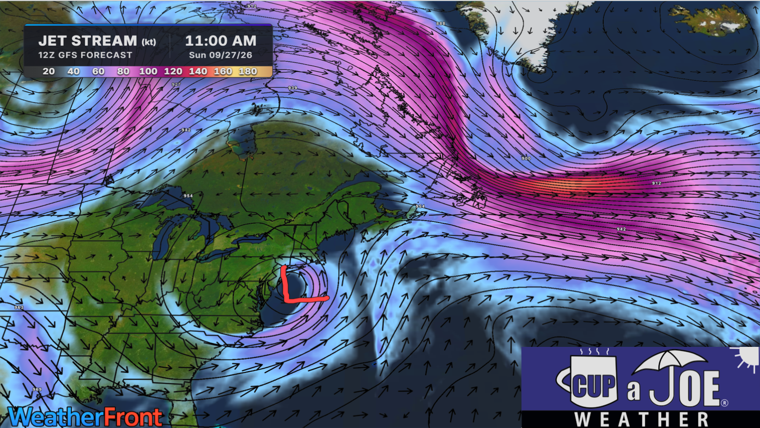
The biggest reason this nor’easter lingered for days can be found high above the surface, at the jet stream level.
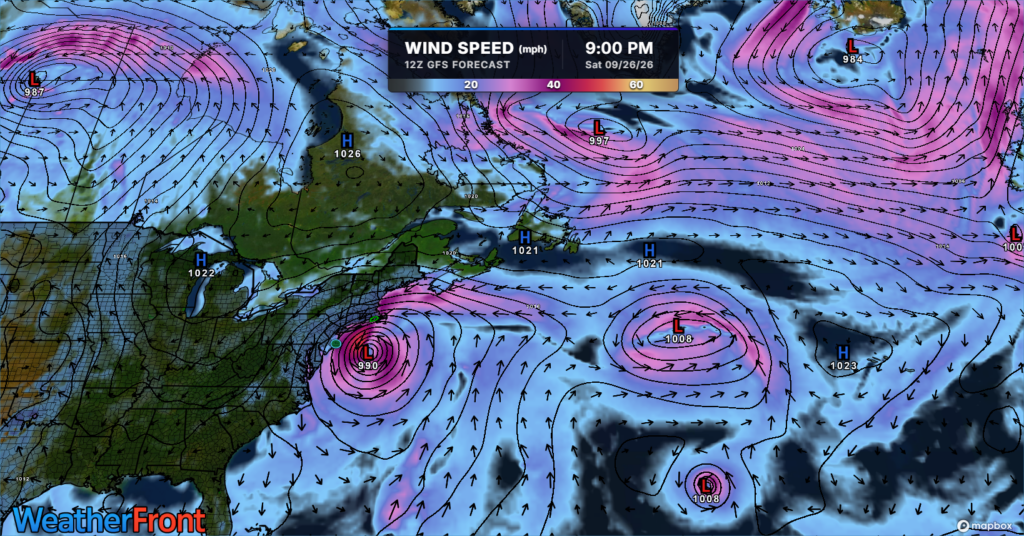
Normally, storm systems get caught in the faster west-to-east flow of the jet stream and are pushed along. This time, the main, faster jet stream was displaced well to the north of New Jersey. Another branch of stronger upper-level winds was farther south.
In between them, a piece of upper-level energy broke away from the main flow. Meteorologists call this a closed low or cutoff low.
Think of it like a leaf breaking away from a fast-moving river and getting caught in a slow eddy. Instead of quickly moving east, this system was largely separated from the faster atmospheric winds that normally steer storms.
That allowed the low-pressure system to meander and circle around the Mid-Atlantic for several days.
The cutoff low was also unusually strong. As the surface low followed the circulation around it, the storm strengthened and eventually moved into New Jersey Sunday morning. Its slow movement helped prolong the northeast and east winds along the coast, allowing water to repeatedly pile into the Jersey Shore and back bays.
That persistence matters with tidal flooding. One high tide can cause problems, but several tidal cycles with sustained onshore flow can keep adding water faster than some bays can drain it.
Barnegat Bay is especially vulnerable to this. Water enters through relatively limited inlets and can take time to escape. That allowed elevated water levels to linger around places such as Waretown, Forked River, Toms River and Manahawkin even as conditions began changing elsewhere.
The pattern finally starts breaking down when the closed low gets close enough to the main jet stream to become absorbed back into the faster flow. In this case, that process is expected around Tuesday.
Once that happens, the atmospheric “traffic jam” breaks. The storm gets picked up by the jet stream and accelerates away from the region.
So while the surface storm produced the wind, rain and flooding people experienced, the unusual jet-stream setup is a major reason New Jersey dealt with the nor’easter for so long.
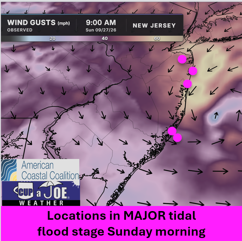
1045AM SUNDAY FLOODING UPDATE | I’m getting reports of flooding nearly as bad as Saturday morning today. Major stage is gripping Keansburg, Sea Bright, Shark River Hills, etc.
Why? The track of the storm and the direction of the wind.
This is where we can bring Superstorm Sandy into play. Anywhere NORTH of where these make landfall had onshore winds, pushing the tide higher.
Winds are from the northeast in Monmouth and Ocean Counties.
South of there, they’re offshore winds. Cape May and Atlantic Counties are in moderate stage flooding.
This is why miles matter in a storm track. Had this storm been 70 miles further south, all of the Jersey Shore would be in major flood stage.
NJ beaches generate billions in revenue, supporting thousands of jobs and businesses. If they erode, our economy collapses. Federal beach funding was cut in 2025. Only the American Coastal Coalition fights 24/7 in DC to restore it. Protect your beach and business. Join today: americancoastalcoalition.org
🌧️SUNDAY NOR’EASTER | Rain and wind continue to hammer the Jersey Shore this morning. There will be a brief lull before another round of rain by late afternoon through tonight.
SATURDAY EVENING UPDATE | The tidal flooding this evening will be lower than this mornings! Still you need to keep your cars far away from flood zones and water can get into ground floors.
For everyone: Rain peaks Sunday morning and winds get strong again, too.
ShorelySafe® helps organizations forecast tidal flooding 84 hours ahead, reduce flood risk and lower insurance costs with property-level flood intelligence.
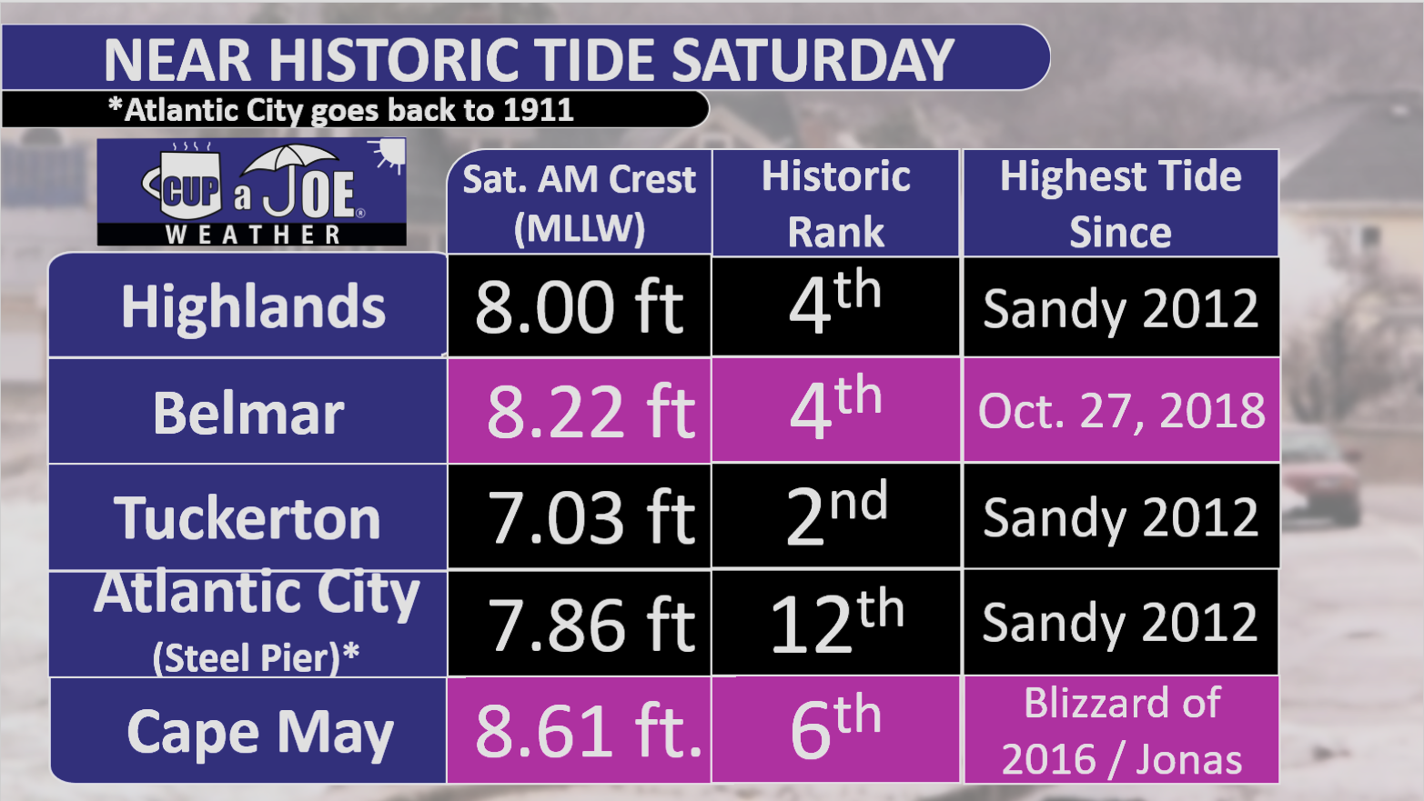
Tuckerton hit second-highest tide in its available record.
Thirteen Shore gauges ranked fifth-highest or higher.
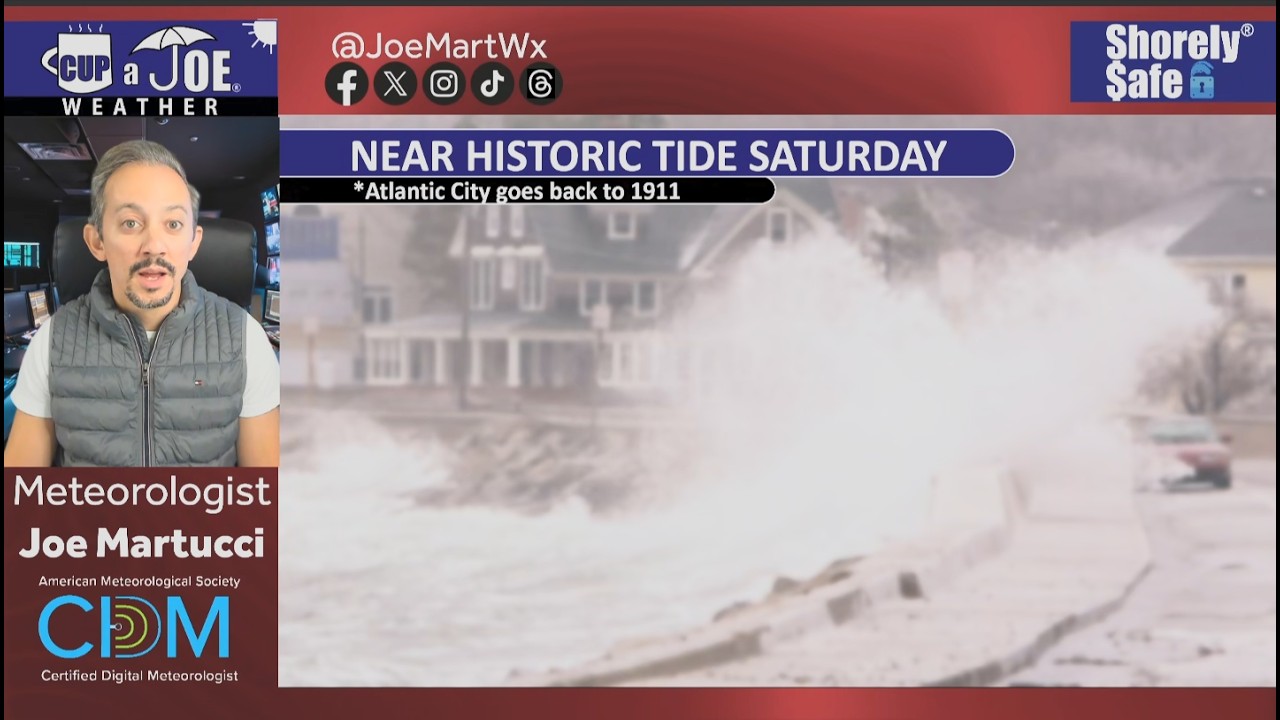
Atlantic City’s tide ranked 12th since 1911.
Major stage tidal flooding gripped the entire Jersey Shore Saturday morning, bringing flooding people haven’t experienced in years.
Water levels rose high enough to rank among the five highest tides in the available record at 13 gauges according to an analysis by PJ Hondros, our Vice President of ShorelySafe,
Tuckerton was one of the biggest standouts. The tide reached 7.03 feet above Mean Lower Low Water, making it the second-highest level in its available record. Ship Bottom also recorded its second-highest tide. Farther north, Highlands reached 8.00 feet and Belmar climbed to 8.22 feet, both ranking fourth in their respective records.
The flooding was also significant farther south. Cape May reached 8.61 feet, its sixth-highest tide on record. Thankfully, only 1 water rescue was needed in the city.
🏖️ 🌧️ MAJOR EROSION: FOX News Multimedia Reporter Pete Cuddihy reports from Cape May, New Jersey, where intense Nor'easter conditions have caused significant coastal erosion, with no signs of slowing down this weekend. pic.twitter.com/kjLu0QiYES
The numbers help put into perspective what residents saw Saturday morning: water covering low-lying roads, difficult travel in bayside communities and flooding that spread well beyond the spots that take on water during more common high tides.
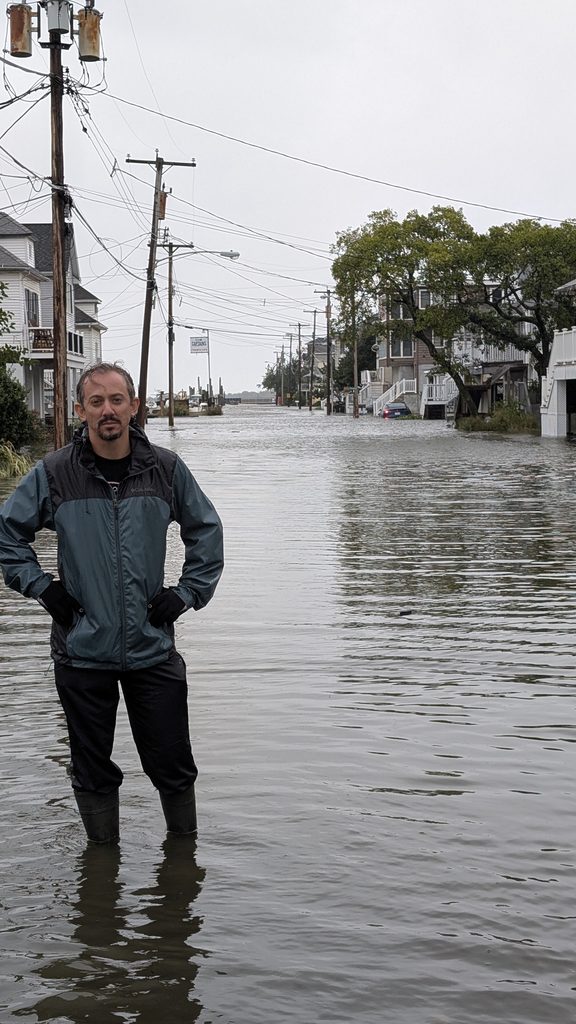
Take Highlands for example. Nearly every street bayward of Bay Avenue was underwater. That’s as much as four blocks inland. Even cross streets out to Shore Road, another block further inland, had water in spots.
In my (Joe Martucci’s) 9 years of covering Jersey Shore weather, this was the first tidal flooding I’ve seen with my own two eyes. The only one that rivals it was standing on Melrose Avenue in Atlantic City during the February 2021 nor’easter with two feet of water. One woman in Highlands carried her baby to higher ground. When she got out of the water, you saw it went to her upper thigh. She was about five and a half feet tall.
Every town floods differently depending on elevation, drainage, bulkheads and local geography. Still, taken together, the gauge data show that Saturday morning was one of the more significant and widespread tidal flooding events to affect the Jersey Shore in recent decades.
Last High Tide as Significant as 9/26/2026(oldest to newest)
Sea Isle City – October 25, 1980
Margate – December 11, 1992
Stone Harbor – March 3, 1994
Cape May Harbor – Superstorm Sandy (2012)
Atlantic City (Inside Thorofare) – Superstorm Sandy
Barnegat Light – Superstorm Sandy
Atlantic City (Steel Pier) – Jan. 23, 2016 (Jonas)
Tuckerton – Jonas
Atlantic City (Absecon Channel) – Jonas
Ocean City – Jonas
Absecon – Oct. 27, 2018
Manasquan – Oct. 27, 2018
Keansburg – Dec. 23, 2022
Sandy Hook – Jan. 13, 2024
Cape May – Hurricane Erin (Aug. 2025)
South Dennis – Hurricane Erin
Waretown – 2025 Columbus Day Nor’easter
Sea Bright, Ship Bottom and Avalon did not have a flood on record within 0.25 feet of 9/26’s morning high tide.
Highest High Tide Since (Oldest to Newest)
Superstorm Sandy (Oct. 29, 2012) – Atlantic City (Inside Thorofare and Steel Pier), Margate, Sea Bright, Ship Bottom, Tuckerton,
Blizzard of 2016 / Jonas (Jan. 23, 2016) – Absecon, Atlantic City (Absecon Channel), Avalon, Cape May, Ocean City, Sea Isle City, Stone Harbor.
Oct. 27, 2018 – Belmar, Manasquan
Dec. 23, 2022 – Keansburg, Sandy Hook
Hurricane Erin (Aug. 2025) – South Dennis
2025 Columbus Day Nor’easter – Waretown
Know More
This was a five-day water-loading event, not a one-tide surprise. Since Tuesday, a strengthening coastal low offshore and strong high pressure over eastern Canada have kept a persistent northeast-to-north wind along the Jersey Shore.
By Wednesday, coastal northeast winds were reaching 30 to 35 mph. That repeated onshore push forced Atlantic water through the inlets and into the back bays.
Just as important, the bays could not fully drain between high tides, so each new tide started with more water already in the system. The National Weather Service specifically noted water piling up in tidal tributaries and back bays.
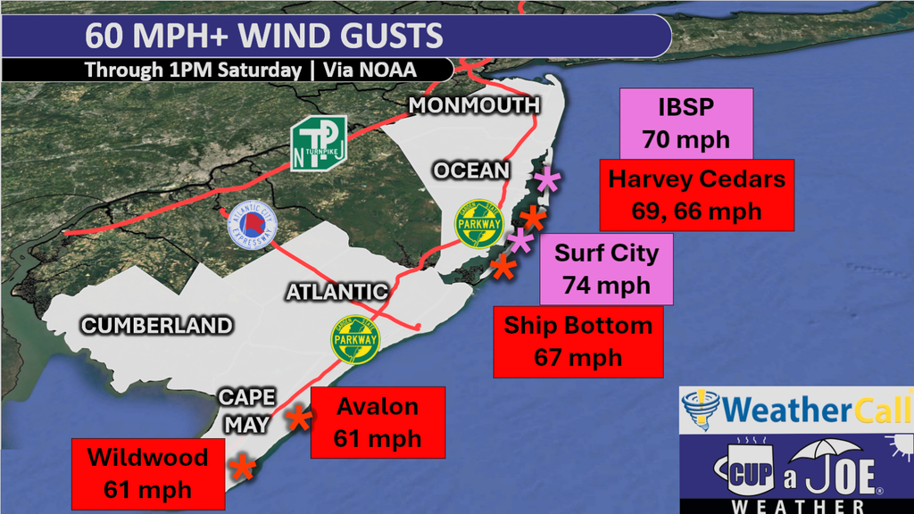
Then the setup intensified heading into Saturday. The nor’easter deepened and moved closer to New Jersey, tightening the pressure gradient. Winds gusts Friday night went over 60 mph in a number of locations from Ocean County on south. Winds were from the onshore direction.
Seas built to 15 to 20 feet come Saturday morning. At the same time, Saturday’s full moon was raising the astronomical tide.
Put it all together you had: days of accumulated water, strong north/northeast winds, low pressure, very rough seas and a higher astronomical tide all peaked at roughly the same time.
Rain and runoff added to the problem in some back bays, but the main story was storm surge plus the astronomical tide.
This was similar to Superstorm Sandy in 2012. The storm’s landfall came at high tide on a full moon. In this case, the storm didn’t make landfall, but the high tide was just after a period of the strongest onshore winds on the same day as a full moon.
Why was this the highest tide since Sandy at some gauges, but since Winter Storm Jonas (2016) at others? Geography.
Jonas was especially potent farther south: Cape May reached 9.0 feet MLLW in 2016, slightly higher than Sandy’s 8.9 feet there.
In other words,this storm behaved more like Jonas in 2016 — a prolonged water-piling nor’easter — while each gauge’s historical comparison depends on its local geography and which past storm hit that location hardest.




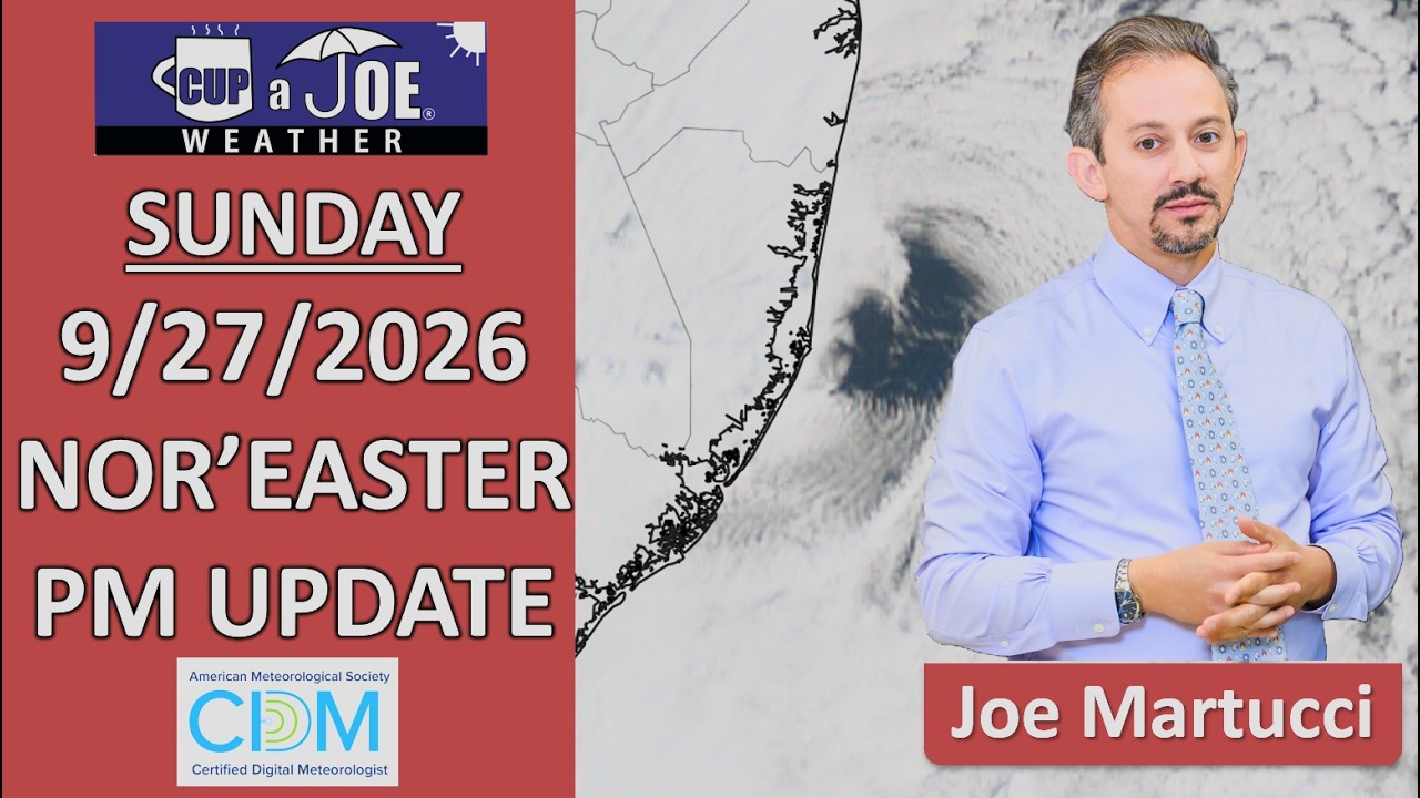
 SUNDAY EVENING VIDEO UPDATE | The tide’s rising again, the rain is coming down (at least in Monmouth-Ocean) and this storm ain’t done yet.