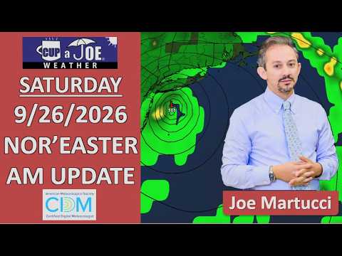
⚠️SATURDAY AM WEATHER UPDATE | The most significant tidal flooding in years is happening very soon. Even if you live away from a flood zone, 50+ mph gusts and periods of rain will make it nasty outside.
Stay safe. Don’t drive through the flood water and here’s your forecast.
Come visit Headley Family Farm for all your Jersey Fresh Produce in West Creek. Call 609-848-3763 or follow www.instagram.com/headleyfamilyfarm/ .
MAJOR STAGE TIDAL FLOODING? | In spots, yes. Major flood stage is a real issue.
Driving around towns is nearly impossible.
People who usually see inches of water see feet of water.
People who rarely flood now flood.
Our research looks at when the last time towns had a high tide this significant. Find the closest town near you and see if you can remember what it was like on that day. That’s what you’ll see Saturday AM.
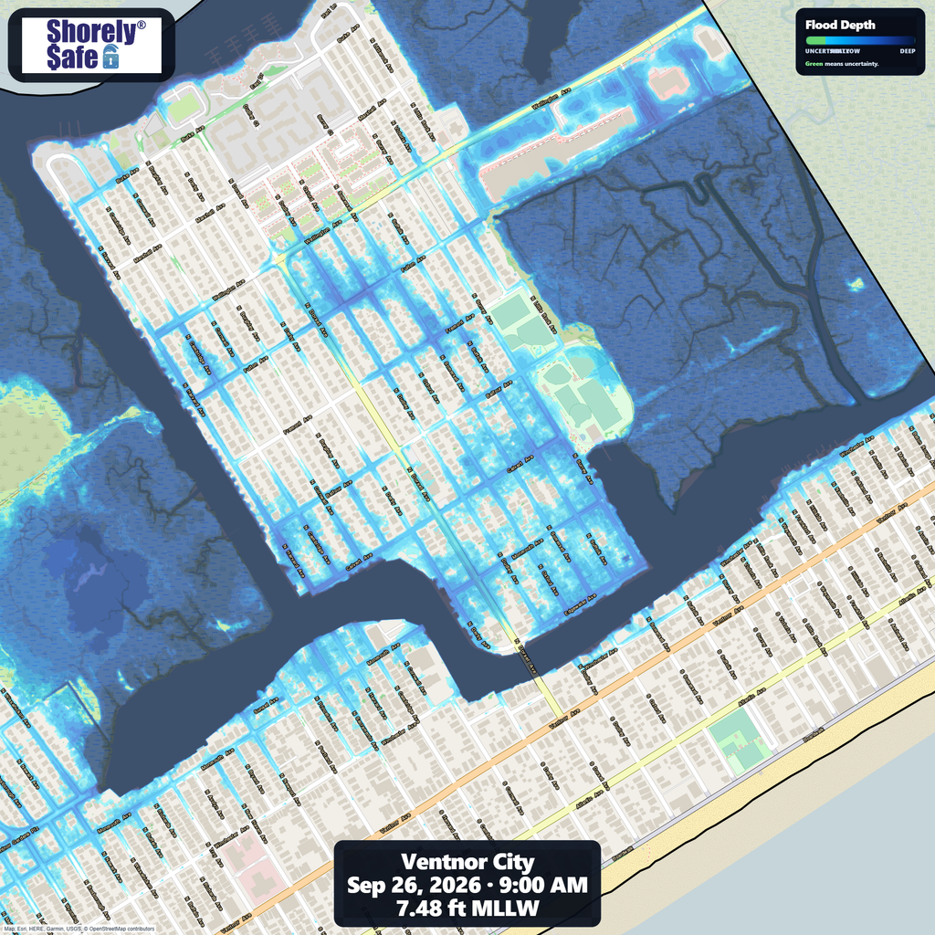
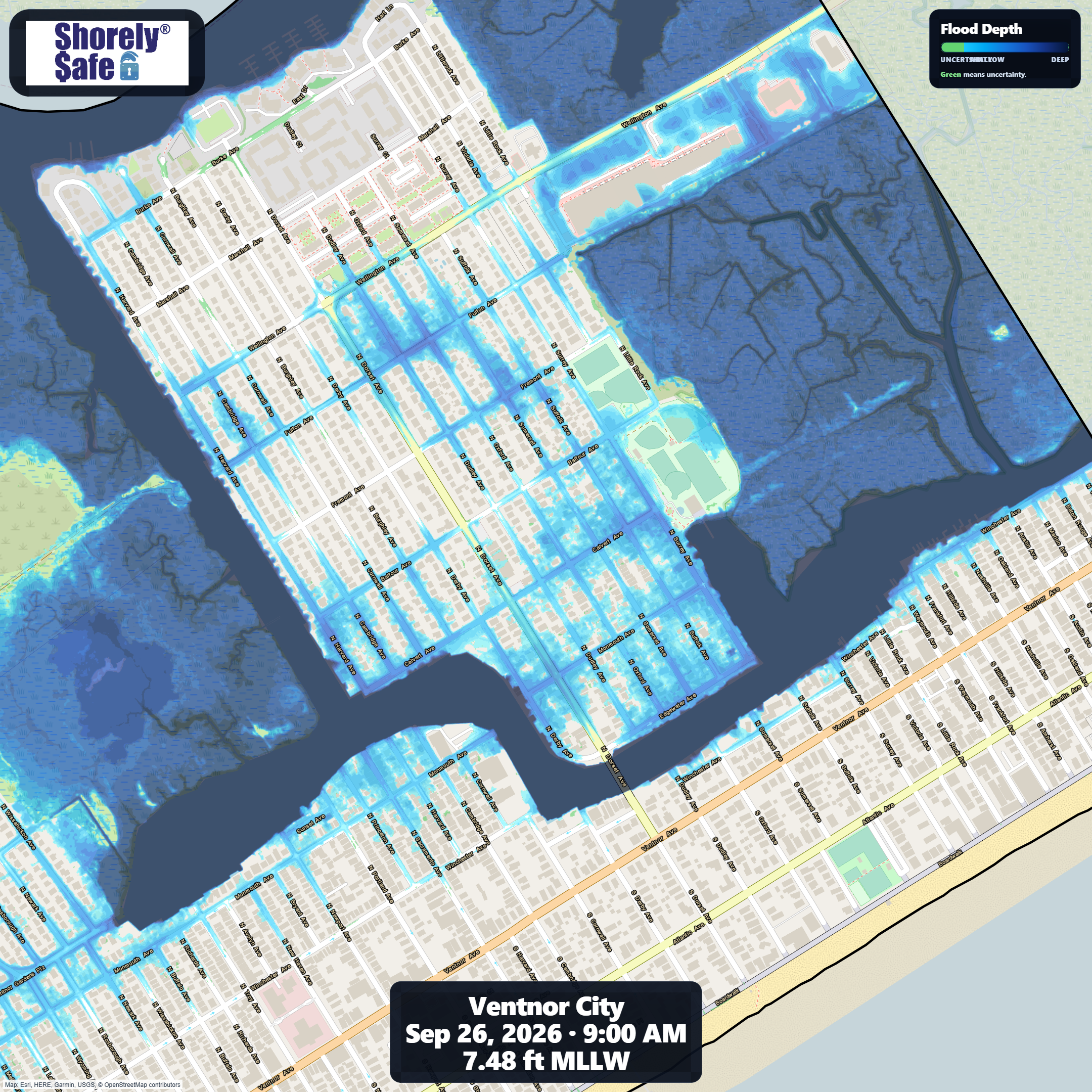
Here’s a look at what Ventnor City’s flooding depth and extent should look like Saturday morning at high tide. This is more than the usual.
NJ beaches generate billions in revenue, supporting thousands of jobs and businesses. If they erode, our economy collapses. Federal beach funding was cut in 2025. Only the American Coastal CoalitionAmerican Coastal Coalition fights 24/7 in DC to restore it. Protect your beach and business. Join today: americancoastalcoalition.org
It’s a 6 minute video and every minute here is important. Here’s why?
2 to 3 moderate, even major, stage tidal flooding is expected Friday-Saturday
High wind warning in effect for the beaches all weekend.
Rain enters the forecast, too.
🏈 Your Rutgers tailgate headquarters! Parking at St. George is only 500 yards from SHI Stadium and features 500+ spots, clean restrooms, and quick access to River Road. It’s where Joe parks! Purchase at: www.rutgersparking.com.
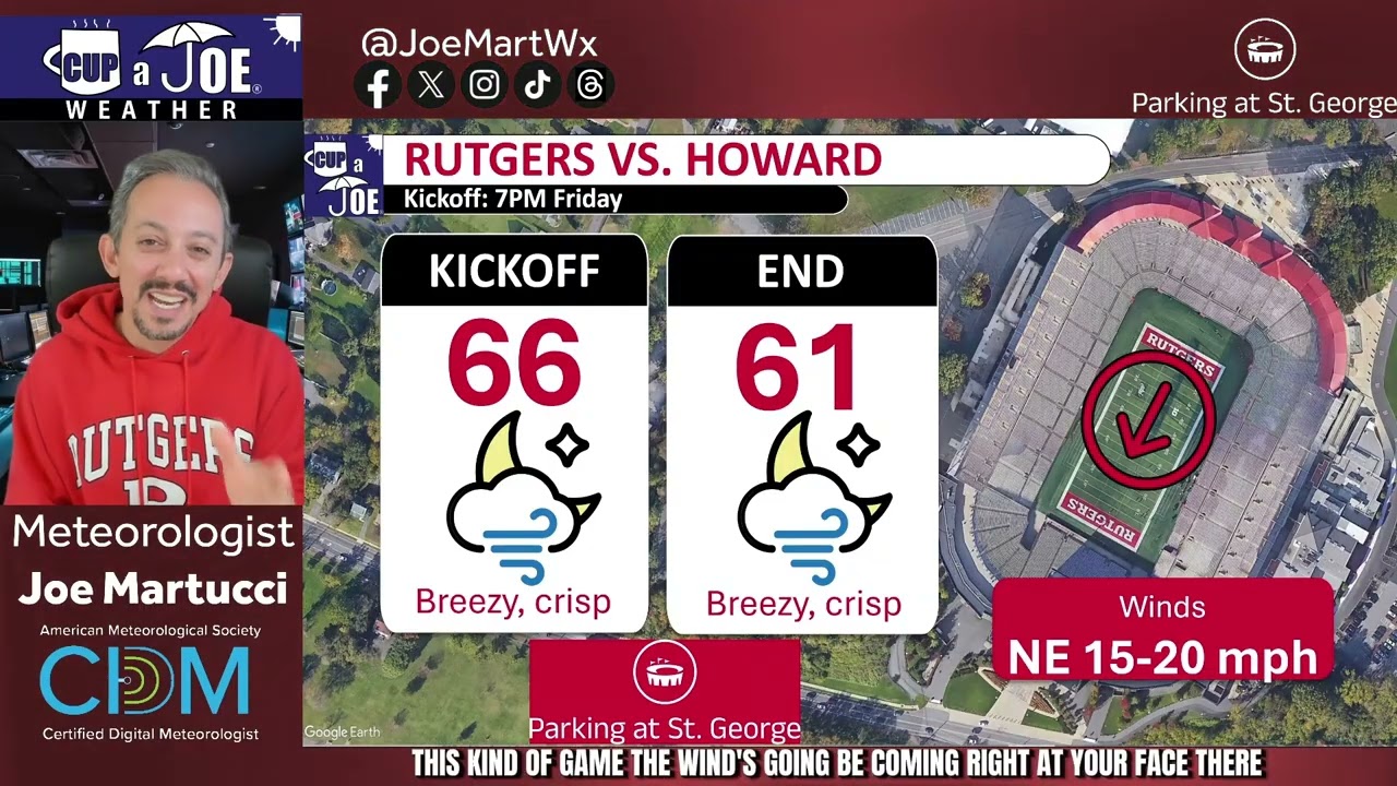
The windiest September home game on record* will be this Friday when Rutgers football takes on the Howard Bison at 7PM! That being said, it’s not a cold wind. Keep your tailgate safe and enjoy. Go RU!
Data from our in-house Rutgers football weather archive.
🏈 Your Rutgers tailgate headquarters! Parking at St. George is only 500 yards from SHI Stadium and features 500+ spots, clean restrooms, and quick access to River Road. It’s where Joe parks! Purchase at: www.rutgersparking.com.
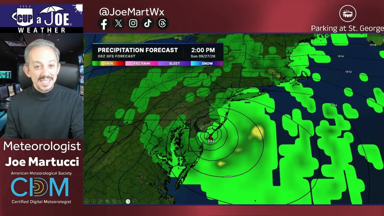
A coastal storm will linger near New Jersey into the weekend, but exactly how close it gets will determine the impacts at the Jersey Shore.
The American GFS model keeps the storm farther offshore. That scenario would mean breezy and mainly dry weather for much of the Shore, although significant tidal flooding, beach erosion, high surf and dangerous rip currents would remain concerns.
The European model brings the storm closer to New Jersey. That could produce major-stage tidal flooding Friday evening, especially from Long Beach Island south, followed by periods of rain Saturday night into Sunday. Rain could be heavy at times, particularly north of the Atlantic City Expressway.
The exact track remains uncertain, so keep checking the forecast before making weekend plans.
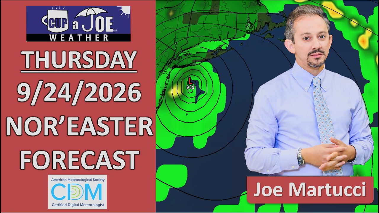
📹THURSDAY’S FORECAST | Listen, I know this video is 5 minutes long. However, with 6 more rounds of tidal flooding, rain chances going up this weekend, beach erosion and more, I believe it’ll be worth your watch. Thank you!
Why settle for big chains? Choose Just Four Wheels Car, Truck and Van Rental family-owned locations all across NJ! Rent brand-new sedans, passenger vans, box trucks and more today! Visit www.just4wheels.com or call 877-650-3500.
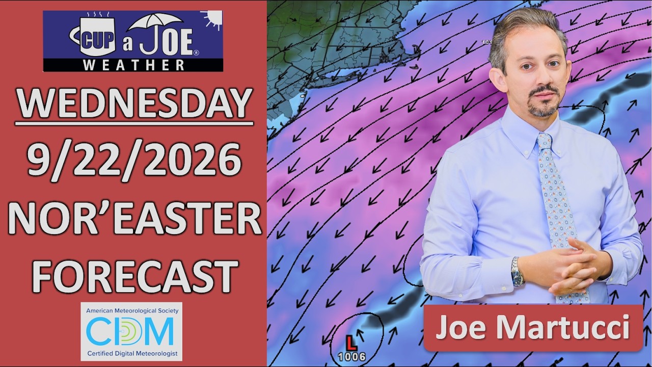
A nor’easter is impacting the Jersey Shore, but this is not mainly a rainstorm. The bigger issues are tidal flooding, strong northeast winds and rough ocean conditions.
Coastal Flood Warnings are in effect for Ocean, Atlantic and Cape May counties, where flooding could threaten property. Monmouth County and other areas are under lower-level coastal flood alerts.
Winds will be gusty today and Thursday, especially along the beaches. Gusts could reach the 30s and 40s mph, so secure outdoor furniture and anything else that can blow around.
The ocean will also be dangerous. Surf could build to 6 to 10 feet, with several rounds of moderate tidal flooding possible. The highest number of flooding rounds is expected from Long Beach Island south.
Thursday and Friday look mostly dry away from the flooding. For the weekend, keep outdoor plans for now, but have a Plan B ready.
For the latest and greatest interviews with artists, authors and entrepreneurs—as well as thoughtfully curated lists of favorites that are never bought and paid for–visit jennypennywriting.com!
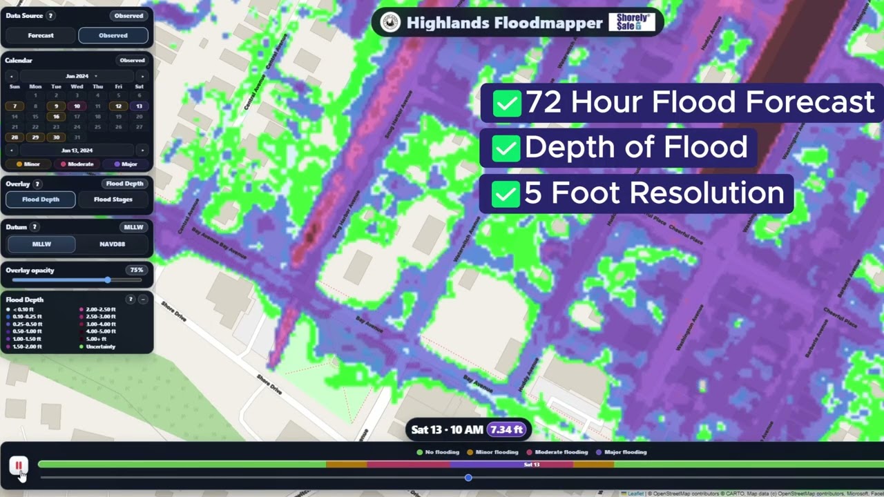
Our Proprietary Flood Mapper is America’s best in class. We provide weather-driven current and forecast tidal flooding, out to 72 hours, at hourly timestep, including the depth of the water, at unprecedented resolution.
ShorelySafe turns flood data into action — helping you protect people, run leaner operations, and qualify for lower flood insurance premiums.
We recently completed several major upgrades to the Coastal Flooding Dashboard developed for our ShorelySafe towns and counties.
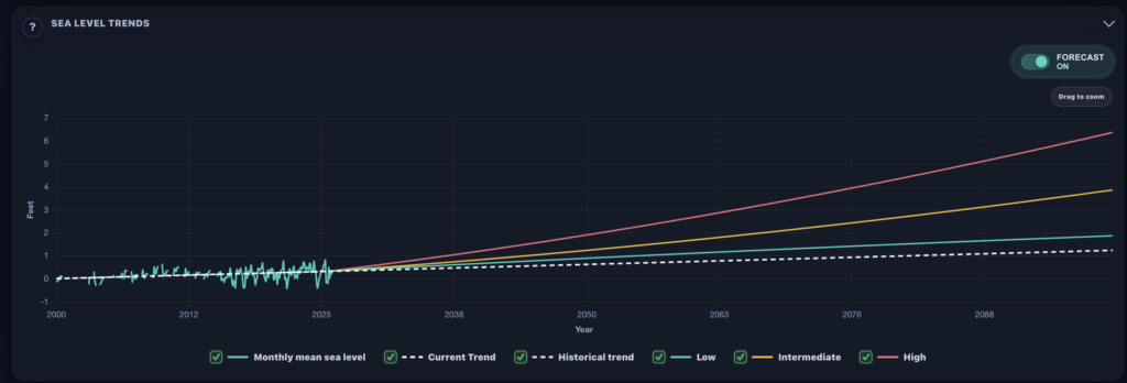
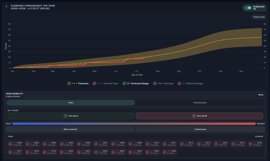
The updated platform includes an interactive dashboard tour, current and historical flooding comparisons, annual forecasts, 50 years of coastal flood data and sea-level projections extending toward the 22nd century. Users can also customize each chart to focus on the information most relevant to them.
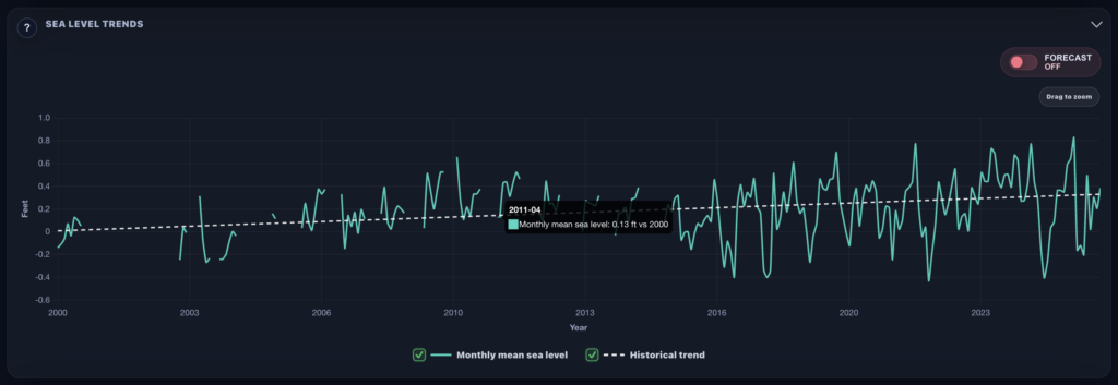
Our new sea level trends feature in the Flood Dashboard shows how sea levels have risen in your community over the decades. Our Sea Level Trends forecast tool allows you to plan for future flooding, decades in advance, using different climate scenarios. Our Flooding Throughout the Year product received a major upgrade. We now forecast the number of tidal floods in a year, with 95% accuracy. You can see how the number of floods in your town occurred based on specific years, too. Just turn them on or off.
These improvements make complex coastal data easier for residents, municipal leaders and emergency managers to understand and use.
That includes you reading this today! Our in-house Flood Mapper and Flood Dashboard are available to the public in that community.
As flooding becomes more frequent, tools like this can strengthen public awareness, planning and coastal resilience.
View the attached images and visit the dashboard to explore the new features. Ask your town or county to sign up for ShorelySafe!
7 to 9 rounds of tidal flooding are possible through Sunday.
Beach wind gusts could reach 40–50 mph in South Jersey.
Dangerous surf and rip currents will make swimming and boating risky.
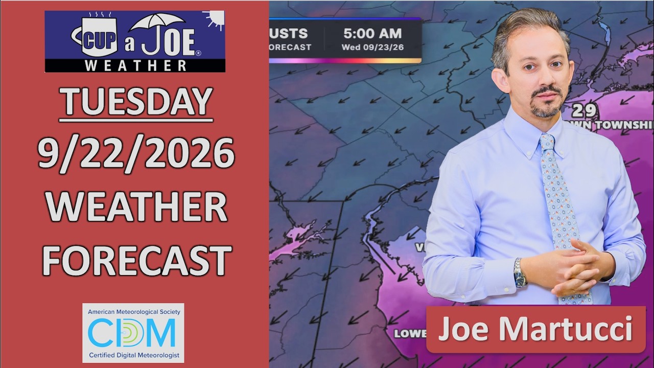
A long-lasting nor’easter will make for a rough week along the Jersey Shore, even though much of the area will see very little rain after Tuesday.
The biggest concern will be repeated tidal flooding. Minor flooding is expected Tuesday evening, followed by more significant flooding Wednesday through Friday. Atlantic and Cape May counties could even approach major flood stage later in the week, especially around the Friday evening high tide. A full Harvest Moon on Saturday will also help raise normal tide levels.
Strong northeast winds will continue pushing ocean water toward the coast. Gusts could reach 40 to 50 mph along the beaches of Atlantic and Cape May counties, with gusts around 35 to 40 mph farther north. Those winds will also create high surf and dangerous rip currents.
Tuesday will be the main rainy day. Wednesday through Friday should be mostly dry, aside from a few possible sprinkles. Inland areas will mainly deal with gusty winds and a raw feel.
Conditions should begin improving Saturday as winds turn more northerly. However, some tidal flooding could continue into the weekend, and Sunday’s weather will depend on how quickly the coastal storm moves away.
Tired of water in your basement or crawlspace? Trust Finally Dry Waterproofing’s family-owned company to fix it right. We install permanent drainage solutions guaranteed for 2 ownerships with no limit! Get your FREE inspection at finallydrywaterproofing.net.

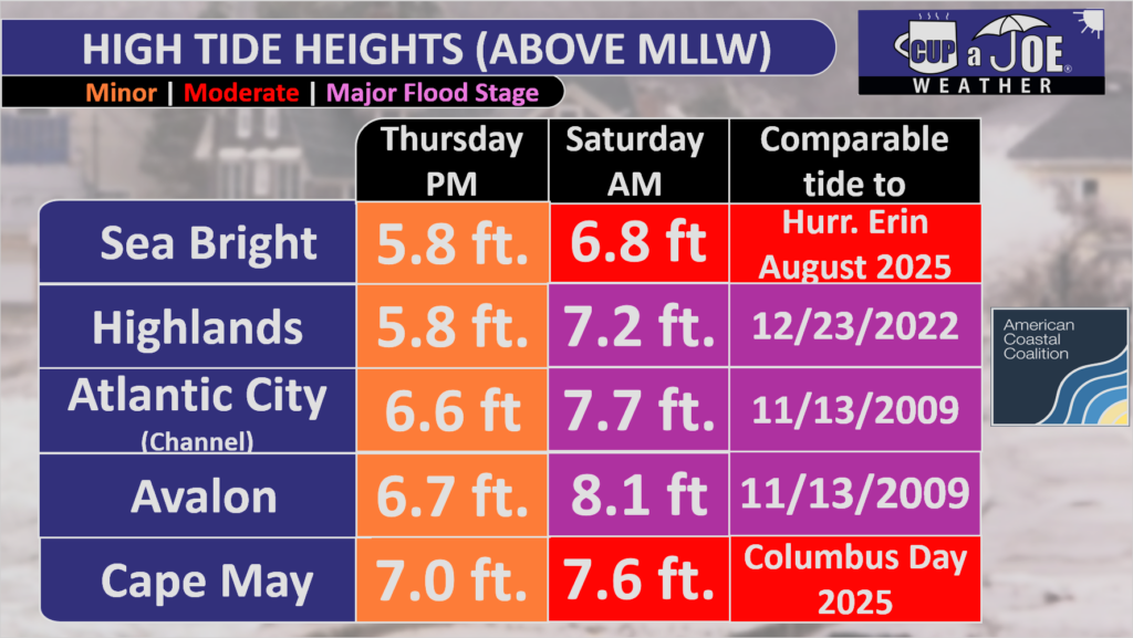
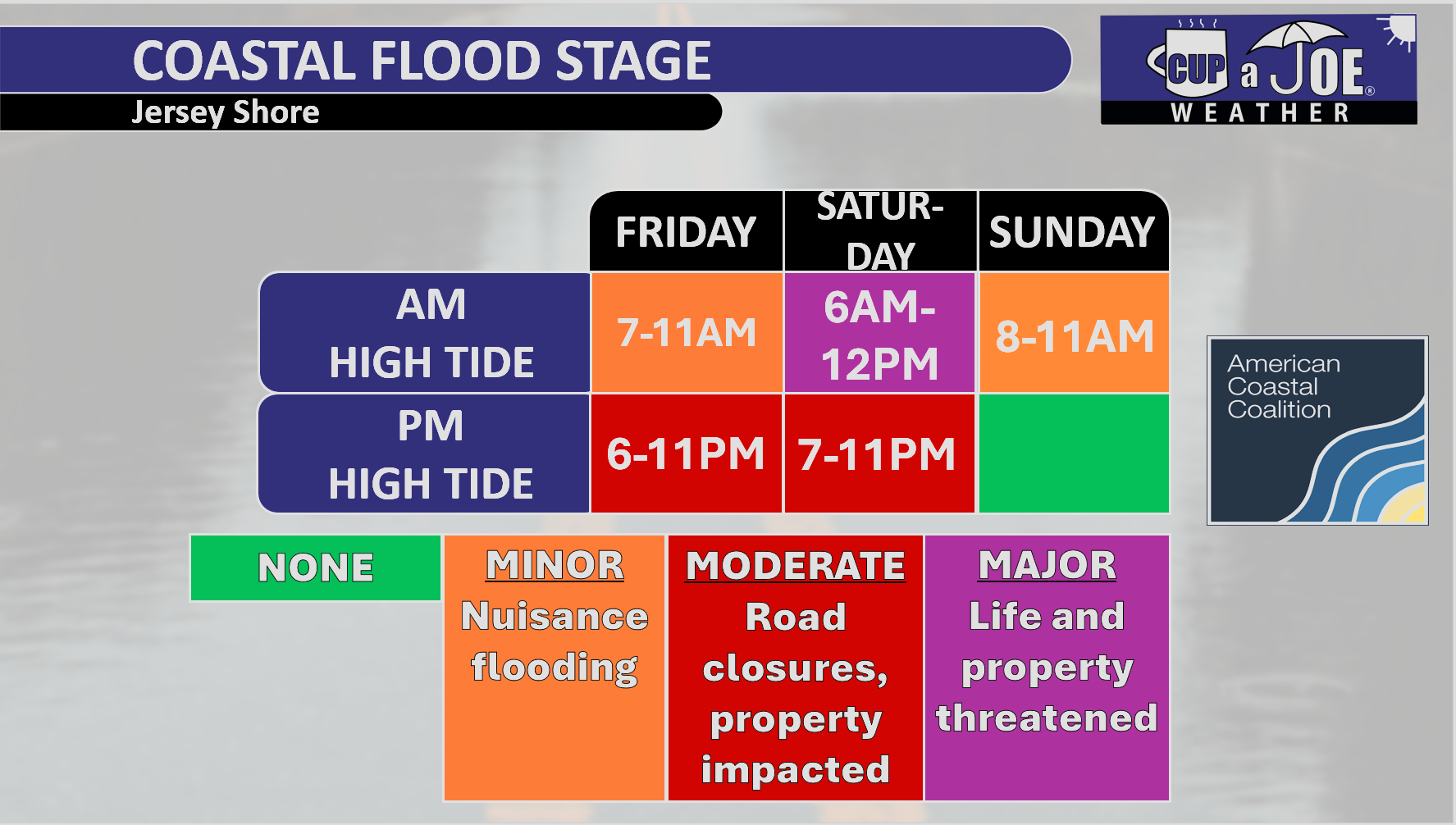
 MAJOR STAGE TIDAL FLOODING? | In spots, yes. Major flood stage is a real issue.