Category: Latest Weather News

  • SEVERE SATURDAY possible…if conditions allow!

    SEVERE SATURDAY possible…if conditions allow!

    SEVERE SATURDAY POSSIBLE | Some nasty storms are a threat later this afternoon and evening, but will any morning showers and wildfire smoke diminish the threat? It is a “boom or bust” type of day.

    Come visit Headley Family Farm at 120 Province Road in West Creek! It’s where farming the pines meets the Jersey Shore. Get your Jersey Fresh produce here. Open weekends and some weekdays. Call us at 609-848-3763 or follow us on Facebook, too!

  • (OPINION) Canadian wildfire smoke is choking the U.S. It’s not really Canada’s fault.

    (OPINION) Canadian wildfire smoke is choking the U.S. It’s not really Canada’s fault.

    It’s back.

    Wildfire smoke in New Jersey. It’s grayed our sky, with hints of orange, too.

    In New Jersey, the smoke has been enough to reduce visibility. In fact, I (Joe Martucci) was driving back from the Ventnor Beach Concert at Ski Beach on Parkway North. Right as soon as you got into the Pinelands around exit 52, you noticed a layer of smoke along the tops of the trees. It looked like fog, but it was the Canadian wildfire smoke.

    Visibility at 8:07 a.m. on Friday, July 17. Without the wildfire smoke, the visibility would be 10 miles. However, visibility is cut in half in spots as a result.

    The culprit? Canada, and their wildfires.

    I wrote that as it if we should “Blame Canada!” like the South Park show did once. While no one has directly blamed Canada maliciously to me, social media shows a few examples of people doing so (example, example).

    The thing is… Canada can’t do much about it unless they spend much more money than they do now. Or, people move to where they haven’t moved before. Here’s why.

    Lightning causes the vast majority of wildfires in Canada

    As the climate warms, lightning has become more frequent. 93% of acres burned due to wildfires in Canada were caused from lightning, in 2023, according to research from the Northern Forestry Center.

    In the United States, that number falls to 60%.

    CountryLightning-causedHuman-caused
    CanadaAbout 83%About 17%
    United StatesAbout 60%About 40%

    You can’t arrest lightning. You can’t charge it with arson. Lightning has been around long before humans and will be long after humans, too.

    Canadian Wildfires Occur in Remote Regions

    About 50% of all acreage burned from Canadian wildfires come from Canadian Provinces and Territories with a population density at or less than 2.5 people per square kilometer. That’s 6.5 people per square mile.

    Northwest Territories – 21% of acres burned – 0.04 people per square kilmometer.

    Saskatchewan – 18% of acres burned – 2.0 people per square kilometer.

    Manitoba – 8% of acres burned – 2.5 people per square kilometer.

    Yukon Territory – 4.5% of acres burned – 0.1 people per square kilometer.

    Newfoundland and Labrador, as well as Nunavut also are very sparse, but contribute less than 1% to the total.

    Population density data comes from Canada’s 2021 Census.

    A map of Canada, including major highways and railroads.

    When a wildfire occurs, there are few, if any, roads to drive to the fire. There also have to be firefighters stationed nearby, ready to go. These wildfires aren’t just occurring in remote areas 100 miles outside of a major city like Toronto. They’re happening 100 miles (and more) outside of towns like Yellowknife or Whitehorse, which have a few tens of thousands of people.

    Even if you had firefighters pre-stationed, they need food, they need water. Those towns do not have the resources on their own to supply them. The federal government needs to step in. Which, they do, but it’s still a logistical challenge.

    Firefighters in the Canadian forest (via Parks Canada Agency)

    Why Can’t Canada Fight Fires By Air?

    They can and that does overcome the challenges poised by lack of roads. However, air is not as effective as ground.

    smoking coming out of a forest
    Photo by POI on Pexels.com

    Canada cannot simply fight every remote wildfire from the air because aircraft alone rarely extinguish large, intense fires. Water and fire retardant drops mainly slow the flames, giving ground crews time to build firebreaks and secure the perimeter.

    In remote forests, there may be no roads, safe landing areas, nearby water sources or crews available to finish the job.

    Heavy smoke, strong winds, thunderstorms and nighttime conditions can also ground aircraft.

    With thousands of fires across an enormous landscape, Canada must prioritize communities, infrastructure and fires that can realistically be controlled.

    Plus, similar to the lack of roads, there are a lack of airports in those remote areas, too. Refueling must be closely coordinated.

    Canadian Wildfires are Generally Larger than America’s

    The vast boreal forests can start large fires at the tops of trees. On the ground, the deep layer of organic soil or peat can bring fire smoldering underground for a long period of time.

    The United States has that in parts, like Alaska, next to Canada. However, Western United States Wildfires often have steep terrain and complex winds. That brings faster moving fires that are aggressive locally. However, it’s the massive wildfires in Canada that bring the large smoke plumes, not the localized ones.

    Also, smoke spreads the further from the source you are. Take, for example, the Jones Road Fire in April 2026 in Ocean County, NJ

    The Jones Road Fire in April, 2025 in New Jersey (via Famartin on Wikipedia)

    Places like Long Branch and Cape May, which were east of the fire barely had smoke in the air. Meanwhile, they are both experiencing the smoky sky now with wildfires thousands of miles away.

    In Conclusion

    To be fair, wildfire smoke is hazardous to your health. Wildfire smoke contains PM2.5, tiny particles made of soot, ash, organic carbon and other burned material. These particles can travel deep into the lungs and enter the bloodstream. Smoke may also contain hazardous gases, including carbon monoxide, benzene, formaldehyde and acrolein, according the Environmental Protection Agency.

    A smoky sunset in Ventnor City, NJ on July 15, 2026

    At the same time, there’s not a whole lot Canada can realistically do to stop this. When fires erupt in the Pine Barrens of New Jersey, firefighters can get there in minutes. Planes can drop fire retardants with ease, refueling at nearby airports. Where the wildfires usually burn in Canada, those options just aren’t possible.

  • SMOKE and STORMS expected Friday – Saturday at the Jersey Shore

    SMOKE and STORMS expected Friday – Saturday at the Jersey Shore

    📹FRIDAY’S FORECAST | After a day of powerful storms in Ocean County and plenty of wildfire smoke. We got:

    • Plenty of wildfire smoke today.
    • Powerful storms possible Saturday.

    Let’s talk you through it.

    🏈 Your Rutgers tailgate headquarters! Parking at St. George is only 500 yards from SHI Stadium and features 500+ spots, clean restrooms, and quick access to River Road. It’s where Joe parks! Purchase at: www.rutgersparking.com.

  • Atlantic City Airport Ties Record for Most 100-Degree Days in a Year

    Atlantic City Airport Ties Record for Most 100-Degree Days in a Year

    The summer heat at Atlantic City International Airport has reached rare territory.

    The airport hit 100 degrees Wednesday, July 15, tying the daily record set in 1995. It was also the fourth day this year with a temperature of at least 100 degrees.

    That ties the airport’s record for the most 100-degree days during an entire year. The remarkable part? Atlantic City reached that total by the middle of summer.

    If the airport hits 100 degrees one more time in 2026, this year will hold the record by itself.

    This is no small achievement, either. Official temperature records at the airport date back to 1943, according to the National Weather Service. That means more than 80 years of weather history are being challenged by this summer’s extreme heat.

    Why settle for big chains? Choose Just4Wheels’ family-owned locations all across NJ! Rent brand-new sedans, passenger vans, box trucks and more today! Visit www.just4wheels.com or call 877-650-3500.

  • Wildfire SMOKE turns NJ gray & orange Thursday. “Boom or bust” storms Saturday.

    Wildfire SMOKE turns NJ gray & orange Thursday. “Boom or bust” storms Saturday.

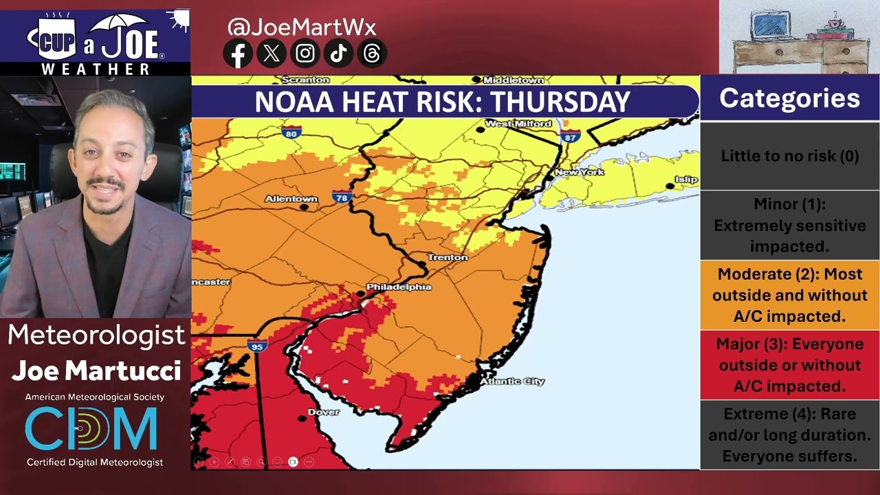
    🔥THURSDAY’S FORECAST | Smelling the wildfire smoke? It’s here. It’ll be very gray, maybe orange, with poor air quality. Otherwise, it’s still hot, but not as muggy. Saturday will be a “boom or bust” thunderstorm day, though.

    Why settle for big chains? Choose Just Four Wheels Car, Truck and Van Rental family-owned locations all across NJ! Rent brand-new sedans, passenger vans, box trucks and more today! Visit www.just4wheels.com or call 877-650-3500.

    Stream our 24×7 Jersey Shore Weather Channel: https://www.youtube.com/live/Gn74OsNF4wQ

  • TRIPLE-THREAT of NJ weather hazards: Heat, humidity and smoke

    TRIPLE-THREAT of NJ weather hazards: Heat, humidity and smoke

    Stream our 24×7 Jersey Shore Weather Channel: https://www.youtube.com/live/Gn74OsNF4wQ

    Jolt your brand with the Shore’s top weather media company. Advertise today! joe@cupajoe.live

  • Strengthening El Nino Brings Quiet Hurricane Forecast, but…

    Strengthening El Nino Brings Quiet Hurricane Forecast, but…

    Strengthening El Nino Brings Quiet Hurricane Forecast, but…
    By: Joe Martucci, Certified Broadcast and Digital Meteorologist
    Owner, Cup A Joe Weather and Drone

    A rapidly strengthening El Nino – one that could be the strongest on record – is helping to make the Atlantic hurricane forecast much quieter than usual. That is good news for New Jersey, but it does not mean the coast is in the clear.

    I spoke with Levi Silvers, a research scientist at Colorado State University, on our Tidal Flooding Talk podcast from the New Jersey Coastal Coalition. New episodes come out Tuesday evenings.

    Silvers said Colorado State University lowered its hurricane forecast again during its July 8 update. The forecast now calls for nine named storms, four hurricanes and one major hurricane (category three, four or five) this season. That is below average in all three categories.

     July 8th CSU Hurricane ForecastInitial CSU Hurricane ForecastAverage Atlantic Season
    Named Storms91314.4
    Hurricanes467.2
    Major Hurricanes (Category 3, 4, 5)123.2

    Table 1. The Colorado State University Hurricane Forecast at different points of 2026, compared to average.

    Colorado State uses the 1991 to 2020 average, the same time period used by NOAA’s National Hurricane Season.

    The main reason for the quieter forecast is El Niño in the Pacific Ocean.

    El Niño is a large weather pattern that has to do with water temperatures in the Pacific Ocean along the Equator. When the water is colder than average, it’s called La Niña. El Nino happens when it is warmer than average, it’s El Niño.


    Figure 1. Sea surface temperatures, compared to average, for July 8, 2026. Note the bright reds off the western coast of South America. Those above average ocean temperatures is El Nino, and helps to reduce the amount of named storms this hurricane season in the Atlantic Ocean. Via TropicalTidbits.

    However, its impacts spread far from there. During many El Niño years, stronger wind shear, or change in wind direction with height, develop high above the Atlantic Ocean and Gulf of Mexico.

    Wind shear is bad news for tropical storms and hurricanes. Tropical systems need to stand tall and stay organized. When winds change direction with height, storms can get tilted, stretched or torn apart.

    Silvers said that is what Colorado State expects this year.

    “As things start to form, they tend to get pulled apart,” Silvers said.

    Sea surface temperatures are also playing a role. Silvers said the Atlantic Ocean is not as warm as it was in recent years. Warm ocean water is the fuel for tropical storms and hurricanes, needing to be at least 79 degrees for tropical development. When the water is not as warm, storms have less energy to work with.

    For New Jersey, the forecast is mostly encouraging.

    Colorado State also looks at the chance of a tropical system impacting specific coastal areas. Silvers said New Jersey normally has about a 23% chance of being impacted by a named storm somewhere along the coastline during hurricane season. This year, Colorado State puts that chance at 8%.

    That is less than half of the normal risk. Still, 8% is not zero.

    He also said the chance of New Jersey being impacted by a hurricane is 2%.

     July 8th CSU 2026 Hurricane ForecastAverage Atlantic Season
    Named Storms8%23%
    Hurricanes2%7%
    Major Hurricanes (Category 3, 4, 5)Less than 1%1%

    Table 2. The likelihood of a tropical system impacting NJ in 2026, compared to average.

    That is welcome news, especially for coastal communities that watch every storm during the heart of hurricane season. However, New Jersey does not need a direct hit from a major hurricane to have problems.

    A storm passing offshore can still bring coastal flooding, beach erosion, dangerous surf and rip currents. A weaker tropical storm or leftover tropical moisture can also bring heavy rain and freshwater flooding. Sometimes, the worst impacts here come from the tidal flooding not wind. Just last year, Hurricane Erin brought the most severe summertime flooding on record for much of the South Jersey shoreline, but without a drop of rain.

    In Avalon, our in-house Tidal Flooding Dashboard through our ShorelySafe program shows that the Aug. 21, 2025 tidal flood was the tenth highest all time. The tide gauge peaked at 7.83 feet above mean lower low water. That’s considered major flood stage by NOAA, sitting right below the flooding experienced on Oct. 27, 2018.


    Figure 2. Flooding in Avalon during Hurricane Erin on Aug. 21, 2025. It was the highest summertime tide on record for the Borough. Via Borough of Avalon

    The biggest wild card is the Atlantic Ocean itself. Silvers said trade winds could still change in a way that allows parts of the tropical Atlantic to warm quickly. If that happens, storms could have more energy available, even with El Niño creating wind shear.

    Right now, though, Silvers said that does not appear likely.

    Colorado State will issue another hurricane season update in early August. After that, updates will come more often as forecasters watch conditions closer to the peak of the season.

    For New Jersey, the message is simple: this hurricane season looks quieter than usual, but the coast should still stay ready.

    It only takes one storm to turn a quiet season into a serious one.

  • Canadian Wildfire Smoke Returns: Hazy Skies, Poor Air Quality Ahead for NJ

    Canadian Wildfire Smoke Returns: Hazy Skies, Poor Air Quality Ahead for NJ

    Wildfire smoke from Canada will bring hazy skies and poor air quality to New Jersey this week.

    The first round of smoke is expected Tuesday afternoon and evening. A second, stronger round should arrive Wednesday afternoon and continue into the evening. Some people may even notice a campfire-like smell Wednesday.

    A high-pressure system over the central United States is creating northwest winds. Those winds are carrying smoke from wildfires in Ontario and other parts of Canada toward New Jersey.

    About 800 wildfires were active across Canada as of Tuesday, July 14.

    The smoke will arrive as New Jersey also deals with high heat and humidity Wednesday. The combination could produce milky skies, reduced air quality and the smell of smoke across parts of the state.

  • Untitled post 9072

    🌡️TUESDAY’S FORECAST | We have a 5 day heat wave starting Wednesday and even the beaches are gonna be close to 100F tomorrow. Enjoy the summer comfort today!

    Tired of water in your basement or crawlspace? Trust Finally Dry Waterproofing’s family-owned company to fix it right. We install permanent drainage solutions guaranteed for 2 ownerships with no limit! Get your FREE inspection at finallydrywaterproofing.net.

    Go with Joe to Bermuda: https://cupajoe.live/joe-martucci-cruise-to-bermuda-fall-2027-sign-up/

  • Win 4 Tickets to Either of These ParkStage Concerts!

    Win 4 Tickets to Either of These ParkStage Concerts!

    Summer’s in full swing- and we’re still singing about winning tickets for summer concerts at ParkStage in Freehold! 🎶 🎤 🎶

    Enter to win four tickets to either of their next two concerts!

    🎵 Brantley Gilbert on Thursday, July 30th
    🎵 Jason Isbelle and the 400 Unit on Friday, July 31st

    Type ‘Brantley’ or ‘Jason’ in the DM to indicate which concert you want to enter. Type ‘Both’ if you want to enter for both concerts. Enter by July 24 at 5AM to win! 🎟️🎟️🎟️🎟️

    Good Luck!