Category: Uncategorized

  • How climate change has and will impact landfalling hurricanes

    How climate change has and will impact landfalling hurricanes

    Read this on Shore Local News here

    I flipped through the Bulletin of the American Meteorological Society (BAMS) last week. It’s our big trade magazine. Among announcements of future conferences and photos of research meteorologists out in nature, was a journal article titled, “Tropical Cyclones and Climate Change.” Given that we live in a hurricane-prone area, I read it.

    Author of the paper Stephen Jewson, from Lambda Climate Research in London, shows that landfalling hurricanes have and will be impacted by climate change differently than hurricanes in general.

    “The commonly heard phrase, ‘hurricanes are projected to be less frequent, but more intense,’ is somewhat unhelpful,” Jewson writes.

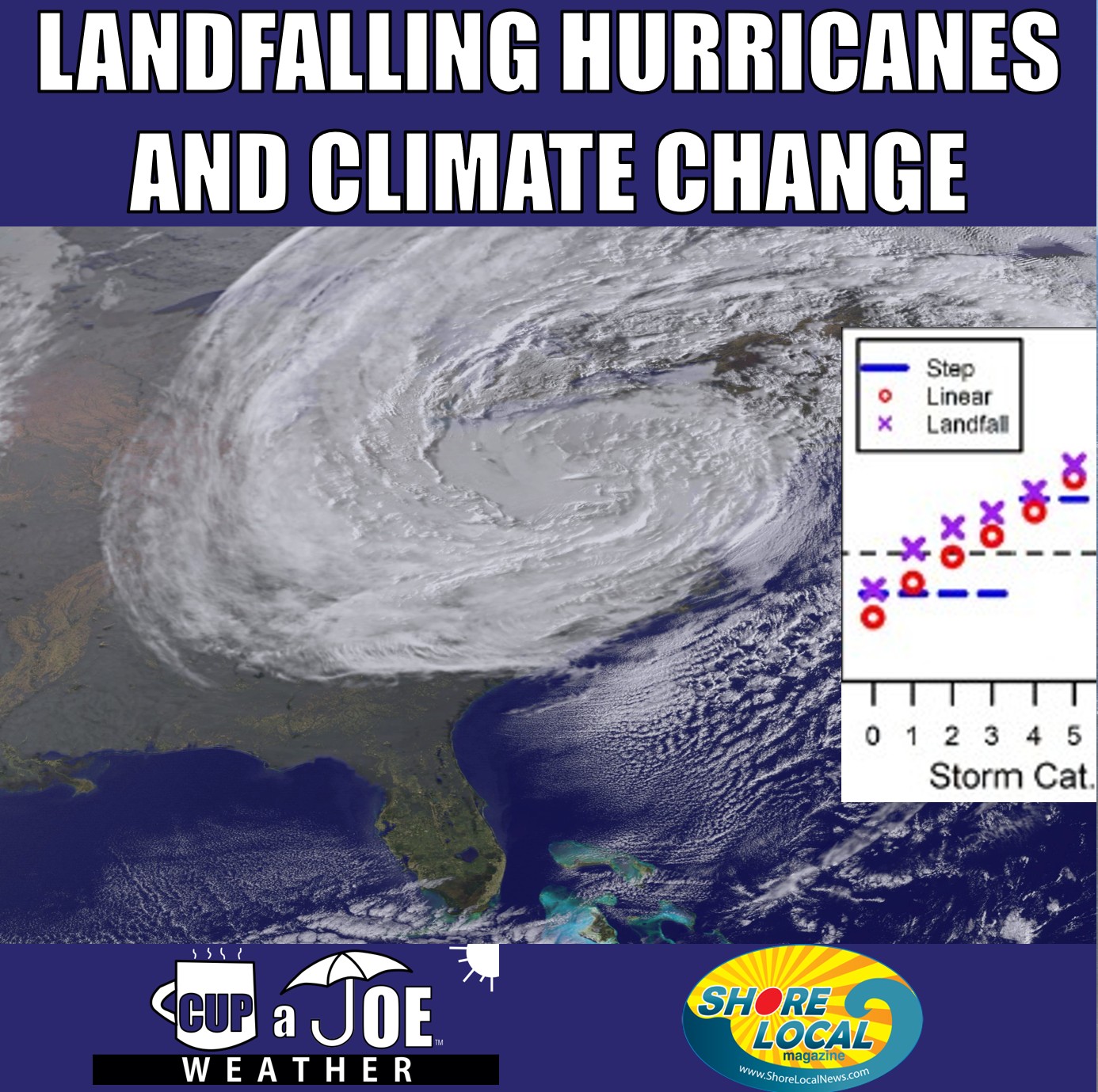
    As the Earth gets a little warmer, about 2 degrees Celsius hotter than it is now, Jewson says the frequency of landfalling hurricanes increases. Specifically, we see a 25 percent increase in the biggest, scariest hurricanes – the ones called Category 5. On the other hand, the smaller, less intense tropical storms, which have winds from 39 to 74 mph, would not happen as often.

    This is important because it’s not just any study about climate change and hurricanes. Jewson looked at the storms that affect us directly; the ones that hit land. It’s also worth noting that the Earth has already warmed up by about 1.62 degrees Celsius from 1917 to 2023, according to the National Oceanic and Atmospheric Administration. These changes are already happening.

    “For instance, there are previously published results that suggest the frequency of hurricanes may decrease. After conversion to landfall, however, the same results suggest that the frequency of hurricanes may increase,” Jewson says.

    Even though New Jersey hasn’t technically had a landfalling hurricane since the Vagabond hurricane of 1903, Superstorm Sandy, which lost its hurricane status just before making landfall, is still fresh in many people’s minds. Tropical Storm Fay was also at sub hurricane status when it made landfall near Brigantine in 2020.

    Here is a rough breakdown of how much more or less likely tropical storms and hurricanes would be on the North American East Coast, which includes us, with a 2 degree increase in temperatures.

    Tropical Storms:

    20 percent less frequent

    Category 1 Hurricanes:

    No change

    Category 2 Hurricanes:

    10 percent more frequent

    Category 3 Hurricanes:

    15 percent more frequent

    Category 4 Hurricanes:

    20 percent more frequent

    Category 5 Hurricanes:

    25 percent more frequent

    This is just my professional opinion, but these changes actually are more good than bad for New Jersey. There’s a 1 percent chance of a Category 3, 4 or 5 hurricane making landfall, or being within 50 miles of landfalling in any given year, according to Colorado State University.

    Even a 25 percent increase on top of that still means it’s very unlikely we’re getting hit by a storm of that magnitude. For context, our last landfalling hurricane that strong was Sept. 3, 1821, says David Ludlum, who founded WeatherWise magazine.

    Tropical storms are more of what we see, with a 23 percent annual occurrence, according to Colorado State. So a decrease there would be welcomed. Remember, too, that Colorado State University considers decades of data, so the latest Jewson research is already partially baked into what the university’s data says.

    You always have to be ready for trouble from the ocean. Jim Eberwine, retired National Weather Service meteorologist and current Absecon emergency manager, says we’re in a year-round hurricane season. After hurricane season ends on Nov. 30, we get into nor’easter season. That’s when we can still get big waves and flooding, just like with hurricanes.
  • The 8 ways it snows at the Jersey Shore

    The 8 ways it snows at the Jersey Shore

    By Meteorologist Joe Martucci

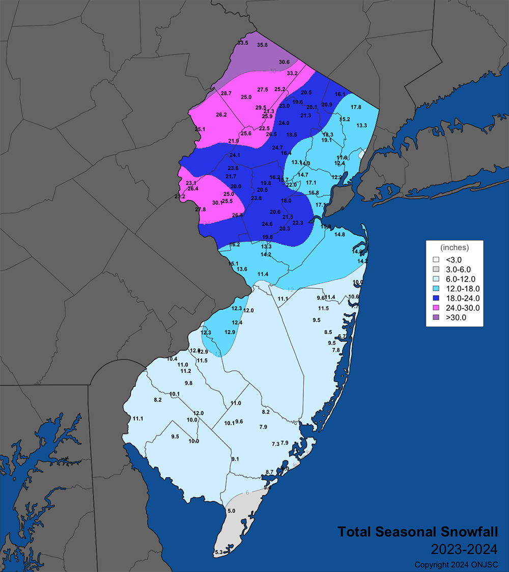
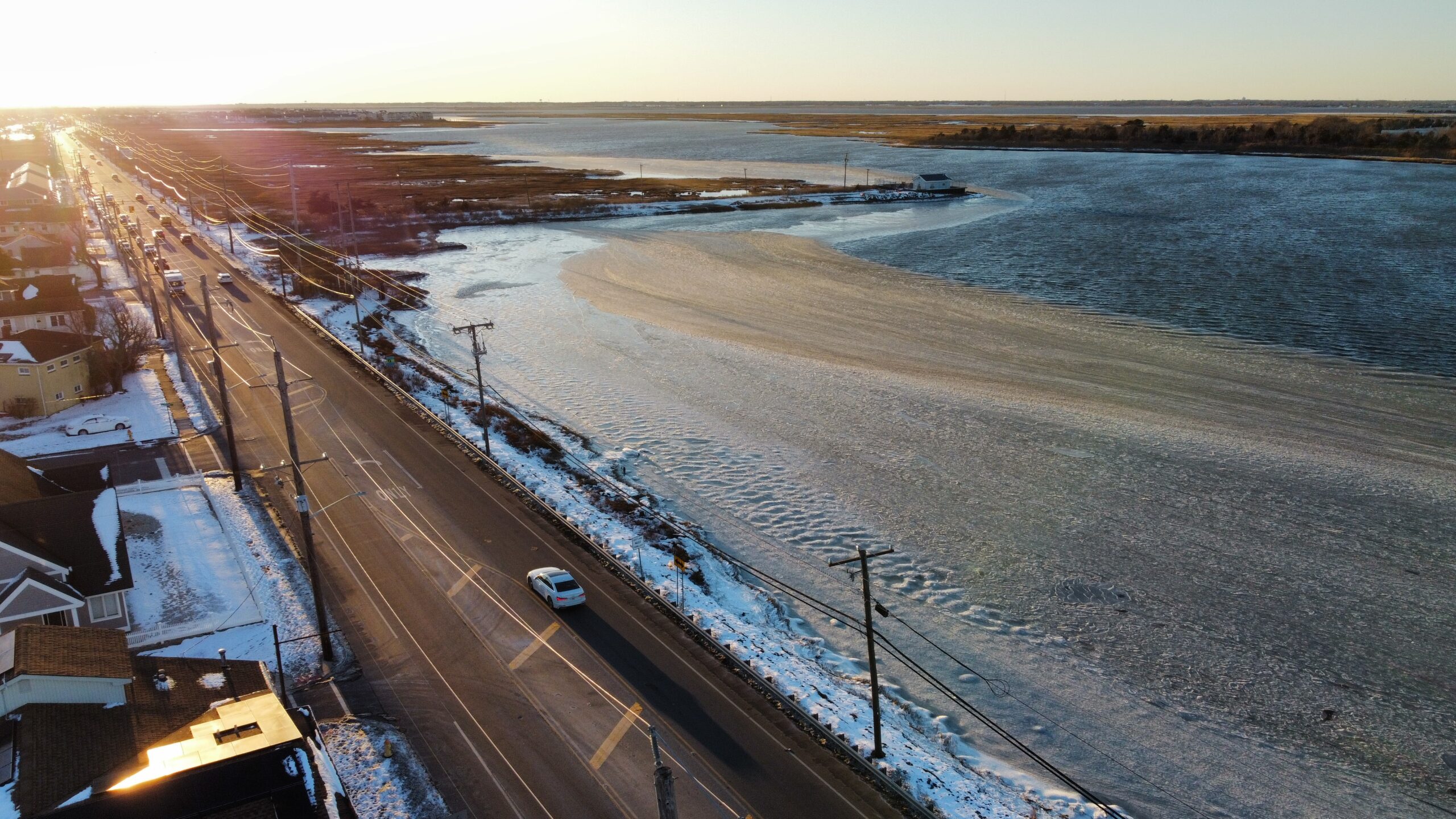
    With the cold, many of us think snow. In the beach towns, we average around 15 inches of snow in a winter. Meanwhile, inland areas in Atlantic and Cape May counties typically see between 16 and 20 inches of snow in a winter.

    By my count there are eight ways that it can snow in our area. Not all of them will bring a complete, start-to-finish snow. After all, we know how it is at the shore. There’s usually some rain, sleet or freezing rain mixing in. However, let’s take a look at each of them, grouping it by how often it typically happens.

    Nearly every winter:

    “Miller” storms

    This is a type of nor’easter winter storm defined by the direction the winds usually blow from. The name comes from J.E. Miller, the researcher who came up with this naming system for East Coast storms in 1946.

    They can happen any time of the year, bringing rain, wind and coastal flooding. However, it’s during the winter when they’re most frequent, and most apt to bring snow, sleet and freezing rain.

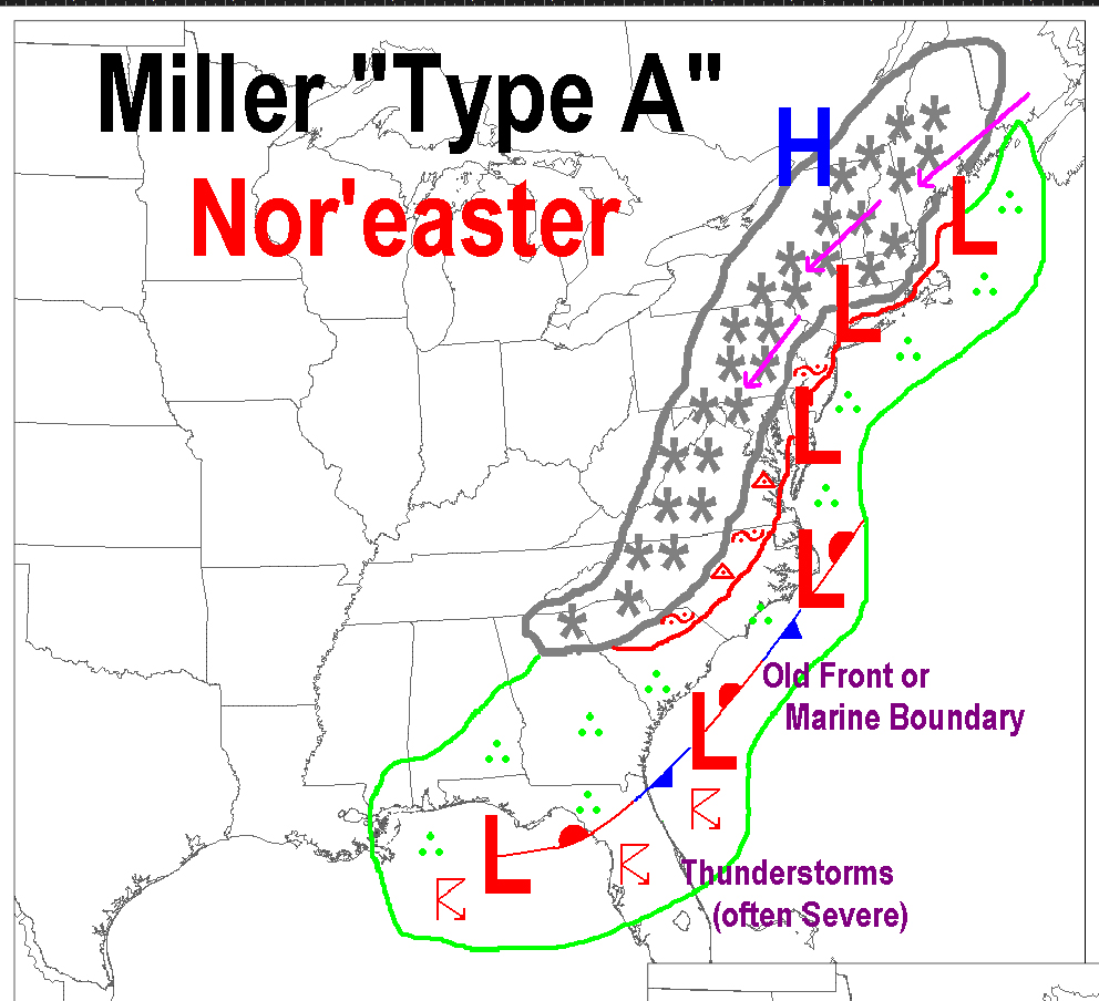
    Whether it’s a Miller A or Miller B depends on where the low-pressure system originates.

    In a Miller A storm, the low-pressure system develops in the Deep South, or the Gulf of Mexico. It strengthens as it moves up the East Coast. Then it will usually make a sharper turn to the northeast in the Mid-Atlantic or the Northeast. The Boxing Day blizzard of 2010 is an example of a Miller A storm when 10 to 20 inches of snow fell along the Jersey Shore.

    Meanwhile, Miller B storms are a little more common. Miller B storms start as low-pressure systems moving east from the Great Plains and Midwest. The system then weakens as it hits the Appalachian Mountains. However, it transfers its energy offshore. Typically, this can happen between North Carolina and Long Island. It will then move to the northeast, strengthening as it does so.

    Miller B storms are typically a little weaker than Miller A storms, since the ocean runway that intensifies storms is shorter than the Gulf of Mexico or Southeast forming Miller A systems.

    However, they are still our best shot of plowable snows, with sleet, freezing rain and coastal flooding. In fact, the snow on Jan. 6 was a Miller B storm.

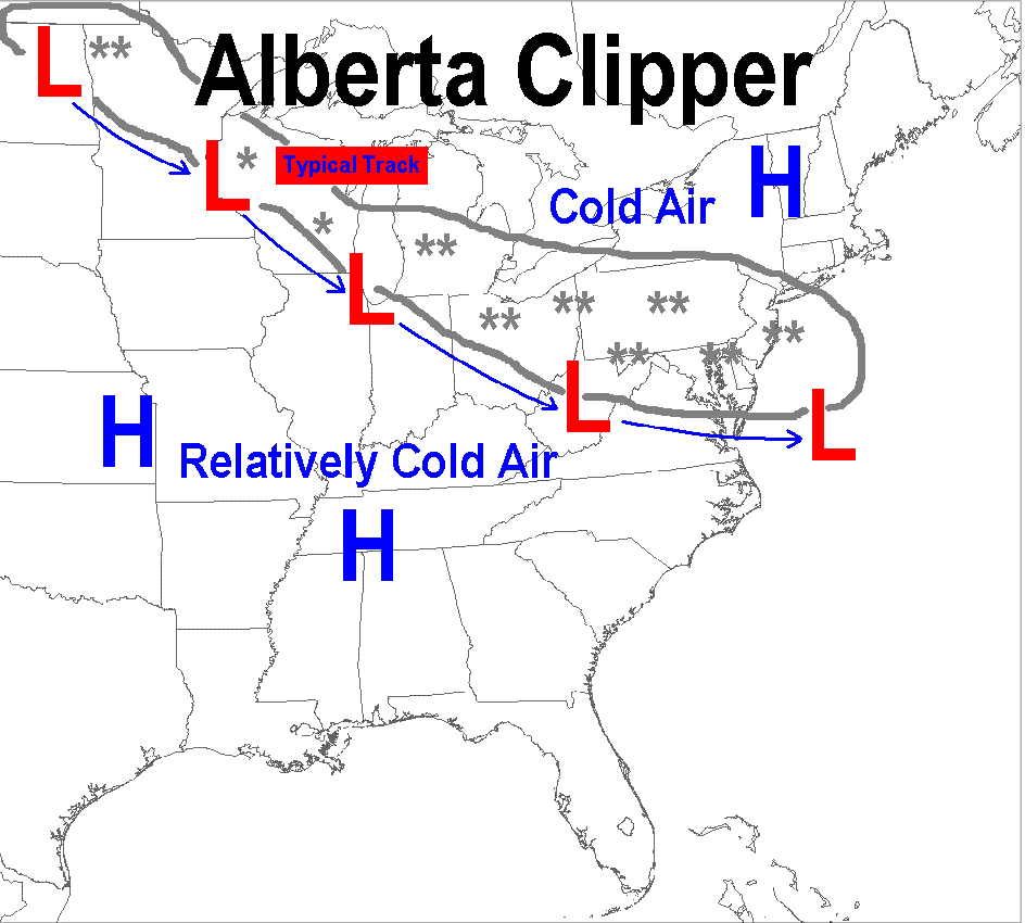
    Alberta Clipper

    Alberta Clippers are low-pressure systems that are cold and fast-moving. They’re named after where they originate, in the Prairies of Alberta, Canada. After forming, they typically arrive in New Jersey in two or three days.

    The low-pressure systems are fairly weak. Therefore, when we receive snow from these, it’s either light (under a half inch per hour) or moderate (a half inch to an inch per hour). Gusty winds come with this, too. However, they’ll be from the south, turning to the northwest with time. Alberta clippers happen numerous times a winter in New Jersey.

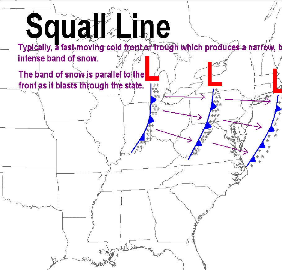
    Snow Squalls

    Think of snow squalls like a thunderstorm. They’re brief, but intense.

    Snow squalls happen about once a winter or so here. Typically, they’ll form in Pennsylvania and quickly move east, dissipating as they do so. We see the weakened leftovers.

    These can bring a quick inch or two of snow. Even if they don’t, they still will bring whiteout conditions. Also, like thunderstorms, strong gusts of wind are common. Power outages and wind damage aren’t ruled out.

    Happens on occasion:

    Norlun trough

    A norlun trough is a highly focused area of snow on the northwest side of a low-pressure system. This is caused by an axis of shifting winds.

    Snow from a norlun trough only lasts a few hours. It gives meteorologists headaches as the heavy band may only be 20 or 30 miles wide. A matter of miles makes the difference between snow you can easily brush off your car, or one where the snowplow will come around multiple times.

    A great example of this happened on Dec. 5, 2018. Brigantine reported 7.5 inches of snow. Southern Ocean City picked up 2.5 inches of snow. Meanwhile, Toms River and Cape May had no measurable snow. That’s a narrow band of snow. My estimate is this happens two or three times per decade at the Jersey Shore.

    Delaware Bay Effect Snow

    My favorite kind of snow, which happens at part of the Jersey Shore, is Delaware Bay effect snow, the lesser-known sibling of the infamous lake effect snow from the Great Lakes. This only happens in lower Cape May County.

    Similar to the more famous version of the phenomenon, this is caused by very cold air going over the relatively milder Delaware Bay. Specifically, it’s when the air temperature about 5,000 feet high is 23 degrees lower than the temperature of the bay surface, according to Penn State University.

    Using the average bay temperatures during the winter, that means temperatures 5,000 feet high must be about 15 degrees or so. That happens a few times during the winter. However, winds need to be nearly due northwest to pick up the moisture off Delaware Bay. Since the bay is much smaller than the Great Lakes, there is little margin for error.

    Plus, winds should be at least 15 mph. Add that all up, and Delaware Bay effect snow only happens a few times a decade. When it does happen, it’s typically flurries. However, an inch or two occurs on rare occasions.

    Ocean Effect Snow

    Ocean effect snow mirrors Delaware Bay effect snow, where cold air crosses warmer water. This happens when there is a northeast wind. There are two ways in which we’ll see flakes fly from this.

    1. Cold northeast winds from Arctic high-pressure over Quebec or Atlantic Canada. This rarely occurs at the Jersey Shore, but will happen once or twice a winter in Eastern New England.
    2. During the late stages of nor’easters, winds will be from the northeast. This leads to low-level snow under larger storm clouds. When it happens, this is most often in Ocean and Atlantic counties. This still doesn’t happen every winter, though.

    It’s rare, but it happens:

    Lake effect snow

    Snow from the Great Lakes will reach New Jersey each winter. However, for this type of snow to fall in Atlantic and Cape May counties, everything has to be just right.

    The Appalachian Mountains usually dry out the snow before it gets to the other side. Also, what is snow in the mountains might just turn to rain when it reaches here. The snow would need to come from Lake Erie, with the wind blowing directly from the west-northwest. The last time this happened was on Dec. 29, 2020, but it was just flurries. Snow that sticks around happens once a decade, if that.

  • Save the dates for these 12 Jersey Shore weather events

    Save the dates for these 12 Jersey Shore weather events

    Swapping the previous year’s calendar in December for the new one in January is a social construct. January is still climatological winter. The shortest day of the year, the winter solstice, was already in December and the coldest days are still ahead of us.

    In fact, in the weather world, a “water year” runs October to September. The snow year goes from July to June. Planet Earth doesn’t care about whether it’s Dec. 31 or Jan. 1.

    However, we can still pick out a few weather, climate and solar phenomena to mark your 2025 calendar for the Jersey Shore. Meteorologist Kyle David, a fellow Rutgers University graduate, and I produced this list. The list is month by month and separated between the immediate shore, using the Sen. Frank S. Farley State Marina in Atlantic City, and for mainland areas, using Atlantic City International Airport in Egg Harbor Township.

    Data is from the National Oceanic and Atmospheric Administration or https://www.timeanddate.com/. Mainland weather and climate data traces back to Aug. 1943. For the shore, that data stretches back to December 1873.

    Happy New Year and enjoy tracking the atmosphere and science throughout 2025!

    READ THE REST OF SHORE LOCAL NEWS HERE!

  • How likely is a White Christmas in New Jersey?

    How likely is a White Christmas in New Jersey?

    Even if you wish you lived in South Florida, far away from any winter weather, chances are the thought of snow on Christmas puts at least a small grin on your face.

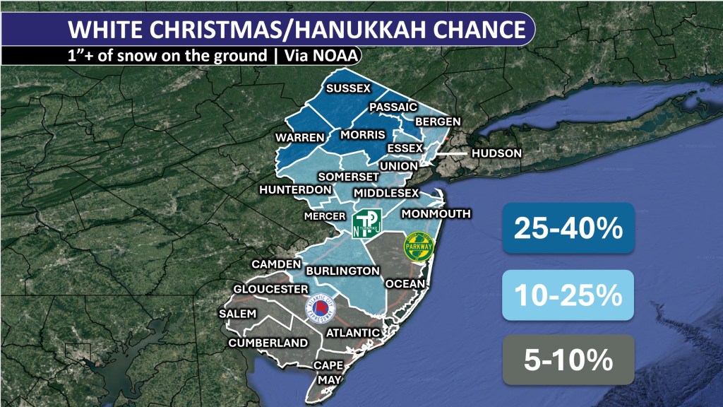
    A white Christmas and first night of Hanukkah (both are Dec. 25 this year) is hard to come by at the South Jersey Shore. That will be true this year as well, with generally mild weather expected around the holiday.

    Even though Dec. 25 falls in the winter season, which starts on Dec. 21, the shortest day of the year, Christmas snow isn’t very common here. While the ocean keeps cooling down, storms bring warm air when they travel up the coast. This warm air makes it harder for snow to fall because it raises the temperature, making it rare for snow to fall on any day in December.

    The technical definition of a white Christmas is an inch or more of snow on the ground on the day itself, according to the National Oceanic and Atmospheric Administration. So even if you were to measure a half inch of snow on Christmas Day, it wouldn’t qualify as a white Christmas.

    If that definition sounds like a lump of coal in your stocking, meeting a cheerier definition that includes any measurable snow on Christmas Day is just as unlikely. There’s a 6% chance for both an inch or more of snow on the ground, or any measurable snow on Christmas Day at Atlantic City International Airport in Egg Harbor Township, according to NOAA.

    Snowfall records at the Sen. Frank S. Farley State Marina in Atlantic City haven’t been taken since 1956. Back then, there was only a 7% chance of having at least 1 inch of snow on the ground, and a 3% chance of any snow at all. Even though the climate was cooler, a Dec. 25 snow was just as unlikely. Nowadays, right by the ocean, there’s actually a bit less chance of snow on holidays than in places farther away from the shore.

    Our last official white Christmas at the South Jersey Shore was in 2009. Do you remember that one? I was a freshman at Rutgers University then. I still remember waking up at my parents’ house in Central Jersey, and seeing how bright Christmas morning was with the sun reflecting off the snow.

    Read the rest on Shore Local here.

  • The Polar Vortex and NJ: What you need to know

    The Polar Vortex and NJ: What you need to know


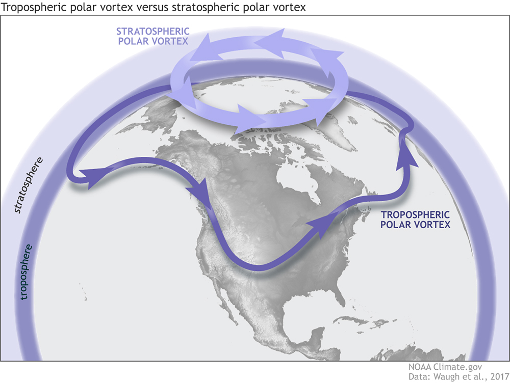
    The polar vortex

    It’s been meteorology’s biggest buzz word in our everyday weather conversations since it gained fame in 2014. However, it’s often misused and misunderstood. As with most things in life, it’s more complicated than it seems.

    Yes, the polar vortex is generally responsible for deep cold and even snowstorms during the winter. However, there are two parts to the polar vortex and typically, when it’s colder than average for a while, like it was last week, the polar vortex already left New Jersey.

    Click here to read more from Shore Local…

  • NJ’s wet start to 2024 has dampened drought impact

    NJ’s wet start to 2024 has dampened drought impact

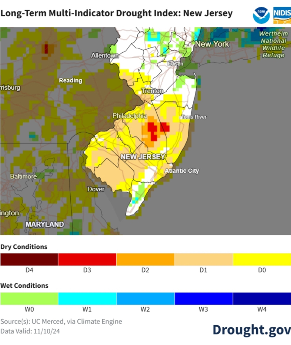
    Did you know? The wettest start to the year on record for Atlantic City International Airport may have saved us from an exceptional drought today. Despite a historic dry spell gripping the state—now the worst since 2002—the rainy start to 2024 kept conditions from being even more dire.

    ➡️ As of November, all of New Jersey is experiencing severe to extreme drought, prompting the first statewide drought warning since 2016. Mandatory water restrictions are in place for many residents, but without those early rains, the situation could have been unprecedented.

    Learn more about the impacts and how we got here in this deep dive into New Jersey’s shifting weather patterns in my latest Shore Local Magazine article. 🌎💧

    NJ’s wet start to 2024 has dampened drought impact – Shore Local Newsmagazine

  • Community observers contribute to America’s largest volunteer weather network

    Community observers contribute to America’s largest volunteer weather network

    Discover how community observers are making a difference in weather forecasting and drought monitoring in New Jersey. Learn about their vital role in America’s largest volunteer weather network, CoCoRaHS, and find out how you can join this impactful initiative.

    Community observers contribute to America’s largest volunteer weather network – Shore Local Newsmagazine

  • What is the winter outlook?

    What is the winter outlook?

    It hasn’t felt like it lately, but winter is coming. With that comes the promise of bone-chilling cold, and yes, at least the talk of snow. After all, our earliest date for measurable snowfall at Atlantic City International Airport is Nov. 5. With that comes the always exciting winter outlook. Interest in the winter ahead is always high.

  • What if Hurricane Milton hit New Jersey?

    What if Hurricane Milton hit New Jersey?

    What’s the worst case hurricane scenario for NJ?

    A category 3. There’s a 1.5-1.7% chance of that happening on any given year.

    Here’s what the storm surge would look like if that happened.

    What if Hurricane Milton hit New Jersey? – Shore Local Newsmagazine

  • National Weather Service simplifies cold weather alerts

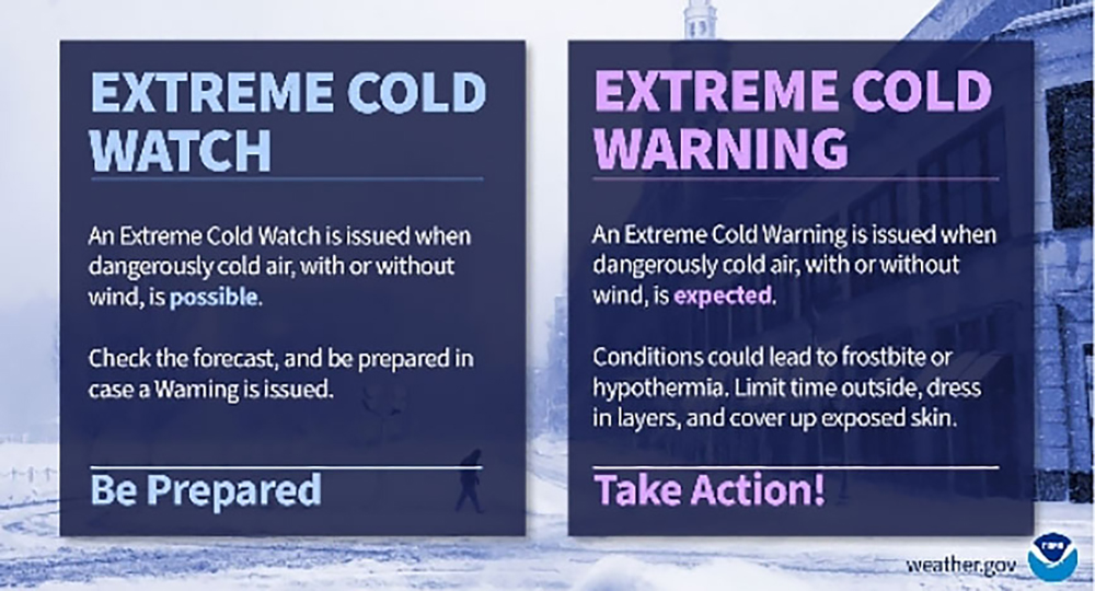
    National Weather Service simplifies cold weather alerts

    Winter is coming. The show “Game of Thrones” made that line famous in its season premiere in 2011.

    Learn more about extreme cold alerts from the National Weather Service in my latest Shore Local Magazine column.

    National Weather Service simplifies cold weather alerts – Shore Local Newsmagazine