
Friday morning (Nov. 7) felt more like June than November as thunderstorms soaked the Jersey Shore, flooding roads and disrupting the morning commute.
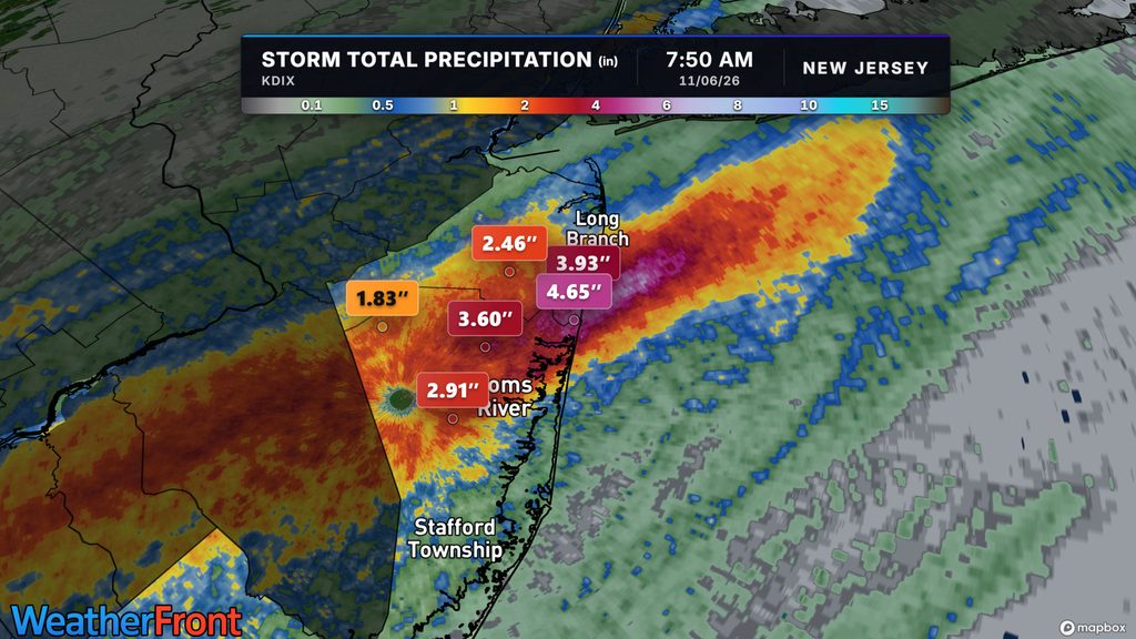
The heaviest rain focused on southern Monmouth and northern Ocean counties on Nov. 6. Spring Lake Heights recorded 4.15 inches by early afternoon, according to rainfall reports published by the National Weather Service in Mount Holly. A station southeast of Manasquan measured 3.97 inches.
Much heaviest rain fell between roughly 5 and 8 a.m., with road closures and water rescues in the hardest-hit areas. Flooding closed roads in Point Pleasant Beach and Manasquan, according to reporting that cited New Jersey’s traffic information service.
Highest reported Jersey Shore rainfall totals
| Reporting location | Rainfall |
|---|---|
| Spring Lake Heights | 4.15 inches |
| 1 mile southeast of Manasquan | 3.97 inches |
| 1 mile north of Mantoloking | 3.84 inches |
| Point Pleasant Beach | 3.70 inches |
| 1 mile east of Lake Como | 3.47 inches |
| 2 miles west of Point Pleasant | 3.46 inches |
Source: NWS Mount Holly’s 2:12 p.m. Nov. 6 report. Measurements were taken around 1:50–2 p.m.; these are station reports, not townwide averages or final storm totals.
Why did so much rain fall?
Two ingredients came together: plenty of moisture and thunderstorms repeatedly crossing the same communities.
Meteorologists call that pattern “training,” because storms follow one another like train cars traveling along a track. Each downpour adds more water before earlier rainfall has time to drain away.
The humid air Thursday and Friday morning felt closer to early June. In fact, in Trenton, the dew point of 65Fwas in the 99th percentile for highest in November. That moisture helped fuel the heavy downpours.
The result was a sharp reminder that damaging rainfall can happen well beyond the summer thunderstorm season.


