SATURDAY EVENING UPDATE | The tidal flooding this evening will be lower than this mornings! Still you need to keep your cars far away from flood zones and water can get into ground floors.
For everyone: Rain peaks Sunday morning and winds get strong again, too.
ShorelySafe® helps organizations forecast tidal flooding 84 hours ahead, reduce flood risk and lower insurance costs with property-level flood intelligence.
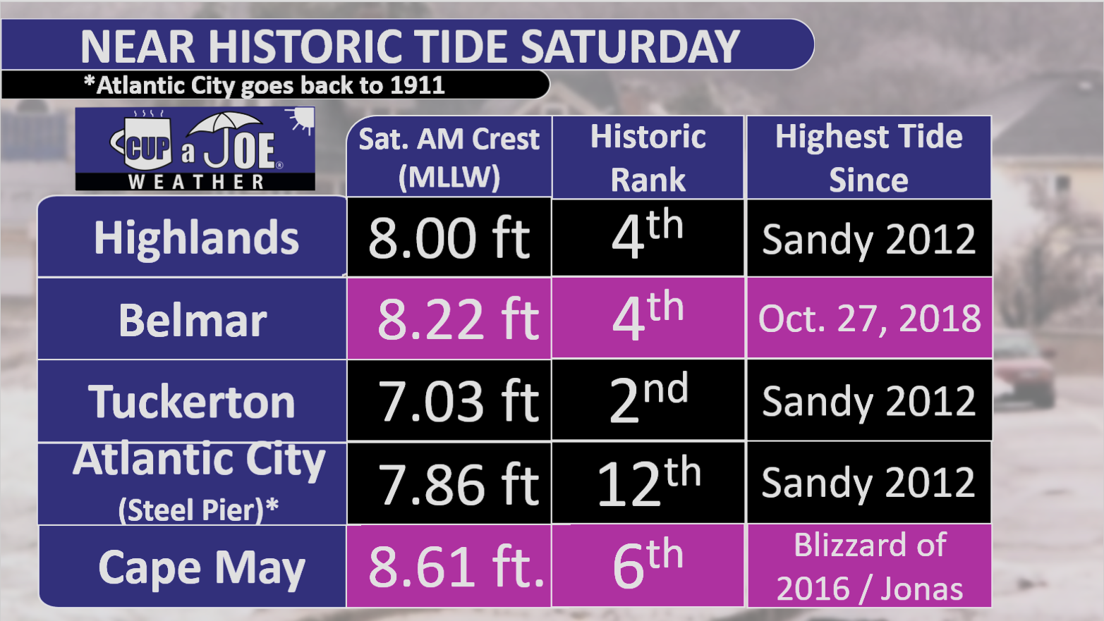
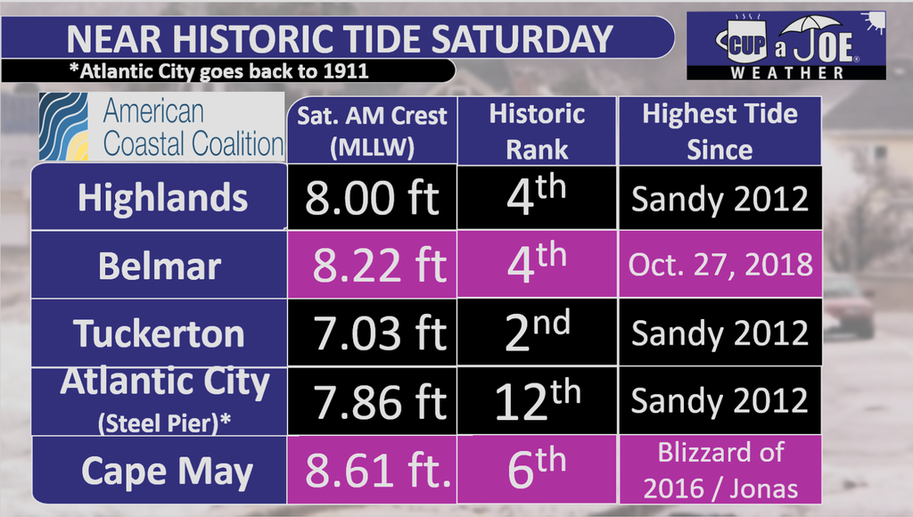
Tuckerton hit second-highest tide in its available record.
Thirteen Shore gauges ranked fifth-highest or higher.
Atlantic City’s tide ranked 12th since 1911.
Major stage tidal flooding gripped the entire Jersey Shore Saturday morning, bringing flooding people haven’t experienced in years.
Water levels rose high enough to rank among the five highest tides in the available record at 13 gauges according to an analysis by PJ Hondros, our Vice President of ShorelySafe,
Tuckerton was one of the biggest standouts. The tide reached 7.03 feet above Mean Lower Low Water, making it the second-highest level in its available record. Ship Bottom also recorded its second-highest tide. Farther north, Highlands reached 8.00 feet and Belmar climbed to 8.22 feet, both ranking fourth in their respective records.
The flooding was also significant farther south. Cape May reached 8.61 feet, its sixth-highest tide on record. Thankfully, only 1 water rescue was needed in the city.
🏖️ 🌧️ MAJOR EROSION: FOX News Multimedia Reporter Pete Cuddihy reports from Cape May, New Jersey, where intense Nor'easter conditions have caused significant coastal erosion, with no signs of slowing down this weekend. pic.twitter.com/kjLu0QiYES
The numbers help put into perspective what residents saw Saturday morning: water covering low-lying roads, difficult travel in bayside communities and flooding that spread well beyond the spots that take on water during more common high tides.
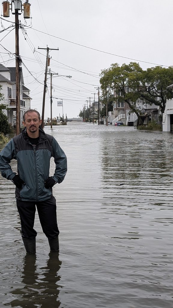
Take Highlands for example. Nearly every street bayward of Bay Avenue was underwater. That’s as much as four blocks inland. Even cross streets out to Shore Road, another block further inland, had water in spots.
In my (Joe Martucci’s) 9 years of covering Jersey Shore weather, this was the first tidal flooding I’ve seen with my own two eyes. The only one that rivals it was standing on Melrose Avenue in Atlantic City during the February 2021 nor’easter with two feet of water. One woman in Highlands carried her baby to higher ground. When she got out of the water, you saw it went to her upper thigh. She was about five and a half feet tall.
Every town floods differently depending on elevation, drainage, bulkheads and local geography. Still, taken together, the gauge data show that Saturday morning was one of the more significant and widespread tidal flooding events to affect the Jersey Shore in recent decades.
Last High Tide as Significant as 9/26/2026(oldest to newest)
Sea Isle City – October 25, 1980
Margate – December 11, 1992
Stone Harbor – March 3, 1994
Cape May Harbor – Superstorm Sandy (2012)
Atlantic City (Inside Thorofare) – Superstorm Sandy
Barnegat Light – Superstorm Sandy
Atlantic City (Steel Pier) – Jan. 23, 2016 (Jonas)
Tuckerton – Jonas
Atlantic City (Absecon Channel) – Jonas
Ocean City – Jonas
Absecon – Oct. 27, 2018
Manasquan – Oct. 27, 2018
Keansburg – Dec. 23, 2022
Sandy Hook – Jan. 13, 2024
Cape May – Hurricane Erin (Aug. 2025)
South Dennis – Hurricane Erin
Waretown – 2025 Columbus Day Nor’easter
Sea Bright, Ship Bottom and Avalon did not have a flood on record within 0.25 feet of 9/26’s morning high tide.
Highest High Tide Since (Oldest to Newest)
Superstorm Sandy (Oct. 29, 2012) – Atlantic City (Inside Thorofare and Steel Pier), Margate, Sea Bright, Ship Bottom, Tuckerton,
Blizzard of 2016 / Jonas (Jan. 23, 2016) – Absecon, Atlantic City (Absecon Channel), Avalon, Cape May, Ocean City, Sea Isle City, Stone Harbor.
Oct. 27, 2018 – Belmar, Manasquan
Dec. 23, 2022 – Keansburg, Sandy Hook
Hurricane Erin (Aug. 2025) – South Dennis
2025 Columbus Day Nor’easter – Waretown
Know More
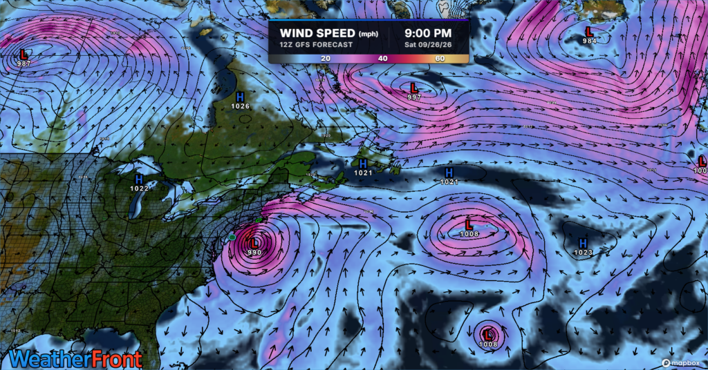
This was a five-day water-loading event, not a one-tide surprise. Since Tuesday, a strengthening coastal low offshore and strong high pressure over eastern Canada have kept a persistent northeast-to-north wind along the Jersey Shore.
By Wednesday, coastal northeast winds were reaching 30 to 35 mph. That repeated onshore push forced Atlantic water through the inlets and into the back bays.
Just as important, the bays could not fully drain between high tides, so each new tide started with more water already in the system. The National Weather Service specifically noted water piling up in tidal tributaries and back bays.
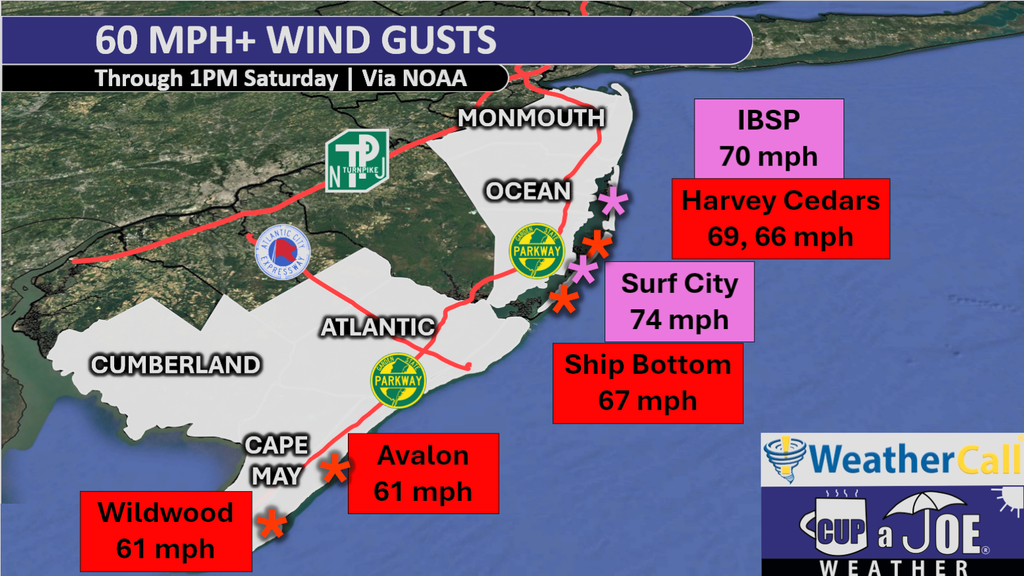
Then the setup intensified heading into Saturday. The nor’easter deepened and moved closer to New Jersey, tightening the pressure gradient. Winds gusts Friday night went over 60 mph in a number of locations from Ocean County on south. Winds were from the onshore direction.
Seas built to 15 to 20 feet come Saturday morning. At the same time, Saturday’s full moon was raising the astronomical tide.
Put it all together you had: days of accumulated water, strong north/northeast winds, low pressure, very rough seas and a higher astronomical tide all peaked at roughly the same time.
Rain and runoff added to the problem in some back bays, but the main story was storm surge plus the astronomical tide.
This was similar to Superstorm Sandy in 2012. The storm’s landfall came at high tide on a full moon. In this case, the storm didn’t make landfall, but the high tide was just after a period of the strongest onshore winds on the same day as a full moon.
Why was this the highest tide since Sandy at some gauges, but since Winter Storm Jonas (2016) at others? Geography.
Jonas was especially potent farther south: Cape May reached 9.0 feet MLLW in 2016, slightly higher than Sandy’s 8.9 feet there.
In other words,this storm behaved more like Jonas in 2016 — a prolonged water-piling nor’easter — while each gauge’s historical comparison depends on its local geography and which past storm hit that location hardest.
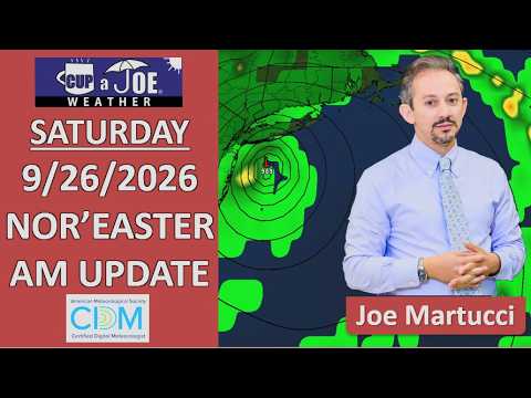
⚠️SATURDAY AM WEATHER UPDATE | The most significant tidal flooding in years is happening very soon. Even if you live away from a flood zone, 50+ mph gusts and periods of rain will make it nasty outside.
Stay safe. Don’t drive through the flood water and here’s your forecast.
Come visit Headley Family Farm for all your Jersey Fresh Produce in West Creek. Call 609-848-3763 or follow www.instagram.com/headleyfamilyfarm/ .
MAJOR STAGE TIDAL FLOODING? | In spots, yes. Major flood stage is a real issue.
Driving around towns is nearly impossible.
People who usually see inches of water see feet of water.
People who rarely flood now flood.
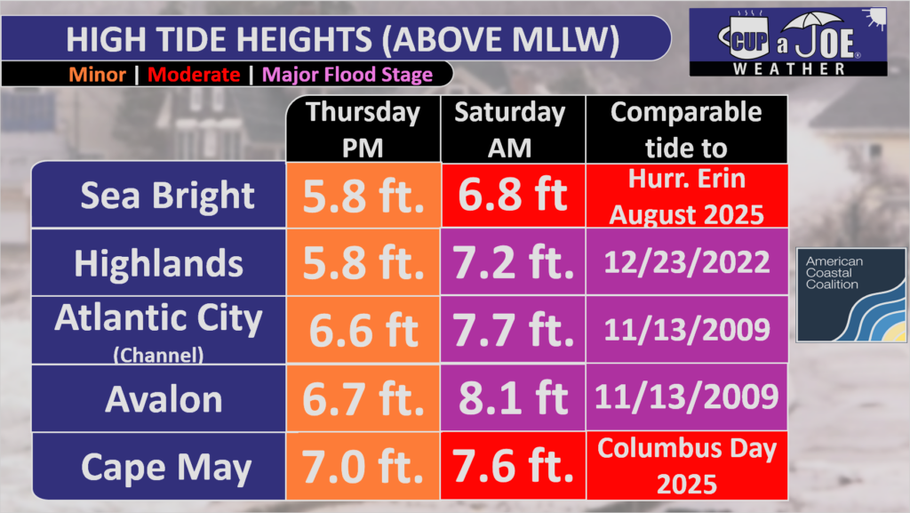
Our research looks at when the last time towns had a high tide this significant. Find the closest town near you and see if you can remember what it was like on that day. That’s what you’ll see Saturday AM.
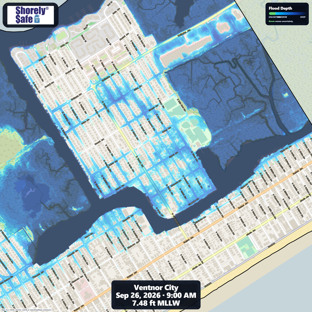
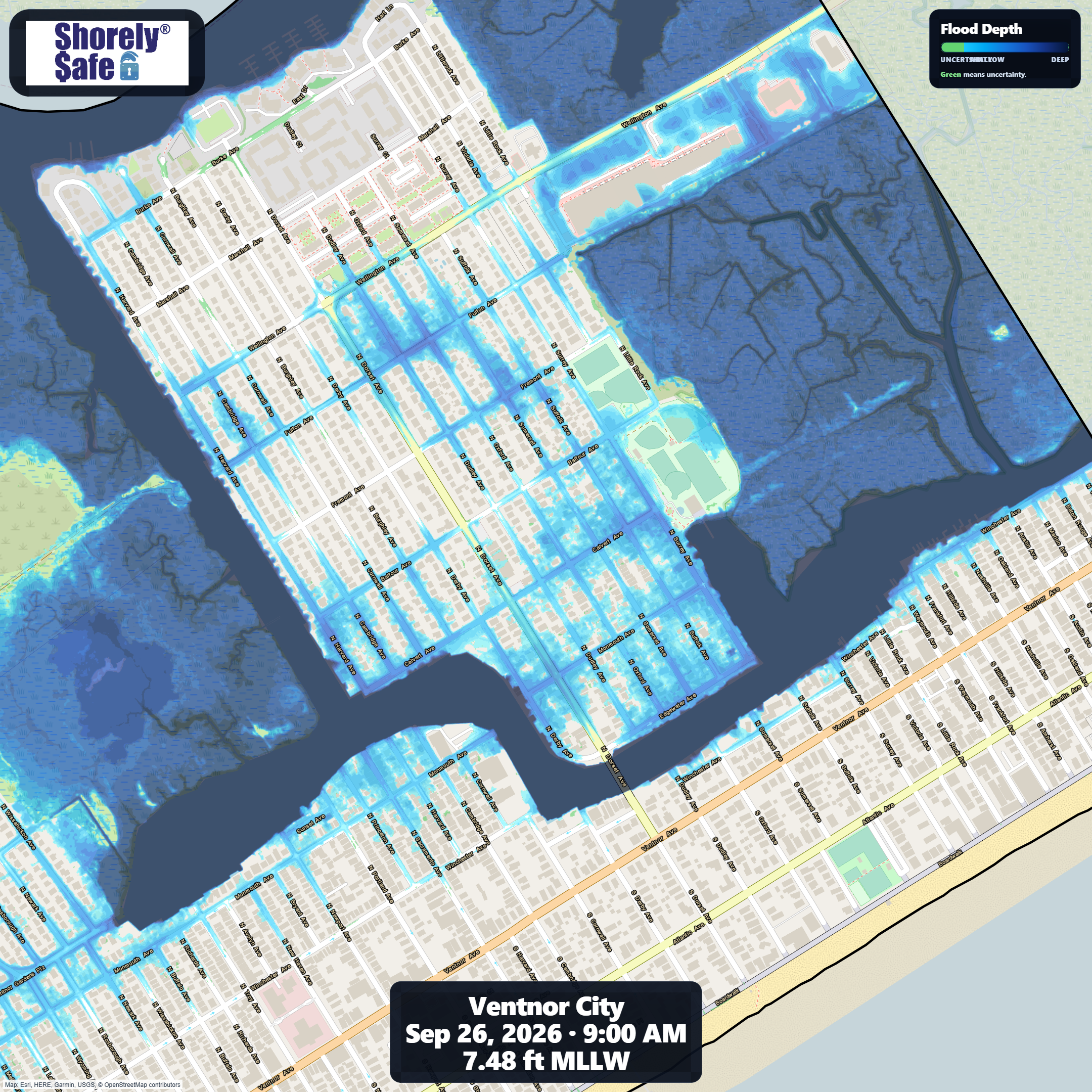
Here’s a look at what Ventnor City’s flooding depth and extent should look like Saturday morning at high tide. This is more than the usual.
NJ beaches generate billions in revenue, supporting thousands of jobs and businesses. If they erode, our economy collapses. Federal beach funding was cut in 2025. Only the American Coastal CoalitionAmerican Coastal Coalition fights 24/7 in DC to restore it. Protect your beach and business. Join today: americancoastalcoalition.org
It’s a 6 minute video and every minute here is important. Here’s why?
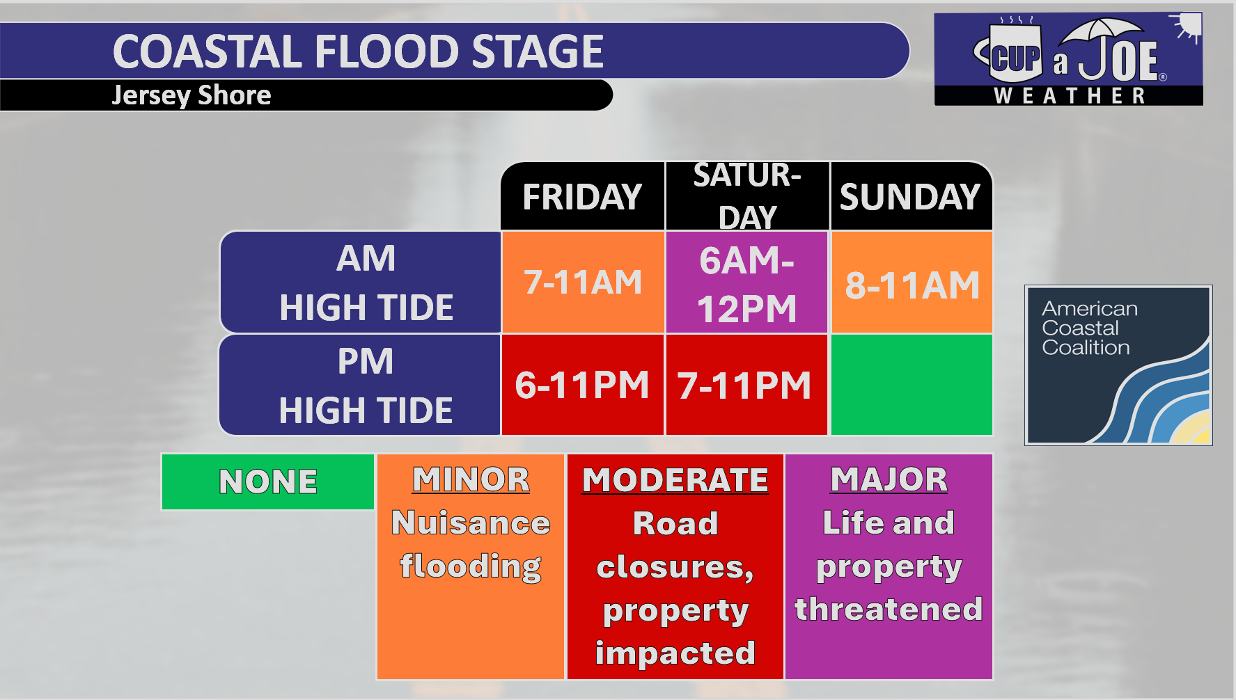
2 to 3 moderate, even major, stage tidal flooding is expected Friday-Saturday
High wind warning in effect for the beaches all weekend.
Rain enters the forecast, too.
🏈 Your Rutgers tailgate headquarters! Parking at St. George is only 500 yards from SHI Stadium and features 500+ spots, clean restrooms, and quick access to River Road. It’s where Joe parks! Purchase at: www.rutgersparking.com.
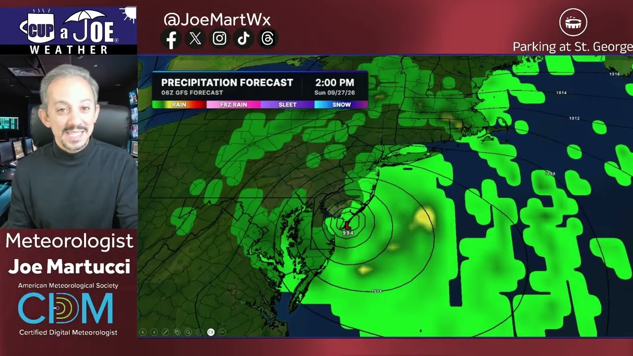
A coastal storm will linger near New Jersey into the weekend, but exactly how close it gets will determine the impacts at the Jersey Shore.
The American GFS model keeps the storm farther offshore. That scenario would mean breezy and mainly dry weather for much of the Shore, although significant tidal flooding, beach erosion, high surf and dangerous rip currents would remain concerns.
The European model brings the storm closer to New Jersey. That could produce major-stage tidal flooding Friday evening, especially from Long Beach Island south, followed by periods of rain Saturday night into Sunday. Rain could be heavy at times, particularly north of the Atlantic City Expressway.
The exact track remains uncertain, so keep checking the forecast before making weekend plans.
What happens beneath the ocean when hurricanes and coastal storms move through? 🌊 Rutgers oceanographer Julia Engdahl joins Tidal Flooding Talk to explain ocean gliders, storm surge, high-tide flooding and how better underwater observations could improve hurricane forecasting and coastal preparedness along the Jersey Shore.
Experience Tidal Flooding Talk every Tuesday night, America’s leading show on coastal flooding resilience. Hosted by the New Jersey Coastal Coalition, which formed after Superstorm Sandy in 2012, it empowers leaders with dynamic workshops. Visit njcoastalcoalition.com to learn more!
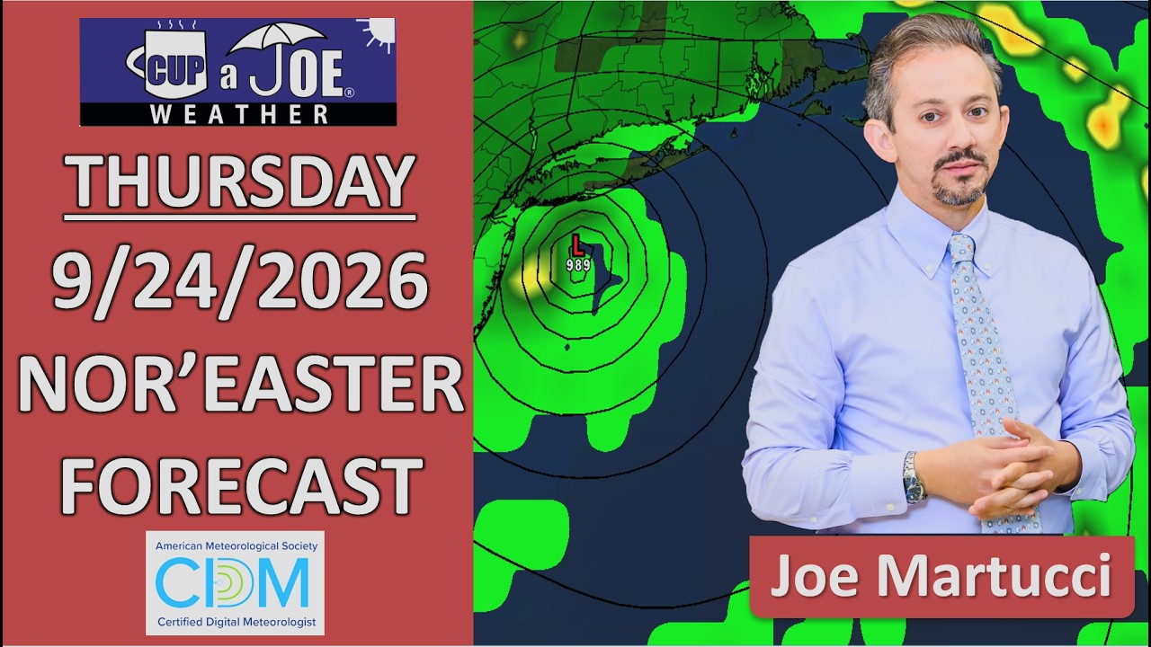
📹THURSDAY’S FORECAST | Listen, I know this video is 5 minutes long. However, with 6 more rounds of tidal flooding, rain chances going up this weekend, beach erosion and more, I believe it’ll be worth your watch. Thank you!
Why settle for big chains? Choose Just Four Wheels Car, Truck and Van Rental family-owned locations all across NJ! Rent brand-new sedans, passenger vans, box trucks and more today! Visit www.just4wheels.com or call 877-650-3500.
A nor’easter is impacting the Jersey Shore, but this is not mainly a rainstorm. The bigger issues are tidal flooding, strong northeast winds and rough ocean conditions.
Coastal Flood Warnings are in effect for Ocean, Atlantic and Cape May counties, where flooding could threaten property. Monmouth County and other areas are under lower-level coastal flood alerts.
Winds will be gusty today and Thursday, especially along the beaches. Gusts could reach the 30s and 40s mph, so secure outdoor furniture and anything else that can blow around.
The ocean will also be dangerous. Surf could build to 6 to 10 feet, with several rounds of moderate tidal flooding possible. The highest number of flooding rounds is expected from Long Beach Island south.
Thursday and Friday look mostly dry away from the flooding. For the weekend, keep outdoor plans for now, but have a Plan B ready.
For the latest and greatest interviews with artists, authors and entrepreneurs—as well as thoughtfully curated lists of favorites that are never bought and paid for–visit jennypennywriting.com!
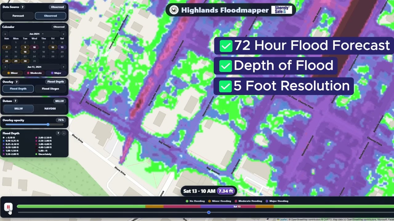
Our Proprietary Flood Mapper is America’s best in class. We provide weather-driven current and forecast tidal flooding, out to 72 hours, at hourly timestep, including the depth of the water, at unprecedented resolution.
ShorelySafe turns flood data into action — helping you protect people, run leaner operations, and qualify for lower flood insurance premiums.

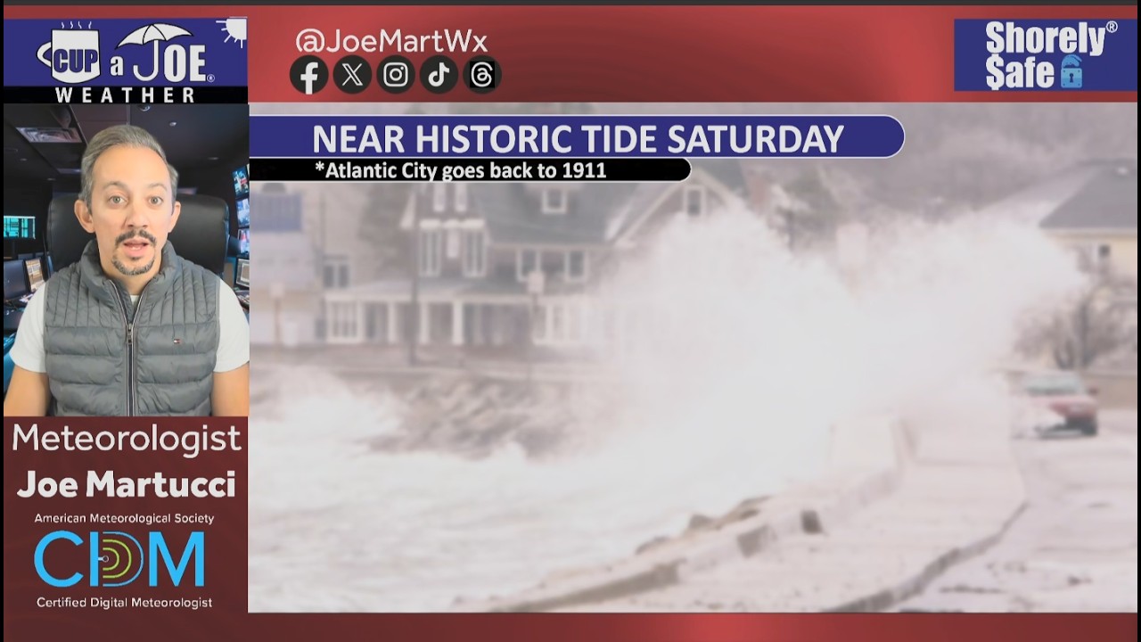
 MAJOR STAGE TIDAL FLOODING? | In spots, yes. Major flood stage is a real issue.