The Jersey Shore is entering its driest stretch of the year. At Atlantic City International Airport, the driest 30-day period runs from August 23 through September 21, with rain falling on roughly one in four days.
The chance drops to just 14% on September 5. Long Branch’s driest stretch runs from August 16 through September 14.
Weaker cold fronts, fewer thunderstorms and a jet stream positioned north of New Jersey limit rainfall. Nor’easter season has not started, leaving tropical systems as the region’s primary rain source.
I start my weekday mornings with Monmouth365 for my Monmouth County weather (from us!), local news, events, business updates, and positive stories from across the community. 📰 Subscribe free: www.monmouth365.beehiiv.com/subscribe?ref=5lTZKBW9hL
Weather warnings work best when they tell people what could happen in their own community—and when officials are honest about what forecasters still do not know.
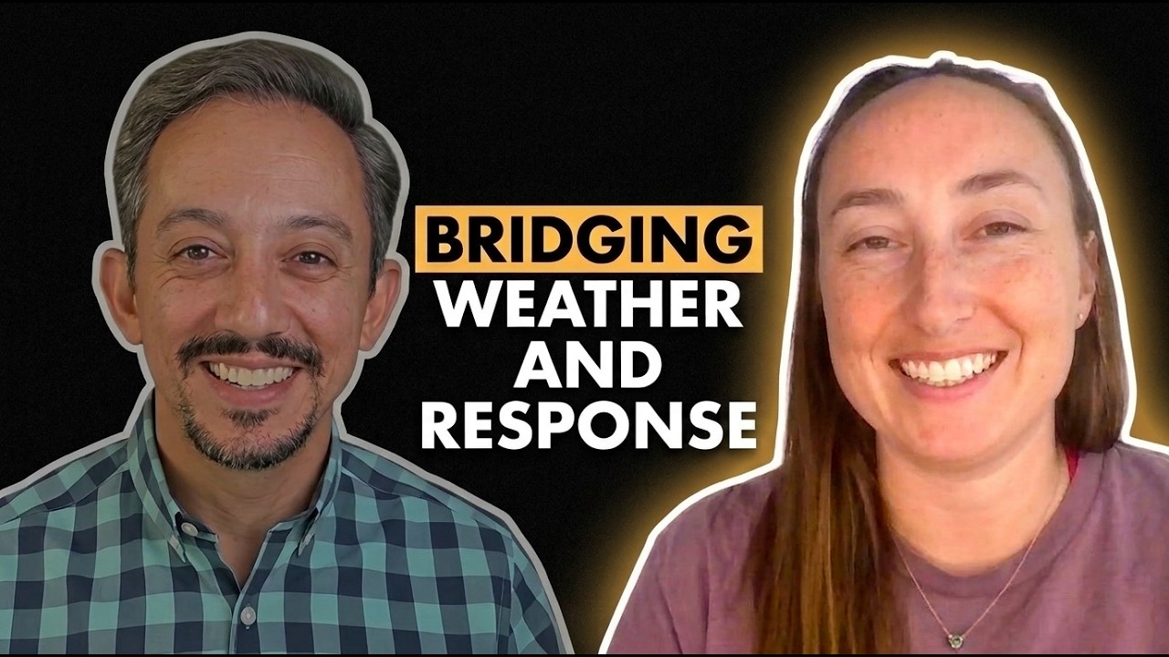
That is the message from emergency manager Ashley Morris, who joined meteorologist Joe Martucci for a conversation about flash flooding, disaster planning and the complicated choices officials face when dangerous weather threatens.
Morris has understood the power of weather since childhood. At 7 years old, she would go outside during thunderstorms, count the seconds after seeing lightning and record what she observed in a lightning journal. That early interest eventually led her to study atmospheric science at Texas Tech University before earning a master’s degree focused on geography and natural hazards.
She once expected to work for the National Weather Service. Instead, she found emergency management and a way to combine her interest in weather with her passion for public safety.
Today, Morris believes effective weather communication begins with being visible and available to residents. Officials can build trust through social media, community presentations and other forms of regular outreach, she said. But the information must also be local enough to matter.
A statewide forecast may not answer the questions residents have about their town, neighborhood or daily work. In the Texas Hill Country, for example, Morris communicates with ranchers and other residents whose plans may depend on whether conditions are safe for cutting hay or conducting a prescribed burn.
“People are very interested” in what will happen specifically where they live, Morris said.
Clear communication also means avoiding technical jargon and resisting the urge to present every storm as the worst-case scenario. Emergency managers must prepare for the worst, Morris said, but repeatedly emphasizing extreme outcomes can exhaust residents and damage their trust.
“If I’m always messaging the worst-case scenario for every single storm, then that’s obviously going to burn them out,” she said.
Flash flooding makes that balance especially difficult. Forecasters may know the atmosphere can produce pockets of 5, 7 or even 10 inches of rain without knowing exactly where those totals will occur. Morris said residents and public-safety leaders deserve to hear both parts of that message: a serious threat is possible, but its precise location remains uncertain.
“We have no idea how to tell you where,” she said. “But it’s important to know that over the next 12 hours, it is possible and that we need to just be prepared to take action.”
Preparation begins well before the first raindrop. Morris reviews weather data each week and starts sending situation reports about three days before a concerning event. Those updates go to city and county elected officials, department leaders, first-response chiefs and others who may need time to act.
Public works crews may clear drains. Fire departments may consider adding staff for water rescues. If the threat grows, Morris can organize a briefing where agency leaders share concerns, plans and resource needs. An emergency operations center may then open to monitor forecasts, dispatch traffic and rescue calls while agencies coordinate in one room.
Morris said that process was used ahead of a July 16 flood affecting her river basin.
Her experience also shapes her argument for stronger local emergency-management offices. In some communities, the emergency manager is part time or responsible for several unrelated duties. Morris said trained, adequately staffed offices can prepare contracts, track supplies, organize damage assessments and keep the records needed to seek federal reimbursement after a disaster.
Even donated materials and volunteer hours may help offset a community’s share of certain disaster costs when they are properly documented, she said. Emergency-management staff can also pursue mitigation funding intended to reduce future losses.
The goal is not simply to respond faster. It is to save lives, protect public money and help communities recover.
Morris now chairs the American Meteorological Society’s Committee on Emergency Management, where she works to strengthen the connection between meteorologists and emergency managers. She said emergency managers need better weather training, while meteorologists need a fuller understanding of the staffing, political and operational challenges behind public-safety decisions.
That cooperation could produce better warnings, clearer action points and fewer weather-related deaths.
Still, Morris sees major holes in the recovery system. One became especially clear after recent Central Texas floods: damaged private roads and driveways can be essential in rural communities, yet they may be difficult to insure or repair through existing disaster-aid programs.
For Morris, the challenge shows why emergency management cannot begin when disaster strikes. It requires trusted communication, trained professionals and sustained investment long before the water starts rising.
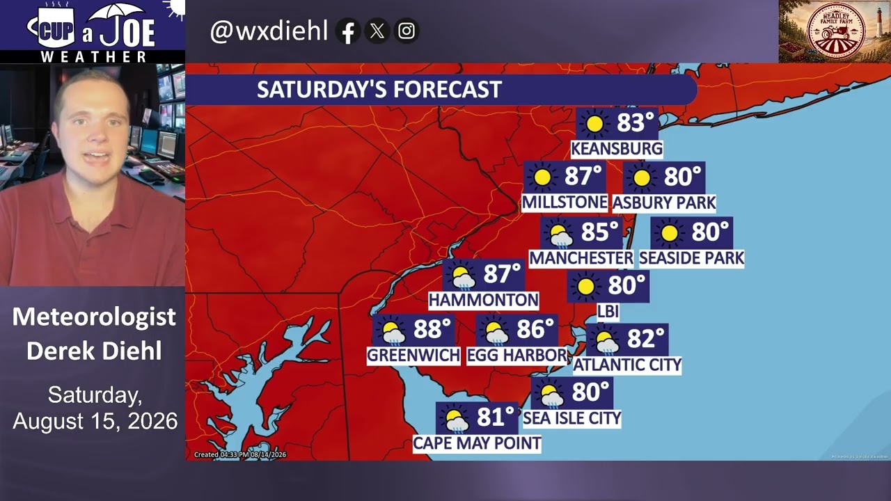
🥳SATURDAY’S FORECAST | Sorry for not showing my face in the video. My right eye is not looking good. I’ll spare you.
On the bright side, this weekend is NOT a washout. In fact, 90% of your daytime Sunday will be dry!
Come visit Headley Family Farm at 120 Province Road in West Creek! It’s where farming the pines meets the Jersey Shore. Get your Jersey Fresh produce here. Open weekends and some weekdays. Call us at 609-848-3763 or follow us on Facebook, too!
📽️FRIDAY’S FORECAST | The flooding rain and severe weather is gone today, but not for long. I got your weekend weather details on another flooding threat, here. Tune in!
🏈 Your Rutgers tailgate headquarters! Parking at St. George is only 500 yards from SHI Stadium and features 500+ spots, clean restrooms, and quick access to River Road. It’s where Joe parks! Purchase at: www.rutgersparking.com.
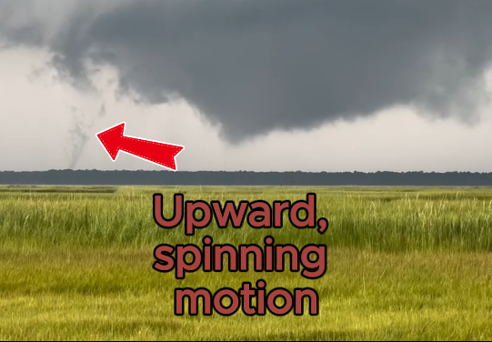
The National Weather Service in Mt. Holly confirmed that a tornado spun through Estell Manor, Atlantic County, on Thursday, Aug. 20. The report was issued Saturday, Aug. 22.
The 30-second long twister took place at 4:41 p.m. in a unpopulated area of town.
The tornado has no rating to it. Typically, tornadoes are rating from an Enhanced Fujita 0 to Enhanced Fujita 5. However, since there was no damage “definitively connected to this tornado”, there is no rating, Alex Staarmann, of the NWS, told Joe Martucci over the phone Saturday.
Dan Forshaw got about as good as a safe/good vantage point you could get from the English Creek section of Egg Harbor Township.
Initially views as a funnel cloud, or spinning clouds that didn’t touch the ground, the NWS studied the video by Forshaw, along with calls to first responders to make the tornado confirmation Saturday.
Cup A Joe Weather livestreamed throughout the entire event, answering questions and issuing warning messages.
THURSDAY’S FORECAST | Flash flooding. Tornadoes. Wind damage. All three are possible at the Jersey Shore.
This is a severe weather risk where most of you will still be OK. However, some will not and that’s why I’m here.
Why settle for big chains? Choose Just4Wheels’ family-owned locations all across NJ! Rent brand-new sedans, passenger vans, box trucks and more today! Visit www.just4wheels.com or call 877-650-3500.
SATURDAY DAILY FORECAST I AN unfortunate change in the forecast today has put the southern part of the coast under a short-notice risk of rain. Sunday afternoon looks to be a total washout with a slight flash flooding risk. Meteorologist Derek Diehl has the details.
Come visit Headley Family Farm for all your Jersey Fresh Produce in West Creek. Call 609-848-3763 or follow www.instagram.com/headleyfamilyfarm/.
♨️THURSDAY’S FORECAST | Woah. It is muuuugggggyy out there. That’s why a heat alert is out for parts of the Jersey Shore through Saturday! Stay cool, stay in the water and watch for the spotty lightning storms.
Why settle for big chains? Choose Just4Wheels’ family-owned locations all across NJ! Rent brand-new sedans, passenger vans, box trucks and more today! Visit www.just4wheels.com or call 877-650-3500.
WEDNESDAY’S FORECAST | Humid. Muggy. Swampy. Sticky! Call it whatever you want but this will be our most humid stretch of 2026 so far. With the humidity comes the storms but it won’t be a washout.
Jolt your brand with the Shore’s top weather media company. Advertise today! advertise@cupajoe.live