
Another nor’easter is expected to develop this week, bringing a prolonged stretch of unsettled weather to New Jersey. The greatest concerns are along the Jersey Shore, where persistent northeast winds could bring tidal flooding and beach erosion across multiple high tides.
Where the storm stalls—and when it moves away—will help determine how much tidal flooding, wind and rain New Jersey experiences.
From Monday into Tuesday, low pressure will move from near South Carolina toward the North Carolina coast. That would establish northeast winds along our coastline, pushing ocean water toward beaches and into the bays.
The forecast becomes less certain Thursday and beyond. The European AI ensemble, which shows a range of possible outcomes, places storm centers anywhere from off the Outer Banks to well northeast of New Jersey.
Three broad scenarios emerge.
Scenario 1: Storm Stalls to Our South
Likelihood: 55%
Low pressure lingers off the Carolina or Virginia coast, maintaining northeast winds toward New Jersey. This setup could bring moderate to major tidal flooding, along with beach erosion.
Flooding would likely be less severe than during September’s nor’easter. Still, repeated high tides could create problems for vulnerable roads, neighborhoods and waterfront properties. A storm does not need to move directly toward New Jersey to cause coastal impacts.
More than likely, the state would be dry. It will be breezy, though.
Scenario 2: A near Repeat of the September Nor’easter
Likelihood: 20%
A stronger storm moves closer to New Jersey, bringing strong winds, heavy rain, significant tidal flooding and beach erosion. This scenario would most closely resemble September’s damaging nor’easter.
Currently, this is the least likely of the three outcomes. It remains a possibility to monitor as the forecast develops.
Scenario 3: Storm Heads Out to Sea
Likelihood: 25%
Low pressure begins moving farther offshore, gradually reducing its influence on New Jersey. Minor tidal flooding and moderate beach erosion would remain possible, but the overall threat would be lower than in the other scenarios.
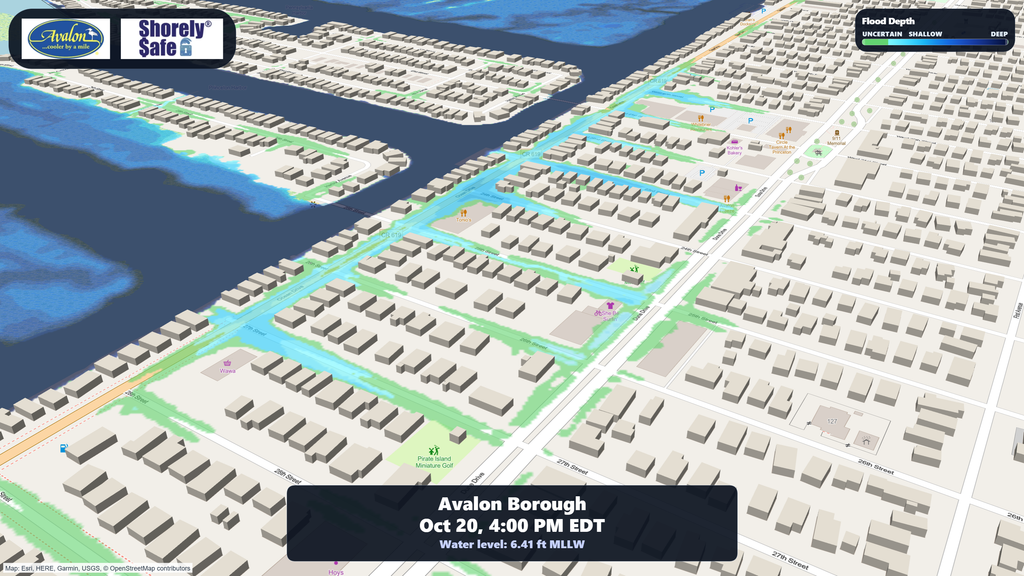
For participating communities, our ShorelySafe Flood Mapper and Flood Dashboard help turn water-level forecasts into local planning information, including potential street-level flooding and comparisons with past events. Learn more at ShorelySafe.live.
Coastal residents should follow forecast updates as the storm’s track and timing become clearer.


